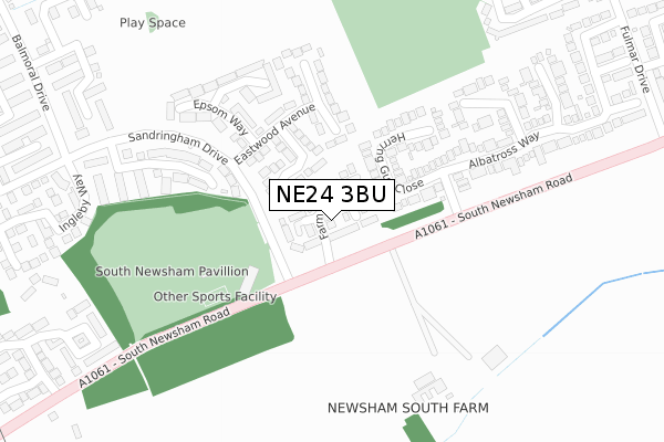
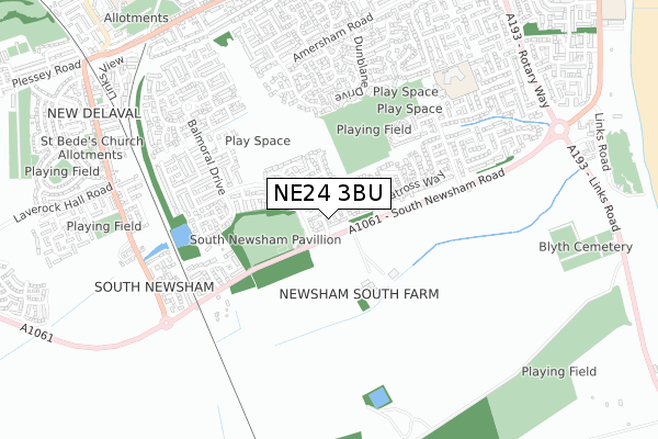
NE24 3BU is located in the South Blyth electoral ward, within the unitary authority of Northumberland and the English Parliamentary constituency of Blyth Valley. The Sub Integrated Care Board (ICB) Location is NHS North East and North Cumbria ICB - 00L and the police force is Northumbria. This postcode has been in use since April 2018.


GetTheData
Source: OS Open Zoomstack (Ordnance Survey)
Licence: Open Government Licence (requires attribution)
Attribution: Contains OS data © Crown copyright and database right 2024
Source: Open Postcode Geo
Licence: Open Government Licence (requires attribution)
Attribution: Contains OS data © Crown copyright and database right 2024; Contains Royal Mail data © Royal Mail copyright and database right 2024; Source: Office for National Statistics licensed under the Open Government Licence v.3.0
| Easting | 430950 |
| Northing | 579219 |
| Latitude | 55.106426 |
| Longitude | -1.516448 |
GetTheData
Source: Open Postcode Geo
Licence: Open Government Licence
| Country | England |
| Postcode District | NE24 |
| ➜ NE24 open data dashboard ➜ See where NE24 is on a map ➜ Where is Blyth? | |
GetTheData
Source: Land Registry Price Paid Data
Licence: Open Government Licence
| Ward | South Blyth |
| Constituency | Blyth Valley |
GetTheData
Source: ONS Postcode Database
Licence: Open Government Licence
26, FARM DRIVE, BLYTH, NE24 3BU 2019 22 MAR £219,995 |
20, FARM DRIVE, BLYTH, NE24 3BU 2019 15 MAR £269,995 |
27, FARM DRIVE, BLYTH, NE24 3BU 2019 8 MAR £269,995 |
19, FARM DRIVE, BLYTH, NE24 3BU 2018 21 DEC £269,995 |
28, FARM DRIVE, BLYTH, NE24 3BU 2018 20 DEC £249,995 |
30, FARM DRIVE, BLYTH, NE24 3BU 2018 30 NOV £249,995 |
3, FARM DRIVE, BLYTH, NE24 3BU 2018 12 OCT £255,995 |
31, FARM DRIVE, BLYTH, NE24 3BU 2018 24 SEP £250,495 |
36, FARM DRIVE, BLYTH, NE24 3BU 2018 4 SEP £250,000 |
34, FARM DRIVE, BLYTH, NE24 3BU 2018 6 JUL £269,995 |
GetTheData
Source: HM Land Registry Price Paid Data
Licence: Contains HM Land Registry data © Crown copyright and database right 2024. This data is licensed under the Open Government Licence v3.0.
| June 2022 | Other theft | On or near Elstree Gardens | 105m |
| June 2022 | Other theft | On or near Herring Gull Close | 149m |
| June 2022 | Criminal damage and arson | On or near South Newsham Road | 178m |
| ➜ Get more crime data in our Crime section | |||
GetTheData
Source: data.police.uk
Licence: Open Government Licence
| Sandringham Drive Entrance (South Newsham Road) | South Newsham | 82m |
| Eastwood Avenue (Sandringham Drive) | South Newsham | 120m |
| Albatross Way (South Newsham Road) | South Beach | 123m |
| Albatross Way (South Newsham Road) | South Beach | 217m |
| Sandringham Drive Entrance (South Newsham Road) | South Newsham | 221m |
GetTheData
Source: NaPTAN
Licence: Open Government Licence
| Percentage of properties with Next Generation Access | 100.0% |
| Percentage of properties with Superfast Broadband | 100.0% |
| Percentage of properties with Ultrafast Broadband | 100.0% |
| Percentage of properties with Full Fibre Broadband | 100.0% |
Superfast Broadband is between 30Mbps and 300Mbps
Ultrafast Broadband is > 300Mbps
| Percentage of properties unable to receive 2Mbps | 0.0% |
| Percentage of properties unable to receive 5Mbps | 0.0% |
| Percentage of properties unable to receive 10Mbps | 0.0% |
| Percentage of properties unable to receive 30Mbps | 0.0% |
GetTheData
Source: Ofcom
Licence: Ofcom Terms of Use (requires attribution)
GetTheData
Source: ONS Postcode Database
Licence: Open Government Licence


➜ Get more ratings from the Food Standards Agency
GetTheData
Source: Food Standards Agency
Licence: FSA terms & conditions
| Last Collection | |||
|---|---|---|---|
| Location | Mon-Fri | Sat | Distance |
| Sandringham Drive | 16:15 | 10:45 | 316m |
| Blagdon Drive | 16:15 | 10:45 | 499m |
| Fulmar Drive | 16:15 | 10:45 | 515m |
GetTheData
Source: Dracos
Licence: Creative Commons Attribution-ShareAlike
| Facility | Distance |
|---|---|
| South Newsham Park (Blyth Town Fc) Sandringham Drive, Blyth Grass Pitches | 171m |
| South Newsham Playing Fields Fulmar Drive, Blyth Grass Pitches | 576m |
| Gloucester Lodge (Closed) Links Road, Blyth Grass Pitches | 1.1km |
GetTheData
Source: Active Places
Licence: Open Government Licence
| School | Phase of Education | Distance |
|---|---|---|
| Newsham Primary School Warwick Street, Blyth, NE24 4NX | Primary | 1.2km |
| Bede Academy Sixth Avenue, Blyth, NE24 2SY | All-through | 1.3km |
| New Delaval Primary School Delaval Gardens, New Delaval, Blyth, NE24 4DA | Primary | 1.4km |
GetTheData
Source: Edubase
Licence: Open Government Licence
The below table lists the International Territorial Level (ITL) codes (formerly Nomenclature of Territorial Units for Statistics (NUTS) codes) and Local Administrative Units (LAU) codes for NE24 3BU:
| ITL 1 Code | Name |
|---|---|
| TLC | North East (England) |
| ITL 2 Code | Name |
| TLC2 | Northumberland, and Tyne and Wear |
| ITL 3 Code | Name |
| TLC21 | Northumberland |
| LAU 1 Code | Name |
| E06000057 | Northumberland |
GetTheData
Source: ONS Postcode Directory
Licence: Open Government Licence
The below table lists the Census Output Area (OA), Lower Layer Super Output Area (LSOA), and Middle Layer Super Output Area (MSOA) for NE24 3BU:
| Code | Name | |
|---|---|---|
| OA | E00139653 | |
| LSOA | E01027440 | Northumberland 026D |
| MSOA | E02005713 | Northumberland 026 |
GetTheData
Source: ONS Postcode Directory
Licence: Open Government Licence
| NE24 3RW | Elstree Gardens | 100m |
| NE24 3RH | Herring Gull Close | 107m |
| NE24 3RR | Esher Gardens | 178m |
| NE24 3RS | Epsom Way | 239m |
| NE24 3AN | Sandringham Meadows | 248m |
| NE24 3RT | Earlswood Grove | 249m |
| NE24 3RG | Kittiwake Close | 280m |
| NE24 3AS | Sandringham Meadows | 328m |
| NE24 3BD | Sandringham Meadows | 376m |
| NE24 3RF | Avocet Close | 383m |
GetTheData
Source: Open Postcode Geo; Land Registry Price Paid Data
Licence: Open Government Licence