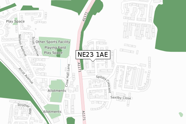
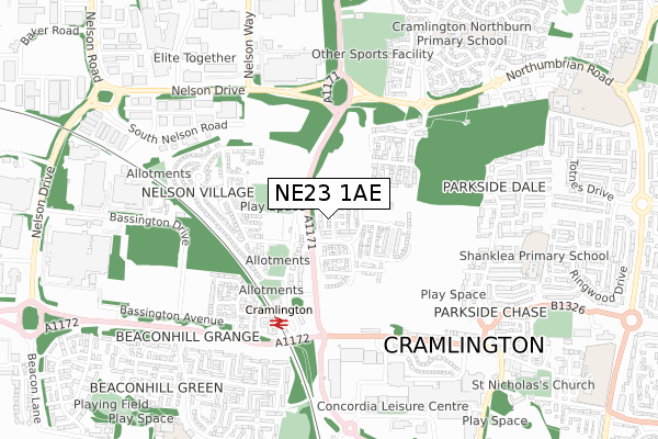
NE23 1AE is located in the Cramlington West electoral ward, within the unitary authority of Northumberland and the English Parliamentary constituency of Blyth Valley. The Sub Integrated Care Board (ICB) Location is NHS North East and North Cumbria ICB - 00L and the police force is Northumbria. This postcode has been in use since September 2018.


GetTheData
Source: OS Open Zoomstack (Ordnance Survey)
Licence: Open Government Licence (requires attribution)
Attribution: Contains OS data © Crown copyright and database right 2024
Source: Open Postcode Geo
Licence: Open Government Licence (requires attribution)
Attribution: Contains OS data © Crown copyright and database right 2024; Contains Royal Mail data © Royal Mail copyright and database right 2024; Source: Office for National Statistics licensed under the Open Government Licence v.3.0
| Easting | 425898 |
| Northing | 577515 |
| Latitude | 55.091403 |
| Longitude | -1.595785 |
GetTheData
Source: Open Postcode Geo
Licence: Open Government Licence
| Country | England |
| Postcode District | NE23 |
| ➜ NE23 open data dashboard ➜ See where NE23 is on a map ➜ Where is Cramlington? | |
GetTheData
Source: Land Registry Price Paid Data
Licence: Open Government Licence
| Ward | Cramlington West |
| Constituency | Blyth Valley |
GetTheData
Source: ONS Postcode Database
Licence: Open Government Licence
10, SOMERSBY GARDENS, ST. NICHOLAS MANOR, CRAMLINGTON, NE23 1AE 2022 3 NOV £308,000 |
10, SOMERSBY GARDENS, ST. NICHOLAS MANOR, CRAMLINGTON, NE23 1AE 2021 30 NOV £259,950 |
8, SOMERSBY GARDENS, ST. NICHOLAS MANOR, CRAMLINGTON, NE23 1AE 2021 23 SEP £269,950 |
2021 17 SEP £205,000 |
2021 26 FEB £215,000 |
2020 14 OCT £240,000 |
22, SOMERSBY GARDENS, ST. NICHOLAS MANOR, CRAMLINGTON, NE23 1AE 2019 20 DEC £249,950 |
14, SOMERSBY GARDENS, ST. NICHOLAS MANOR, CRAMLINGTON, NE23 1AE 2019 31 OCT £279,950 |
20, SOMERSBY GARDENS, ST. NICHOLAS MANOR, CRAMLINGTON, NE23 1AE 2019 30 AUG £243,950 |
18, SOMERSBY GARDENS, ST. NICHOLAS MANOR, CRAMLINGTON, NE23 1AE 2019 28 JUN £239,950 |
GetTheData
Source: HM Land Registry Price Paid Data
Licence: Contains HM Land Registry data © Crown copyright and database right 2024. This data is licensed under the Open Government Licence v3.0.
| June 2022 | Violence and sexual offences | On or near Burdon Avenue | 261m |
| June 2022 | Violence and sexual offences | On or near Ross Grove | 303m |
| June 2022 | Violence and sexual offences | On or near Ross Grove | 303m |
| ➜ Get more crime data in our Crime section | |||
GetTheData
Source: data.police.uk
Licence: Open Government Licence
| Nelson Drive Roundabout (A1171) | Northburn | 232m |
| Entrance (Crow Hall Lane) | Nelson Village | 245m |
| Crow Hall Lane | Nelson Village | 254m |
| Nelson Drive Roundabout (A1171) | Northburn | 274m |
| Burdon Avenue | Nelson Village | 288m |
| Cramlington Station | 0.4km |
GetTheData
Source: NaPTAN
Licence: Open Government Licence
| Percentage of properties with Next Generation Access | 100.0% |
| Percentage of properties with Superfast Broadband | 100.0% |
| Percentage of properties with Ultrafast Broadband | 100.0% |
| Percentage of properties with Full Fibre Broadband | 100.0% |
Superfast Broadband is between 30Mbps and 300Mbps
Ultrafast Broadband is > 300Mbps
| Percentage of properties unable to receive 2Mbps | 0.0% |
| Percentage of properties unable to receive 5Mbps | 0.0% |
| Percentage of properties unable to receive 10Mbps | 0.0% |
| Percentage of properties unable to receive 30Mbps | 0.0% |
GetTheData
Source: Ofcom
Licence: Ofcom Terms of Use (requires attribution)
GetTheData
Source: ONS Postcode Database
Licence: Open Government Licence


➜ Get more ratings from the Food Standards Agency
GetTheData
Source: Food Standards Agency
Licence: FSA terms & conditions
| Last Collection | |||
|---|---|---|---|
| Location | Mon-Fri | Sat | Distance |
| Nelson Village Post Office | 17:30 | 11:30 | 343m |
| Station Road | 16:30 | 11:45 | 462m |
| Underwood Grove | 16:15 | 11:15 | 534m |
GetTheData
Source: Dracos
Licence: Creative Commons Attribution-ShareAlike
| Facility | Distance |
|---|---|
| Nelson Miners Welfare (Closed) Nelson Avenue, Nelson Village, Cramlington Grass Pitches | 418m |
| Central Park (Cramlington) Norwich Way, Cramlington Grass Pitches | 444m |
| Concordia Leisure Centre Forum Way, Cramlington Sports Hall, Indoor Bowls, Swimming Pool, Health and Fitness Gym, Studio, Squash Courts | 731m |
GetTheData
Source: Active Places
Licence: Open Government Licence
| School | Phase of Education | Distance |
|---|---|---|
| Cramlington Shanklea Primary School Nairn Road, Parkside Chase, Cramlington, NE23 1RQ | Primary | 787m |
| Cramlington Northburn Primary School Horton Drive, Cramlington, NE23 3QS | Primary | 867m |
| Beaconhill Community Primary School Langdale Drive, Beacon Hill Grange, Cramlington, NE23 8EH | Primary | 956m |
GetTheData
Source: Edubase
Licence: Open Government Licence
The below table lists the International Territorial Level (ITL) codes (formerly Nomenclature of Territorial Units for Statistics (NUTS) codes) and Local Administrative Units (LAU) codes for NE23 1AE:
| ITL 1 Code | Name |
|---|---|
| TLC | North East (England) |
| ITL 2 Code | Name |
| TLC2 | Northumberland, and Tyne and Wear |
| ITL 3 Code | Name |
| TLC21 | Northumberland |
| LAU 1 Code | Name |
| E06000057 | Northumberland |
GetTheData
Source: ONS Postcode Directory
Licence: Open Government Licence
The below table lists the Census Output Area (OA), Lower Layer Super Output Area (LSOA), and Middle Layer Super Output Area (MSOA) for NE23 1AE:
| Code | Name | |
|---|---|---|
| OA | E00139463 | |
| LSOA | E01027404 | Northumberland 028E |
| MSOA | E02005716 | Northumberland 028 |
GetTheData
Source: ONS Postcode Directory
Licence: Open Government Licence
| NE23 1BN | Old Crow Hall Lane | 201m |
| NE23 1TW | Yardley Grove | 234m |
| NE23 1DR | Wolsingham Court | 256m |
| NE23 1HB | Ross Grove | 281m |
| NE23 1HA | Burdon Avenue | 283m |
| NE23 1HD | Chichester Avenue | 302m |
| NE23 1TR | Yeovil Close | 305m |
| NE23 1EZ | Arcot Avenue | 312m |
| NE23 1HE | Scott Avenue | 314m |
| NE23 1TS | Yarmouth Drive | 337m |
GetTheData
Source: Open Postcode Geo; Land Registry Price Paid Data
Licence: Open Government Licence