Property/Postcode Data Search:
NE22 7FE maps, stats, and open data
NE22 7FE is located in the Sleekburn electoral ward, within the unitary authority of Northumberland and the English Parliamentary constituency of Wansbeck. The Sub Integrated Care Board (ICB) Location is NHS North East and North Cumbria ICB - 00L and the police force is Northumbria. This postcode has been in use since February 2020.
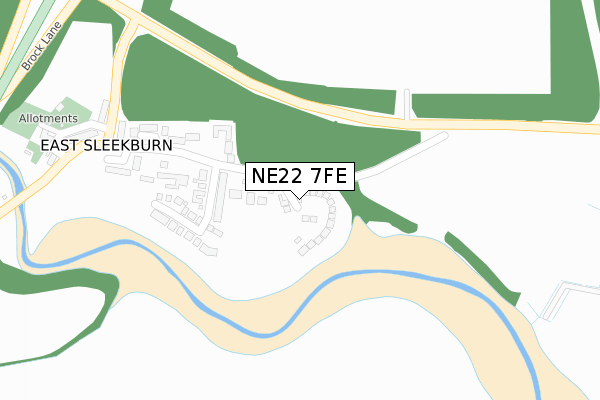
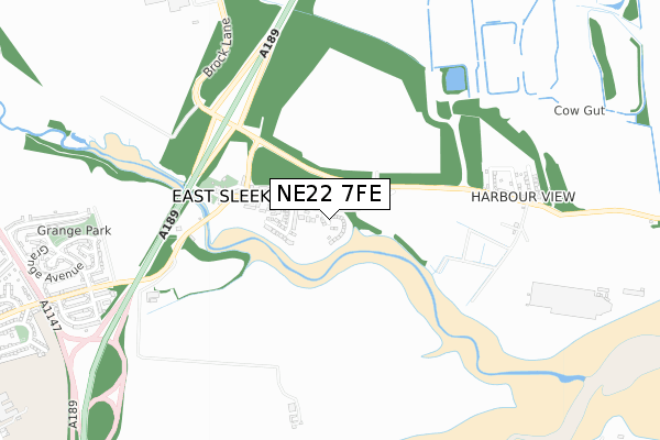
NE22 7FE maps


Source: OS Open Zoomstack (Ordnance Survey)
Licence: Open Government Licence (requires attribution)
Attribution: Contains OS data © Crown copyright and database right 2025
Source: Open Postcode Geo
Licence: Open Government Licence (requires attribution)
Attribution: Contains OS data © Crown copyright and database right 2025; Contains Royal Mail data © Royal Mail copyright and database right 2025; Source: Office for National Statistics licensed under the Open Government Licence v.3.0
Licence: Open Government Licence (requires attribution)
Attribution: Contains OS data © Crown copyright and database right 2025
Source: Open Postcode Geo
Licence: Open Government Licence (requires attribution)
Attribution: Contains OS data © Crown copyright and database right 2025; Contains Royal Mail data © Royal Mail copyright and database right 2025; Source: Office for National Statistics licensed under the Open Government Licence v.3.0
NE22 7FE geodata
| Easting | 429051 |
| Northing | 583293 |
| Latitude | 55.143148 |
| Longitude | -1.545796 |
Where is NE22 7FE?
| Country | England |
| Postcode District | NE22 |
Politics
| Ward | Sleekburn |
|---|---|
| Constituency | Wansbeck |
House Prices
Sales of detached houses in NE22 7FE
36, BRUNEL WAY, EAST SLEEKBURN, BEDLINGTON, NE22 7FE 2024 8 AUG £260,000 |
42, BRUNEL WAY, EAST SLEEKBURN, BEDLINGTON, NE22 7FE 2024 24 MAY £295,000 |
43, BRUNEL WAY, EAST SLEEKBURN, BEDLINGTON, NE22 7FE 2024 23 JAN £235,000 |
13, BRUNEL WAY, EAST SLEEKBURN, BEDLINGTON, NE22 7FE 2023 27 JAN £220,000 |
22, BRUNEL WAY, EAST SLEEKBURN, BEDLINGTON, NE22 7FE 2022 25 NOV £385,000 |
21, BRUNEL WAY, EAST SLEEKBURN, BEDLINGTON, NE22 7FE 2022 14 NOV £259,950 |
16, BRUNEL WAY, EAST SLEEKBURN, BEDLINGTON, NE22 7FE 2022 1 NOV £380,000 |
17, BRUNEL WAY, EAST SLEEKBURN, BEDLINGTON, NE22 7FE 2022 30 SEP £259,950 |
2022 28 SEP £245,000 |
23, BRUNEL WAY, EAST SLEEKBURN, BEDLINGTON, NE22 7FE 2022 5 AUG £222,950 |
Source: HM Land Registry Price Paid Data
Licence: Contains HM Land Registry data © Crown copyright and database right 2025. This data is licensed under the Open Government Licence v3.0.
Licence: Contains HM Land Registry data © Crown copyright and database right 2025. This data is licensed under the Open Government Licence v3.0.
Transport
Nearest bus stops to NE22 7FE
| Bypass (Brock Lane) | East Sleekburn | 411m |
| Bypass (Brock Lane) | East Sleekburn | 464m |
| Sandfield Road (C415) | Cambois | 673m |
| Sandfield Road (C415) | Cambois | 778m |
| St John's Road | Bedlington Station | 1,094m |
Deprivation
87.4% of English postcodes are less deprived than NE22 7FE:Food Standards Agency
Three nearest food hygiene ratings to NE22 7FE (metres)
The General Havelock

East Sleekburn
104m
Cake Box

9 Park Avenue
930m
Benny Blue's

9 Park Avenue
930m
➜ Get more ratings from the Food Standards Agency
Nearest post box to NE22 7FE
| Last Collection | |||
|---|---|---|---|
| Location | Mon-Fri | Sat | Distance |
| South View | 16:00 | 11:00 | 334m |
| Sandfield Road | 16:00 | 11:00 | 705m |
| Park Avenue | 16:00 | 11:00 | 980m |
NE22 7FE ITL and NE22 7FE LAU
The below table lists the International Territorial Level (ITL) codes (formerly Nomenclature of Territorial Units for Statistics (NUTS) codes) and Local Administrative Units (LAU) codes for NE22 7FE:
| ITL 1 Code | Name |
|---|---|
| TLC | North East (England) |
| ITL 2 Code | Name |
| TLC2 | Northumberland, and Tyne and Wear |
| ITL 3 Code | Name |
| TLC21 | Northumberland |
| LAU 1 Code | Name |
| E06000057 | Northumberland |
NE22 7FE census areas
The below table lists the Census Output Area (OA), Lower Layer Super Output Area (LSOA), and Middle Layer Super Output Area (MSOA) for NE22 7FE:
| Code | Name | |
|---|---|---|
| OA | E00140233 | |
| LSOA | E01027552 | Northumberland 020G |
| MSOA | E02005740 | Northumberland 020 |
Nearest postcodes to NE22 7FE
| NE22 7BZ | Barrington Park | 129m |
| NE22 7AT | 174m | |
| NE22 7DP | Havelock Mews | 188m |
| NE22 7BB | Havelock Villas | 263m |
| NE22 7BD | Havelock Crescent | 269m |
| NE22 7BA | Brockdale | 307m |
| NE22 7AZ | Spring Ville | 354m |
| NE22 7AY | South View | 362m |
| NE22 7AU | Bank Cottages | 386m |
| NE22 7AX | Belle Vue Terrace | 409m |