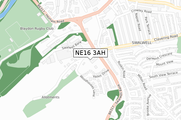
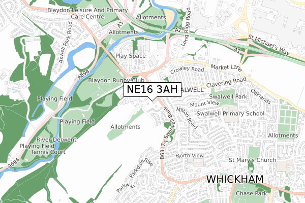
NE16 3AH is located in the Whickham North electoral ward, within the metropolitan district of Gateshead and the English Parliamentary constituency of Blaydon. The Sub Integrated Care Board (ICB) Location is NHS North East and North Cumbria ICB - 13T and the police force is Northumbria. This postcode has been in use since September 2019.


GetTheData
Source: OS Open Zoomstack (Ordnance Survey)
Licence: Open Government Licence (requires attribution)
Attribution: Contains OS data © Crown copyright and database right 2024
Source: Open Postcode Geo
Licence: Open Government Licence (requires attribution)
Attribution: Contains OS data © Crown copyright and database right 2024; Contains Royal Mail data © Royal Mail copyright and database right 2024; Source: Office for National Statistics licensed under the Open Government Licence v.3.0
| Easting | 420167 |
| Northing | 561912 |
| Latitude | 54.951460 |
| Longitude | -1.686667 |
GetTheData
Source: Open Postcode Geo
Licence: Open Government Licence
| Country | England |
| Postcode District | NE16 |
| ➜ NE16 open data dashboard ➜ See where NE16 is on a map ➜ Where is Whickham? | |
GetTheData
Source: Land Registry Price Paid Data
Licence: Open Government Licence
| Ward | Whickham North |
| Constituency | Blaydon |
GetTheData
Source: ONS Postcode Database
Licence: Open Government Licence
| October 2023 | Anti-social behaviour | On or near Ruskin Road | 205m |
| August 2023 | Violence and sexual offences | On or near Ruskin Road | 205m |
| August 2023 | Criminal damage and arson | On or near Ruskin Road | 205m |
| ➜ Get more crime data in our Crime section | |||
GetTheData
Source: data.police.uk
Licence: Open Government Licence
| Swalwell Bank-clavering Road (Swalwell Bank) | Swalwell | 48m |
| Swalwell Bank-clavering Road (Swalwell Bank) | Swalwell | 74m |
| Clavering Road-whickham Bank (Clavering Road) | Swalwell | 89m |
| Clavering Road-crawley Road (Clavering Road) | Swalwell | 128m |
| Ruskin Road | Swalwell | 179m |
| Metrocentre Station | 1.6km |
| Blaydon Station | 2.3km |
| Dunston Station | 2.9km |
GetTheData
Source: NaPTAN
Licence: Open Government Licence
| Percentage of properties with Next Generation Access | 100.0% |
| Percentage of properties with Superfast Broadband | 100.0% |
| Percentage of properties with Ultrafast Broadband | 100.0% |
| Percentage of properties with Full Fibre Broadband | 0.0% |
Superfast Broadband is between 30Mbps and 300Mbps
Ultrafast Broadband is > 300Mbps
| Percentage of properties unable to receive 2Mbps | 0.0% |
| Percentage of properties unable to receive 5Mbps | 0.0% |
| Percentage of properties unable to receive 10Mbps | 0.0% |
| Percentage of properties unable to receive 30Mbps | 0.0% |
GetTheData
Source: Ofcom
Licence: Ofcom Terms of Use (requires attribution)
GetTheData
Source: ONS Postcode Database
Licence: Open Government Licence


➜ Get more ratings from the Food Standards Agency
GetTheData
Source: Food Standards Agency
Licence: FSA terms & conditions
| Last Collection | |||
|---|---|---|---|
| Location | Mon-Fri | Sat | Distance |
| Swalwell Bank | 16:00 | 11:45 | 125m |
| Clavering Road | 16:00 | 11:45 | 227m |
| Jet Garage | 17:00 | 12:00 | 274m |
GetTheData
Source: Dracos
Licence: Creative Commons Attribution-ShareAlike
| Facility | Distance |
|---|---|
| Energie Fitness (Blaydon) (Closed) Hexham Road, Swalwell, Newcastle Upon Tyne Health and Fitness Gym, Studio | 347m |
| Blaydon Rugby Football Club Hexham Road, Swalwell, Newcastle Upon Tyne Health and Fitness Gym, Grass Pitches, Artificial Grass Pitch | 347m |
| Vision Health & Fitness (Gateshead) Sands Industrial Estate, Swalwell, Newcastle Upon Tyne Health and Fitness Gym, Studio | 440m |
GetTheData
Source: Active Places
Licence: Open Government Licence
| School | Phase of Education | Distance |
|---|---|---|
| Front Street Community Primary School North View, Whickham, Newcastle-upon-Tyne, NE16 4AY | Primary | 559m |
| Swalwell Primary School South View Terrace, Swalwell, Newcastle-upon-Tyne, NE16 3HZ | Primary | 617m |
| Whickham School Burnthouse Lane, Whickham, Newcastle-upon-Tyne, NE16 5AR | Secondary | 1.2km |
GetTheData
Source: Edubase
Licence: Open Government Licence
The below table lists the International Territorial Level (ITL) codes (formerly Nomenclature of Territorial Units for Statistics (NUTS) codes) and Local Administrative Units (LAU) codes for NE16 3AH:
| ITL 1 Code | Name |
|---|---|
| TLC | North East (England) |
| ITL 2 Code | Name |
| TLC2 | Northumberland, and Tyne and Wear |
| ITL 3 Code | Name |
| TLC22 | Tyneside |
| LAU 1 Code | Name |
| E08000037 | Gateshead |
GetTheData
Source: ONS Postcode Directory
Licence: Open Government Licence
The below table lists the Census Output Area (OA), Lower Layer Super Output Area (LSOA), and Middle Layer Super Output Area (MSOA) for NE16 3AH:
| Code | Name | |
|---|---|---|
| OA | E00170027 | |
| LSOA | E01008262 | Gateshead 009A |
| MSOA | E02001690 | Gateshead 009 |
GetTheData
Source: ONS Postcode Directory
Licence: Open Government Licence
| NE16 3JW | Valley Drive | 79m |
| NE16 3JL | Whickham Bank | 114m |
| NE16 3JR | Woodhouse Lane | 134m |
| NE16 3DF | Rosebud Close | 146m |
| NE16 3JP | Lonnen Drive | 151m |
| NE16 3JN | Plantation Avenue | 170m |
| NE16 3JF | Ruskin Road | 179m |
| NE16 3JJ | Clavering Road | 199m |
| NE16 3JQ | Carlyle Crescent | 205m |
| NE16 3AG | Jubilee Terrace | 211m |
GetTheData
Source: Open Postcode Geo; Land Registry Price Paid Data
Licence: Open Government Licence