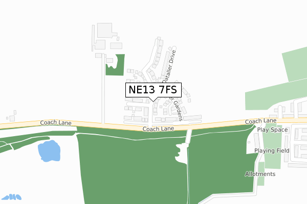
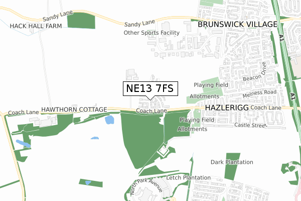
NE13 7FS is located in the Castle electoral ward, within the metropolitan district of Newcastle upon Tyne and the English Parliamentary constituency of Newcastle upon Tyne North. The Sub Integrated Care Board (ICB) Location is NHS North East and North Cumbria ICB - 13T and the police force is Northumbria. This postcode has been in use since May 2019.


GetTheData
Source: OS Open Zoomstack (Ordnance Survey)
Licence: Open Government Licence (requires attribution)
Attribution: Contains OS data © Crown copyright and database right 2024
Source: Open Postcode Geo
Licence: Open Government Licence (requires attribution)
Attribution: Contains OS data © Crown copyright and database right 2024; Contains Royal Mail data © Royal Mail copyright and database right 2024; Source: Office for National Statistics licensed under the Open Government Licence v.3.0
| Easting | 422671 |
| Northing | 572038 |
| Latitude | 55.042345 |
| Longitude | -1.646776 |
GetTheData
Source: Open Postcode Geo
Licence: Open Government Licence
| Country | England |
| Postcode District | NE13 |
| ➜ NE13 open data dashboard ➜ See where NE13 is on a map ➜ Where is Hazlerigg? | |
GetTheData
Source: Land Registry Price Paid Data
Licence: Open Government Licence
| Ward | Castle |
| Constituency | Newcastle Upon Tyne North |
GetTheData
Source: ONS Postcode Database
Licence: Open Government Licence
2022 25 MAR £280,000 |
66, COLLIER GARDENS, HAZLERIGG, NEWCASTLE UPON TYNE, NE13 7FS 2021 30 NOV £354,950 |
64, COLLIER GARDENS, HAZLERIGG, NEWCASTLE UPON TYNE, NE13 7FS 2021 30 NOV £309,950 |
53, COLLIER GARDENS, HAZLERIGG, NEWCASTLE UPON TYNE, NE13 7FS 2021 31 AUG £399,950 |
55, COLLIER GARDENS, HAZLERIGG, NEWCASTLE UPON TYNE, NE13 7FS 2021 27 AUG £267,950 |
57, COLLIER GARDENS, HAZLERIGG, NEWCASTLE UPON TYNE, NE13 7FS 2021 20 AUG £329,950 |
59, COLLIER GARDENS, HAZLERIGG, NEWCASTLE UPON TYNE, NE13 7FS 2021 16 JUL £354,950 |
48, COLLIER GARDENS, HAZLERIGG, NEWCASTLE UPON TYNE, NE13 7FS 2021 19 MAR £249,950 |
50, COLLIER GARDENS, HAZLERIGG, NEWCASTLE UPON TYNE, NE13 7FS 2021 12 MAR £246,950 |
46, COLLIER GARDENS, HAZLERIGG, NEWCASTLE UPON TYNE, NE13 7FS 2021 5 MAR £297,950 |
GetTheData
Source: HM Land Registry Price Paid Data
Licence: Contains HM Land Registry data © Crown copyright and database right 2024. This data is licensed under the Open Government Licence v3.0.
| October 2023 | Violence and sexual offences | On or near Ryall Avenue | 452m |
| September 2023 | Violence and sexual offences | On or near Ryall Avenue | 452m |
| March 2023 | Violence and sexual offences | On or near Ryall Avenue | 452m |
| ➜ Get more crime data in our Crime section | |||
GetTheData
Source: data.police.uk
Licence: Open Government Licence
| Coach Lane-morley Hill Farm (Coach Lane) | Hazlerigg | 280m |
| Coach Lane - Lola Street (Coach Lane) | Hazlerigg | 288m |
| Coach Lane - Lola Street (Coach Lane) | Hazlerigg | 294m |
| Coach Lane-morley Hill Farm (Coach Lane) | Hazlerigg | 339m |
| Brunswick Industrial Estate (Unclassified Estate Road) | Brunswick Village | 428m |
| Newcastle Airport Metro | 4.2km |
GetTheData
Source: NaPTAN
Licence: Open Government Licence
| Percentage of properties with Next Generation Access | 75.0% |
| Percentage of properties with Superfast Broadband | 75.0% |
| Percentage of properties with Ultrafast Broadband | 75.0% |
| Percentage of properties with Full Fibre Broadband | 75.0% |
Superfast Broadband is between 30Mbps and 300Mbps
Ultrafast Broadband is > 300Mbps
| Percentage of properties unable to receive 2Mbps | 0.0% |
| Percentage of properties unable to receive 5Mbps | 0.0% |
| Percentage of properties unable to receive 10Mbps | 0.0% |
| Percentage of properties unable to receive 30Mbps | 0.0% |
GetTheData
Source: Ofcom
Licence: Ofcom Terms of Use (requires attribution)
GetTheData
Source: ONS Postcode Database
Licence: Open Government Licence


➜ Get more ratings from the Food Standards Agency
GetTheData
Source: Food Standards Agency
Licence: FSA terms & conditions
| Last Collection | |||
|---|---|---|---|
| Location | Mon-Fri | Sat | Distance |
| Hazelrigg Post Office | 17:45 | 12:00 | 538m |
| Beacon Drive | 17:30 | 11:30 | 777m |
| Brunswick Village Post Office | 17:30 | 11:45 | 914m |
GetTheData
Source: Dracos
Licence: Creative Commons Attribution-ShareAlike
| Facility | Distance |
|---|---|
| Hazelrigg Recreation Ground Windt Street, Hazlerigg, Newcastle Upon Tyne Grass Pitches | 464m |
| Brunswick Recreation Ground Westfield Avenue, Brunswick, Newcastle Upon Tyne Grass Pitches | 985m |
| Great Park Community Centre Roseden Way, Newcastle Upon Tyne Grass Pitches, Sports Hall, Outdoor Tennis Courts | 1.4km |
GetTheData
Source: Active Places
Licence: Open Government Licence
| School | Phase of Education | Distance |
|---|---|---|
| Hazlewood Community Primary School Canterbury Way, Wideopen, Newcastle-upon-Tyne, NE13 6JJ | Primary | 1.1km |
| Brunton First School Roseden Way, Newcastle Great Park, Newcastle-upon-Tyne, NE13 9BD | Primary | 1.3km |
| Havannah First School Primrose Lane, Newcastle-upon-Tyne, NE13 9FR | Primary | 1.4km |
GetTheData
Source: Edubase
Licence: Open Government Licence
The below table lists the International Territorial Level (ITL) codes (formerly Nomenclature of Territorial Units for Statistics (NUTS) codes) and Local Administrative Units (LAU) codes for NE13 7FS:
| ITL 1 Code | Name |
|---|---|
| TLC | North East (England) |
| ITL 2 Code | Name |
| TLC2 | Northumberland, and Tyne and Wear |
| ITL 3 Code | Name |
| TLC22 | Tyneside |
| LAU 1 Code | Name |
| E08000021 | Newcastle upon Tyne |
GetTheData
Source: ONS Postcode Directory
Licence: Open Government Licence
The below table lists the Census Output Area (OA), Lower Layer Super Output Area (LSOA), and Middle Layer Super Output Area (MSOA) for NE13 7FS:
| Code | Name | |
|---|---|---|
| OA | E00042155 | |
| LSOA | E01008307 | Newcastle upon Tyne 001C |
| MSOA | E02001708 | Newcastle upon Tyne 001 |
GetTheData
Source: ONS Postcode Directory
Licence: Open Government Licence
| NE13 7AR | Strawberry Terrace | 270m |
| NE13 7AT | Lola Street | 312m |
| NE13 7DA | Heddon Avenue | 356m |
| NE13 7AU | Lieven Street | 362m |
| NE13 7AS | Coach Lane | 393m |
| NE13 7AX | Enid Street | 413m |
| NE13 7BX | Ryall Avenue | 418m |
| NE13 7DB | Belsay Avenue | 427m |
| NE13 7BZ | The Crossways | 445m |
| NE13 7AY | Charles Street | 445m |
GetTheData
Source: Open Postcode Geo; Land Registry Price Paid Data
Licence: Open Government Licence