NE13 6DX maps, stats, and open data
NE13 6DX is located in the Weetslade electoral ward, within the metropolitan district of North Tyneside and the English Parliamentary constituency of North Tyneside. The Sub Integrated Care Board (ICB) Location is NHS North East and North Cumbria ICB - 99C and the police force is Northumbria. This postcode has been in use since July 2018.
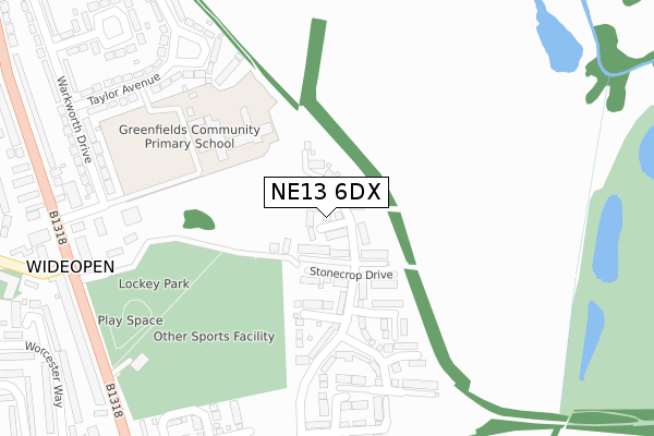
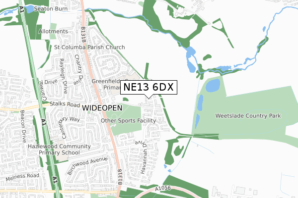
NE13 6DX maps


Licence: Open Government Licence (requires attribution)
Attribution: Contains OS data © Crown copyright and database right 2025
Source: Open Postcode Geo
Licence: Open Government Licence (requires attribution)
Attribution: Contains OS data © Crown copyright and database right 2025; Contains Royal Mail data © Royal Mail copyright and database right 2025; Source: Office for National Statistics licensed under the Open Government Licence v.3.0
NE13 6DX geodata
| Easting | 424531 |
| Northing | 572731 |
| Latitude | 55.048484 |
| Longitude | -1.617611 |
Where is NE13 6DX?
| Country | England |
| Postcode District | NE13 |
Politics
| Ward | Weetslade |
|---|---|
| Constituency | North Tyneside |
House Prices
Sales of detached houses in NE13 6DX
2022 26 JAN £435,000 |
1, TREE TOP CLOSE, WIDEOPEN, NEWCASTLE UPON TYNE, NE13 6DX 2018 26 SEP £403,395 |
2018 21 SEP £402,995 |
3, TREE TOP CLOSE, WIDEOPEN, NEWCASTLE UPON TYNE, NE13 6DX 2018 31 AUG £395,295 |
4, TREE TOP CLOSE, WIDEOPEN, NEWCASTLE UPON TYNE, NE13 6DX 2018 27 JUL £368,995 |
5, TREE TOP CLOSE, WIDEOPEN, NEWCASTLE UPON TYNE, NE13 6DX 2018 27 JUL £334,995 |
7, TREE TOP CLOSE, WIDEOPEN, NEWCASTLE UPON TYNE, NE13 6DX 2018 26 JUL £338,395 |
Licence: Contains HM Land Registry data © Crown copyright and database right 2025. This data is licensed under the Open Government Licence v3.0.
Transport
Nearest bus stops to NE13 6DX
| Greenfields Community Primary School (Taylor Avenue) | Wideopen | 221m |
| Wideopen (Gt North Road) | Wideopen | 389m |
| Wideopen (Gt North Road) | Wideopen | 425m |
| Wideopen (Stalks Road) | Wideopen | 432m |
| Great North Road-harrow Gardens (Great North Road) | Wideopen | 472m |
Nearest railway stations to NE13 6DX
| Cramlington Station | 4.5km |
Broadband
Broadband access in NE13 6DX (2020 data)
| Percentage of properties with Next Generation Access | 100.0% |
| Percentage of properties with Superfast Broadband | 100.0% |
| Percentage of properties with Ultrafast Broadband | 0.0% |
| Percentage of properties with Full Fibre Broadband | 0.0% |
Superfast Broadband is between 30Mbps and 300Mbps
Ultrafast Broadband is > 300Mbps
Broadband speed in NE13 6DX (2019 data)
Download
| Median download speed | 8.1Mbps |
| Average download speed | 34.9Mbps |
| Maximum download speed | 80.00Mbps |
Upload
| Median upload speed | 1.2Mbps |
| Average upload speed | 7.1Mbps |
| Maximum upload speed | 17.19Mbps |
Broadband limitations in NE13 6DX (2020 data)
| Percentage of properties unable to receive 2Mbps | 0.0% |
| Percentage of properties unable to receive 5Mbps | 0.0% |
| Percentage of properties unable to receive 10Mbps | 0.0% |
| Percentage of properties unable to receive 30Mbps | 0.0% |
Deprivation
48.1% of English postcodes are less deprived than NE13 6DX:Food Standards Agency
Three nearest food hygiene ratings to NE13 6DX (metres)


➜ Get more ratings from the Food Standards Agency
Nearest post box to NE13 6DX
| Last Collection | |||
|---|---|---|---|
| Location | Mon-Fri | Sat | Distance |
| Wideopen Post Office | 17:45 | 12:00 | 400m |
| Wooler Square | 17:30 | 11:15 | 471m |
| Winchester Walk | 17:30 | 11:15 | 614m |
NE13 6DX ITL and NE13 6DX LAU
The below table lists the International Territorial Level (ITL) codes (formerly Nomenclature of Territorial Units for Statistics (NUTS) codes) and Local Administrative Units (LAU) codes for NE13 6DX:
| ITL 1 Code | Name |
|---|---|
| TLC | North East (England) |
| ITL 2 Code | Name |
| TLC2 | Northumberland, and Tyne and Wear |
| ITL 3 Code | Name |
| TLC22 | Tyneside |
| LAU 1 Code | Name |
| E08000022 | North Tyneside |
NE13 6DX census areas
The below table lists the Census Output Area (OA), Lower Layer Super Output Area (LSOA), and Middle Layer Super Output Area (MSOA) for NE13 6DX:
| Code | Name | |
|---|---|---|
| OA | E00043567 | |
| LSOA | E01008577 | North Tyneside 004A |
| MSOA | E02001741 | North Tyneside 004 |
Nearest postcodes to NE13 6DX
| NE13 6DW | 95m | |
| NE13 6NA | Taylor Avenue | 356m |
| NE13 6PL | Great North Road | 377m |
| NE13 6LW | North Road | 399m |
| NE13 6LD | Havannah Drive | 409m |
| NE13 6LX | Warkworth Drive | 420m |
| NE13 6LH | Park View | 420m |
| NE13 6LN | North Road | 444m |
| NE13 6NE | Morpeth Avenue | 444m |
| NE13 6LF | Fenchurch Close | 445m |