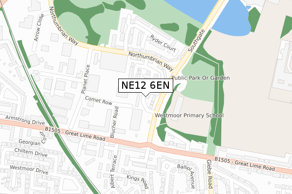
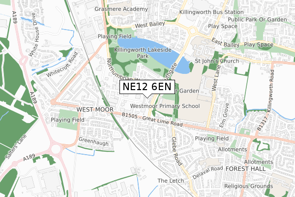
NE12 6EN is located in the Camperdown electoral ward, within the metropolitan district of North Tyneside and the English Parliamentary constituency of North Tyneside. The Sub Integrated Care Board (ICB) Location is NHS North East and North Cumbria ICB - 99C and the police force is Northumbria. This postcode has been in use since January 2018.


GetTheData
Source: OS Open Zoomstack (Ordnance Survey)
Licence: Open Government Licence (requires attribution)
Attribution: Contains OS data © Crown copyright and database right 2024
Source: Open Postcode Geo
Licence: Open Government Licence (requires attribution)
Attribution: Contains OS data © Crown copyright and database right 2024; Contains Royal Mail data © Royal Mail copyright and database right 2024; Source: Office for National Statistics licensed under the Open Government Licence v.3.0
| Easting | 427307 |
| Northing | 570608 |
| Latitude | 55.029264 |
| Longitude | -1.574367 |
GetTheData
Source: Open Postcode Geo
Licence: Open Government Licence
| Country | England |
| Postcode District | NE12 |
| ➜ NE12 open data dashboard ➜ See where NE12 is on a map ➜ Where is Killingworth? | |
GetTheData
Source: Land Registry Price Paid Data
Licence: Open Government Licence
| Ward | Camperdown |
| Constituency | North Tyneside |
GetTheData
Source: ONS Postcode Database
Licence: Open Government Licence
| June 2022 | Burglary | On or near Comet Row | 126m |
| June 2022 | Violence and sexual offences | On or near Comet Row | 126m |
| June 2022 | Violence and sexual offences | On or near Comet Row | 126m |
| ➜ Get more crime data in our Crime section | |||
GetTheData
Source: data.police.uk
Licence: Open Government Licence
| Northumbrian Way-norgas (Northumbrian Way) | Killingworth | 141m |
| Great Lime Road-blucher Road (Great Lime Road) | West Moor | 163m |
| Southgate-norgas House (Southgate) | Killingworth | 179m |
| Great Lime Road-sheldon Court (Great Lime Road) | West Moor | 221m |
| Northumbrian Way-planet Place (Northumbrian Way) | Killingworth | 230m |
GetTheData
Source: NaPTAN
Licence: Open Government Licence
➜ Broadband speed and availability dashboard for NE12 6EN
| Percentage of properties with Next Generation Access | 100.0% |
| Percentage of properties with Superfast Broadband | 100.0% |
| Percentage of properties with Ultrafast Broadband | 100.0% |
| Percentage of properties with Full Fibre Broadband | 0.0% |
Superfast Broadband is between 30Mbps and 300Mbps
Ultrafast Broadband is > 300Mbps
| Median download speed | 15.0Mbps |
| Average download speed | 21.5Mbps |
| Maximum download speed | 71.27Mbps |
| Median upload speed | 1.2Mbps |
| Average upload speed | 3.7Mbps |
| Maximum upload speed | 17.33Mbps |
| Percentage of properties unable to receive 2Mbps | 0.0% |
| Percentage of properties unable to receive 5Mbps | 0.0% |
| Percentage of properties unable to receive 10Mbps | 0.0% |
| Percentage of properties unable to receive 30Mbps | 0.0% |
➜ Broadband speed and availability dashboard for NE12 6EN
GetTheData
Source: Ofcom
Licence: Ofcom Terms of Use (requires attribution)
GetTheData
Source: ONS Postcode Database
Licence: Open Government Licence


➜ Get more ratings from the Food Standards Agency
GetTheData
Source: Food Standards Agency
Licence: FSA terms & conditions
| Last Collection | |||
|---|---|---|---|
| Location | Mon-Fri | Sat | Distance |
| High Glebe | 17:30 | 12:15 | 332m |
| Westmoor Post Office | 17:30 | 12:15 | 371m |
| Bolam Road | 17:30 | 12:00 | 623m |
GetTheData
Source: Dracos
Licence: Creative Commons Attribution-ShareAlike
| Facility | Distance |
|---|---|
| Southgate Playing Fields Southgate, Newcastle Upon Tyne Grass Pitches | 176m |
| The Lakeside Centre Southgate, Newcastle Upon Tyne Sports Hall, Swimming Pool, Health and Fitness Gym, Studio | 495m |
| Percy Hedley School West Lane, Newcastle Upon Tyne Sports Hall | 498m |
GetTheData
Source: Active Places
Licence: Open Government Licence
| School | Phase of Education | Distance |
|---|---|---|
| Westmoor Primary School Southgate, Killingworth, Newcastle-upon-Tyne, NE12 6SA | Primary | 114m |
| Percy Hedley School West Lane, Killingworth, Newcastle-upon-Tyne, NE12 7BH | Not applicable | 498m |
| George Stephenson High School Southgate, Killingworth, Newcastle-upon-Tyne, NE12 6SA | Secondary | 634m |
GetTheData
Source: Edubase
Licence: Open Government Licence
The below table lists the International Territorial Level (ITL) codes (formerly Nomenclature of Territorial Units for Statistics (NUTS) codes) and Local Administrative Units (LAU) codes for NE12 6EN:
| ITL 1 Code | Name |
|---|---|
| TLC | North East (England) |
| ITL 2 Code | Name |
| TLC2 | Northumberland, and Tyne and Wear |
| ITL 3 Code | Name |
| TLC22 | Tyneside |
| LAU 1 Code | Name |
| E08000022 | North Tyneside |
GetTheData
Source: ONS Postcode Directory
Licence: Open Government Licence
The below table lists the Census Output Area (OA), Lower Layer Super Output Area (LSOA), and Middle Layer Super Output Area (MSOA) for NE12 6EN:
| Code | Name | |
|---|---|---|
| OA | E00043029 | |
| LSOA | E01008477 | North Tyneside 008C |
| MSOA | E02001745 | North Tyneside 008 |
GetTheData
Source: ONS Postcode Directory
Licence: Open Government Licence
| NE12 6ED | Southgate | 88m |
| NE12 6EB | Northumbrian Way | 123m |
| NE12 7NN | Cowper Terrace | 189m |
| NE12 6EG | Ryder Court | 201m |
| NE12 7DQ | Great Lime Road | 205m |
| NE12 7PB | The Limes | 211m |
| NE12 6EE | Ryder Court | 250m |
| NE12 7LZ | Sheldon Court | 266m |
| NE12 7PA | Albert Terrace | 273m |
| NE12 7PP | Balliol Avenue | 287m |
GetTheData
Source: Open Postcode Geo; Land Registry Price Paid Data
Licence: Open Government Licence