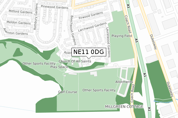
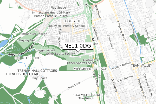
NE11 0DG is located in the Lobley Hill and Bensham electoral ward, within the metropolitan district of Gateshead and the English Parliamentary constituency of Gateshead. The Sub Integrated Care Board (ICB) Location is NHS North East and North Cumbria ICB - 13T and the police force is Northumbria. This postcode has been in use since October 2020.


GetTheData
Source: OS Open Zoomstack (Ordnance Survey)
Licence: Open Government Licence (requires attribution)
Attribution: Contains OS data © Crown copyright and database right 2024
Source: Open Postcode Geo
Licence: Open Government Licence (requires attribution)
Attribution: Contains OS data © Crown copyright and database right 2024; Contains Royal Mail data © Royal Mail copyright and database right 2024; Source: Office for National Statistics licensed under the Open Government Licence v.3.0
| Easting | 423003 |
| Northing | 560250 |
| Latitude | 54.936403 |
| Longitude | -1.642521 |
GetTheData
Source: Open Postcode Geo
Licence: Open Government Licence
| Country | England |
| Postcode District | NE11 |
| ➜ NE11 open data dashboard ➜ See where NE11 is on a map ➜ Where is Gateshead? | |
GetTheData
Source: Land Registry Price Paid Data
Licence: Open Government Licence
| Ward | Lobley Hill And Bensham |
| Constituency | Gateshead |
GetTheData
Source: ONS Postcode Database
Licence: Open Government Licence
| June 2022 | Anti-social behaviour | On or near Alwinton Gardens | 122m |
| June 2022 | Violence and sexual offences | On or near Sports/Recreation Area | 248m |
| June 2022 | Anti-social behaviour | On or near Consett Road | 325m |
| ➜ Get more crime data in our Crime section | |||
GetTheData
Source: data.police.uk
Licence: Open Government Licence
| Consett Road-ravenswood Lodge (Consett Road) | Lobley Hill | 25m |
| Consett Road-greens Farm (Consett Road) | Lobley Hill | 36m |
| Emmanuel College (Lobley Hill Road) | Lobley Hill | 213m |
| Alwinton Gardens | Lobley Hill | 216m |
| Rothbury Gardens - Meldon Gardens (Rothbury Gardens) | Lobley Hill | 304m |
| Dunston Station | 1.5km |
| Metrocentre Station | 2.9km |
| Newcastle Station | 3.9km |
GetTheData
Source: NaPTAN
Licence: Open Government Licence
GetTheData
Source: ONS Postcode Database
Licence: Open Government Licence


➜ Get more ratings from the Food Standards Agency
GetTheData
Source: Food Standards Agency
Licence: FSA terms & conditions
| Last Collection | |||
|---|---|---|---|
| Location | Mon-Fri | Sat | Distance |
| Lobley Hill Post Office | 18:30 | 12:00 | 432m |
| Beechwood Gardens | 17:45 | 12:00 | 522m |
| Lobley Hill | 17:45 | 12:00 | 643m |
GetTheData
Source: Dracos
Licence: Creative Commons Attribution-ShareAlike
| Facility | Distance |
|---|---|
| Emmanuel College Consett Road, Gateshead Sports Hall, Health and Fitness Gym, Studio, Grass Pitches, Artificial Grass Pitch | 201m |
| Watergate Playing Fields Consett Road, Gateshead Grass Pitches | 216m |
| Lobley Hill Primary School Rothbury Gardens, Gateshead Grass Pitches | 517m |
GetTheData
Source: Active Places
Licence: Open Government Licence
| School | Phase of Education | Distance |
|---|---|---|
| Emmanuel College Consett Road, Lobley Hill, Gateshead, NE11 0AN | Not applicable | 225m |
| Lobley Hill Primary School Rothbury Gardens, Lobley Hill, Gateshead, NE11 0AT | Primary | 435m |
| Dunston Hill Community Primary School Market Lane, Dunston, Gateshead, NE11 9NX | Primary | 1.5km |
GetTheData
Source: Edubase
Licence: Open Government Licence
The below table lists the International Territorial Level (ITL) codes (formerly Nomenclature of Territorial Units for Statistics (NUTS) codes) and Local Administrative Units (LAU) codes for NE11 0DG:
| ITL 1 Code | Name |
|---|---|
| TLC | North East (England) |
| ITL 2 Code | Name |
| TLC2 | Northumberland, and Tyne and Wear |
| ITL 3 Code | Name |
| TLC22 | Tyneside |
| LAU 1 Code | Name |
| E08000037 | Gateshead |
GetTheData
Source: ONS Postcode Directory
Licence: Open Government Licence
The below table lists the Census Output Area (OA), Lower Layer Super Output Area (LSOA), and Middle Layer Super Output Area (MSOA) for NE11 0DG:
| Code | Name | |
|---|---|---|
| OA | E00041892 | |
| LSOA | E01008256 | Gateshead 019A |
| MSOA | E02001700 | Gateshead 019 |
GetTheData
Source: ONS Postcode Directory
Licence: Open Government Licence
| NE11 0AN | Consett Road | 127m |
| NE11 0AP | Alwinton Gardens | 173m |
| NE11 0BB | Meldon Gardens | 213m |
| NE11 0BA | Mitford Gardens | 234m |
| NE11 0AR | Belford Gardens | 263m |
| NE11 0AQ | Cragside Gardens | 276m |
| NE11 0AU | Rothbury Gardens | 317m |
| NE11 0AS | Belsay Gardens | 318m |
| NE11 0HQ | Ravensworth Park Estate | 333m |
| NE11 0AT | Rothbury Gardens | 368m |
GetTheData
Source: Open Postcode Geo; Land Registry Price Paid Data
Licence: Open Government Licence