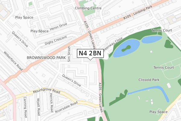
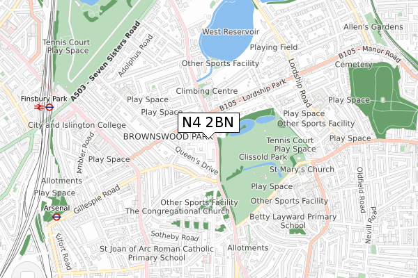
N4 2BN is located in the Brownswood electoral ward, within the London borough of Hackney and the English Parliamentary constituency of Hackney North and Stoke Newington. The Sub Integrated Care Board (ICB) Location is NHS North East London ICB - A3A8R and the police force is Metropolitan Police. This postcode has been in use since October 2017.


GetTheData
Source: OS Open Zoomstack (Ordnance Survey)
Licence: Open Government Licence (requires attribution)
Attribution: Contains OS data © Crown copyright and database right 2024
Source: Open Postcode Geo
Licence: Open Government Licence (requires attribution)
Attribution: Contains OS data © Crown copyright and database right 2024; Contains Royal Mail data © Royal Mail copyright and database right 2024; Source: Office for National Statistics licensed under the Open Government Licence v.3.0
| Easting | 532321 |
| Northing | 186575 |
| Latitude | 51.562541 |
| Longitude | -0.092438 |
GetTheData
Source: Open Postcode Geo
Licence: Open Government Licence
| Country | England |
| Postcode District | N4 |
| ➜ N4 open data dashboard ➜ See where N4 is on a map ➜ Where is London? | |
GetTheData
Source: Land Registry Price Paid Data
Licence: Open Government Licence
| Ward | Brownswood |
| Constituency | Hackney North And Stoke Newington |
GetTheData
Source: ONS Postcode Database
Licence: Open Government Licence
| December 2023 | Violence and sexual offences | On or near Allerton Road | 369m |
| November 2023 | Anti-social behaviour | On or near Park/Open Space | 380m |
| September 2023 | Vehicle crime | On or near Allerton Road | 369m |
| ➜ Get more crime data in our Crime section | |||
GetTheData
Source: data.police.uk
Licence: Open Government Licence
| Kings Crescent Estate (Green Lanes) | Brownswood Park | 53m |
| Brownswood Road | Brownswood Park | 86m |
| Brownswood Road Green Lanes | Brownswood Park | 131m |
| Kings Crescent Estate (Green Lanes) | Brownswood Park | 175m |
| Green Lanes | Brownswood Park | 187m |
| Manor House Underground Station | Manor House | 946m |
| Finsbury Park Underground Station | Finsbury Park | 1,012m |
| Arsenal Underground Station | Arsenal | 1,126m |
| Holloway Road Underground Station | Holloway Road | 1,810m |
| Finsbury Park Station | 1km |
| Stoke Newington Station | 1.4km |
| Drayton Park Station | 1.4km |
GetTheData
Source: NaPTAN
Licence: Open Government Licence
| Percentage of properties with Next Generation Access | 100.0% |
| Percentage of properties with Superfast Broadband | 100.0% |
| Percentage of properties with Ultrafast Broadband | 100.0% |
| Percentage of properties with Full Fibre Broadband | 100.0% |
Superfast Broadband is between 30Mbps and 300Mbps
Ultrafast Broadband is > 300Mbps
| Percentage of properties unable to receive 2Mbps | 0.0% |
| Percentage of properties unable to receive 5Mbps | 0.0% |
| Percentage of properties unable to receive 10Mbps | 0.0% |
| Percentage of properties unable to receive 30Mbps | 0.0% |
GetTheData
Source: Ofcom
Licence: Ofcom Terms of Use (requires attribution)
GetTheData
Source: ONS Postcode Database
Licence: Open Government Licence


➜ Get more ratings from the Food Standards Agency
GetTheData
Source: Food Standards Agency
Licence: FSA terms & conditions
| Last Collection | |||
|---|---|---|---|
| Location | Mon-Fri | Sat | Distance |
| 65 Queens Drive | 17:30 | 12:00 | 194m |
| 279 Green Lanes | 17:30 | 12:00 | 196m |
| 203 Green Lanes | 17:30 | 12:00 | 268m |
GetTheData
Source: Dracos
Licence: Creative Commons Attribution-ShareAlike
| Facility | Distance |
|---|---|
| Clissold Park Stoke Newington Church Street, Hackney, London Grass Pitches, Outdoor Tennis Courts | 350m |
| Clissold Leisure Centre Clissold Road, London Sports Hall, Swimming Pool, Health and Fitness Gym, Studio, Squash Courts | 611m |
| Stoke Newington School & Sixth Form Clissold Road, London Sports Hall, Studio, Artificial Grass Pitch, Athletics | 702m |
GetTheData
Source: Active Places
Licence: Open Government Licence
| School | Phase of Education | Distance |
|---|---|---|
| Parkwood Primary School Queen's Drive, Parkwood Primary School, LONDON, N4 2HQ | Primary | 552m |
| Side By Side School Avigdor Mews, Lordship Road, London, London, N16 0QJ | Not applicable | 578m |
| Gillespie Primary School Gillespie Road, London, N5 1LH | Primary | 597m |
GetTheData
Source: Edubase
Licence: Open Government Licence
The below table lists the International Territorial Level (ITL) codes (formerly Nomenclature of Territorial Units for Statistics (NUTS) codes) and Local Administrative Units (LAU) codes for N4 2BN:
| ITL 1 Code | Name |
|---|---|
| TLI | London |
| ITL 2 Code | Name |
| TLI4 | Inner London - East |
| ITL 3 Code | Name |
| TLI41 | Hackney and Newham |
| LAU 1 Code | Name |
| E09000012 | Hackney |
GetTheData
Source: ONS Postcode Directory
Licence: Open Government Licence
The below table lists the Census Output Area (OA), Lower Layer Super Output Area (LSOA), and Middle Layer Super Output Area (MSOA) for N4 2BN:
| Code | Name | |
|---|---|---|
| OA | E00176291 | |
| LSOA | E01001719 | Hackney 007E |
| MSOA | E02000351 | Hackney 007 |
GetTheData
Source: ONS Postcode Directory
Licence: Open Government Licence
| N4 2XN | Brownswood Road | 64m |
| N4 2XD | Queen's Drive | 98m |
| N4 2XL | Brownswood Road | 102m |
| N4 2EY | Green Lanes | 104m |
| N4 2XG | Queens Drive | 119m |
| N4 2XB | Queen's Drive | 128m |
| N4 2XH | Queen's Drive | 129m |
| N4 2XJ | Brownswood Road | 139m |
| N4 2SZ | Queens Drive | 169m |
| N4 2EZ | Greenway Close | 172m |
GetTheData
Source: Open Postcode Geo; Land Registry Price Paid Data
Licence: Open Government Licence