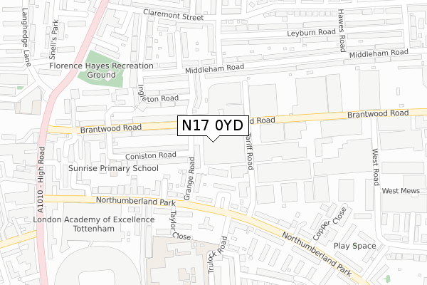
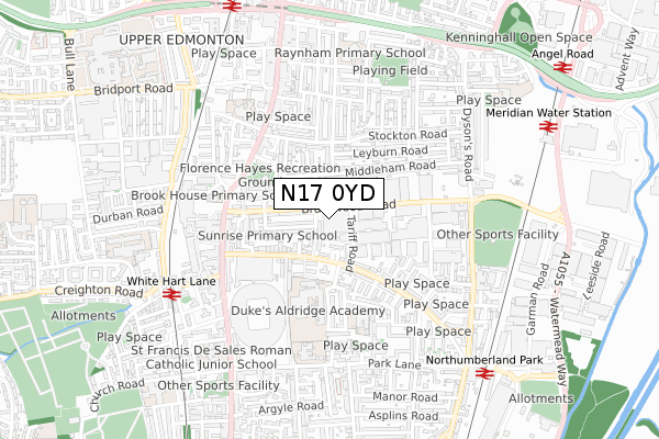
N17 0YD is located in the Northumberland Park electoral ward, within the London borough of Haringey and the English Parliamentary constituency of Tottenham. The Sub Integrated Care Board (ICB) Location is NHS North Central London ICB - 93C and the police force is Metropolitan Police. This postcode has been in use since November 2017.


GetTheData
Source: OS Open Zoomstack (Ordnance Survey)
Licence: Open Government Licence (requires attribution)
Attribution: Contains OS data © Crown copyright and database right 2024
Source: Open Postcode Geo
Licence: Open Government Licence (requires attribution)
Attribution: Contains OS data © Crown copyright and database right 2024; Contains Royal Mail data © Royal Mail copyright and database right 2024; Source: Office for National Statistics licensed under the Open Government Licence v.3.0
| Easting | 534285 |
| Northing | 191617 |
| Latitude | 51.607385 |
| Longitude | -0.062196 |
GetTheData
Source: Open Postcode Geo
Licence: Open Government Licence
| Country | England |
| Postcode District | N17 |
| ➜ N17 open data dashboard ➜ See where N17 is on a map | |
GetTheData
Source: Land Registry Price Paid Data
Licence: Open Government Licence
| Ward | Northumberland Park |
| Constituency | Tottenham |
GetTheData
Source: ONS Postcode Database
Licence: Open Government Licence
| January 2024 | Burglary | On or near Hawes Road | 400m |
| January 2024 | Criminal damage and arson | On or near Hawes Road | 400m |
| January 2024 | Vehicle crime | On or near Hawes Road | 400m |
| ➜ Get more crime data in our Crime section | |||
GetTheData
Source: data.police.uk
Licence: Open Government Licence
| Gillham Terrace (Northumberland Park) | Northumberland Park | 170m |
| Gillham Terrace (Northumberland Park) | Northumberland Park | 170m |
| Tottenham High Road (Northumberland Park) | Northumberland Park | 187m |
| Tottenham High Road (Northumberland Park) | Northumberland Park | 254m |
| Scotswood Walk (Northumberland Park) | Northumberland Park | 302m |
| White Hart Lane Station | 0.7km |
| Northumberland Park Station | 0.8km |
| Silver Street Station | 0.9km |
GetTheData
Source: NaPTAN
Licence: Open Government Licence
| Percentage of properties with Next Generation Access | 100.0% |
| Percentage of properties with Superfast Broadband | 100.0% |
| Percentage of properties with Ultrafast Broadband | 100.0% |
| Percentage of properties with Full Fibre Broadband | 0.0% |
Superfast Broadband is between 30Mbps and 300Mbps
Ultrafast Broadband is > 300Mbps
| Percentage of properties unable to receive 2Mbps | 0.0% |
| Percentage of properties unable to receive 5Mbps | 0.0% |
| Percentage of properties unable to receive 10Mbps | 0.0% |
| Percentage of properties unable to receive 30Mbps | 0.0% |
GetTheData
Source: Ofcom
Licence: Ofcom Terms of Use (requires attribution)
GetTheData
Source: ONS Postcode Database
Licence: Open Government Licence


➜ Get more ratings from the Food Standards Agency
GetTheData
Source: Food Standards Agency
Licence: FSA terms & conditions
| Last Collection | |||
|---|---|---|---|
| Location | Mon-Fri | Sat | Distance |
| Northumberland Park/Trulock Road | 17:30 | 12:00 | 178m |
| 3 Leyburn Road/Leyburn Grove | 17:30 | 12:00 | 251m |
| Brantwood Road | 18:30 | 301m | |
GetTheData
Source: Dracos
Licence: Creative Commons Attribution-ShareAlike
| Facility | Distance |
|---|---|
| Duke's Aldridge Academy Trulock Road, Tottenham, London Sports Hall, Swimming Pool, Artificial Grass Pitch, Studio, Outdoor Tennis Courts | 362m |
| Old Stable Gym (Closed) High Road, London Health and Fitness Gym | 381m |
| The Gym Group (London Tottenham White Hart Lane) High Road, Tottenham, London Health and Fitness Gym | 434m |
GetTheData
Source: Active Places
Licence: Open Government Licence
| School | Phase of Education | Distance |
|---|---|---|
| Duke's Aldridge Trulock Road, Tottenham, London, N17 0PG | Secondary | 286m |
| Vale School Trulock Road, Tottenham, London, N17 0PG | Not applicable | 286m |
| Lea Valley Primary School Somerford Grove, London, N17 0PT | Primary | 413m |
GetTheData
Source: Edubase
Licence: Open Government Licence
The below table lists the International Territorial Level (ITL) codes (formerly Nomenclature of Territorial Units for Statistics (NUTS) codes) and Local Administrative Units (LAU) codes for N17 0YD:
| ITL 1 Code | Name |
|---|---|
| TLI | London |
| ITL 2 Code | Name |
| TLI4 | Inner London - East |
| ITL 3 Code | Name |
| TLI43 | Haringey and Islington |
| LAU 1 Code | Name |
| E09000014 | Haringey |
GetTheData
Source: ONS Postcode Directory
Licence: Open Government Licence
The below table lists the Census Output Area (OA), Lower Layer Super Output Area (LSOA), and Middle Layer Super Output Area (MSOA) for N17 0YD:
| Code | Name | |
|---|---|---|
| OA | E00010248 | |
| LSOA | E01002036 | Haringey 002A |
| MSOA | E02000398 | Haringey 002 |
GetTheData
Source: ONS Postcode Directory
Licence: Open Government Licence
| N17 0DY | Tariff Road | 45m |
| N17 0ES | Grange Road | 60m |
| N17 0ET | Wood Mead | 102m |
| N17 0TJ | Gillham Terrace | 107m |
| N17 0DU | Grange Road | 112m |
| N17 0TE | Offord Close | 141m |
| N17 0EX | Coniston Road | 149m |
| N17 0EU | Brantwood Road | 152m |
| N18 2SH | Grange Road | 152m |
| N17 0TG | Northumberland Park | 153m |
GetTheData
Source: Open Postcode Geo; Land Registry Price Paid Data
Licence: Open Government Licence