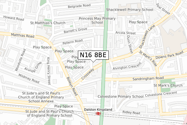
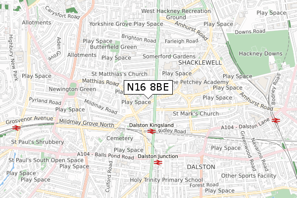
N16 8BE is located in the Shacklewell electoral ward, within the London borough of Hackney and the English Parliamentary constituency of Hackney North and Stoke Newington. The Sub Integrated Care Board (ICB) Location is NHS North East London ICB - A3A8R and the police force is Metropolitan Police. This postcode has been in use since December 2017.


GetTheData
Source: OS Open Zoomstack (Ordnance Survey)
Licence: Open Government Licence (requires attribution)
Attribution: Contains OS data © Crown copyright and database right 2024
Source: Open Postcode Geo
Licence: Open Government Licence (requires attribution)
Attribution: Contains OS data © Crown copyright and database right 2024; Contains Royal Mail data © Royal Mail copyright and database right 2024; Source: Office for National Statistics licensed under the Open Government Licence v.3.0
| Easting | 533497 |
| Northing | 185278 |
| Latitude | 51.550608 |
| Longitude | -0.075974 |
GetTheData
Source: Open Postcode Geo
Licence: Open Government Licence
| Country | England |
| Postcode District | N16 |
| ➜ N16 open data dashboard ➜ See where N16 is on a map ➜ Where is London? | |
GetTheData
Source: Land Registry Price Paid Data
Licence: Open Government Licence
| Ward | Shacklewell |
| Constituency | Hackney North And Stoke Newington |
GetTheData
Source: ONS Postcode Database
Licence: Open Government Licence
| January 2024 | Anti-social behaviour | On or near Alvington Crescent | 183m |
| January 2024 | Public order | On or near Alvington Crescent | 183m |
| January 2024 | Public order | On or near Alvington Crescent | 183m |
| ➜ Get more crime data in our Crime section | |||
GetTheData
Source: data.police.uk
Licence: Open Government Licence
| Crossway Kingsland High Street | Shacklewell | 22m |
| Crossway (N16) (Crossway) | Shacklewell | 45m |
| Rio Cinema (Kingsland High Street) | Shacklewell | 62m |
| Rio Cinema (Kingsland High Street) | Shacklewell | 84m |
| Shacklewell Lane High Street (Stoke Newington Road) | Shacklewell | 113m |
| Dalston Kingsland Station | 0.3km |
| Dalston Junction Station | 0.5km |
| Rectory Road Station | 1km |
GetTheData
Source: NaPTAN
Licence: Open Government Licence
➜ Broadband speed and availability dashboard for N16 8BE
| Percentage of properties with Next Generation Access | 100.0% |
| Percentage of properties with Superfast Broadband | 100.0% |
| Percentage of properties with Ultrafast Broadband | 0.0% |
| Percentage of properties with Full Fibre Broadband | 0.0% |
Superfast Broadband is between 30Mbps and 300Mbps
Ultrafast Broadband is > 300Mbps
| Median download speed | 75.4Mbps |
| Average download speed | 59.5Mbps |
| Maximum download speed | 80.00Mbps |
| Median upload speed | 17.6Mbps |
| Average upload speed | 13.6Mbps |
| Maximum upload speed | 20.00Mbps |
| Percentage of properties unable to receive 2Mbps | 0.0% |
| Percentage of properties unable to receive 5Mbps | 0.0% |
| Percentage of properties unable to receive 10Mbps | 0.0% |
| Percentage of properties unable to receive 30Mbps | 0.0% |
➜ Broadband speed and availability dashboard for N16 8BE
GetTheData
Source: Ofcom
Licence: Ofcom Terms of Use (requires attribution)
GetTheData
Source: ONS Postcode Database
Licence: Open Government Licence


➜ Get more ratings from the Food Standards Agency
GetTheData
Source: Food Standards Agency
Licence: FSA terms & conditions
| Last Collection | |||
|---|---|---|---|
| Location | Mon-Fri | Sat | Distance |
| 118 Kingsland High Street E8 | 18:30 | 12:00 | 74m |
| Stoke Newington Rd/Shackwell | 17:30 | 12:00 | 91m |
| 171 Sandringham Road E8 | 17:00 | 11:30 | 129m |
GetTheData
Source: Dracos
Licence: Creative Commons Attribution-ShareAlike
| Facility | Distance |
|---|---|
| Legends Gym (Dalston) Ridley Road, London Health and Fitness Gym | 309m |
| Petchey Academy Shacklewell Road, London Sports Hall, Health and Fitness Gym, Studio, Artificial Grass Pitch, Outdoor Tennis Courts | 471m |
| St Matthias Club Cecilia Road, London Sports Hall | 586m |
GetTheData
Source: Active Places
Licence: Open Government Licence
| School | Phase of Education | Distance |
|---|---|---|
| Colvestone Primary School Colvestone Crescent, Hackney, London, E8 2LG | Primary | 209m |
| Princess May Primary School Princess May Road, London, N16 8DF | Primary | 265m |
| Halley House School 52-58 Arcola Street, Hackney, London, E8 2DJ | Primary | 282m |
GetTheData
Source: Edubase
Licence: Open Government Licence
The below table lists the International Territorial Level (ITL) codes (formerly Nomenclature of Territorial Units for Statistics (NUTS) codes) and Local Administrative Units (LAU) codes for N16 8BE:
| ITL 1 Code | Name |
|---|---|
| TLI | London |
| ITL 2 Code | Name |
| TLI4 | Inner London - East |
| ITL 3 Code | Name |
| TLI41 | Hackney and Newham |
| LAU 1 Code | Name |
| E09000012 | Hackney |
GetTheData
Source: ONS Postcode Directory
Licence: Open Government Licence
The below table lists the Census Output Area (OA), Lower Layer Super Output Area (LSOA), and Middle Layer Super Output Area (MSOA) for N16 8BE:
| Code | Name | |
|---|---|---|
| OA | E00008691 | |
| LSOA | E01001747 | Hackney 014B |
| MSOA | E02000358 | Hackney 014 |
GetTheData
Source: ONS Postcode Directory
Licence: Open Government Licence
| N16 8HX | Crossway | 26m |
| N16 8HY | Selsea Place | 47m |
| N16 8BH | Stoke Newington Road | 52m |
| N16 8LA | Crossway | 57m |
| N16 8UY | Templeton Close | 69m |
| N16 7XN | Stoke Newington Road | 91m |
| N16 8JZ | John Campbell Road | 92m |
| N16 8UT | Lydford Close | 98m |
| N16 8AX | Salcombe Road | 98m |
| N16 8AU | Salcombe Road | 105m |
GetTheData
Source: Open Postcode Geo; Land Registry Price Paid Data
Licence: Open Government Licence