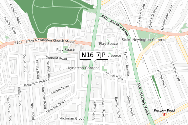
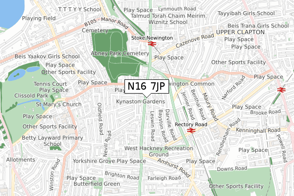
N16 7JP is located in the Stoke Newington electoral ward, within the London borough of Hackney and the English Parliamentary constituency of Hackney North and Stoke Newington. The Sub Integrated Care Board (ICB) Location is NHS North East London ICB - A3A8R and the police force is Metropolitan Police. This postcode has been in use since March 2018.


GetTheData
Source: OS Open Zoomstack (Ordnance Survey)
Licence: Open Government Licence (requires attribution)
Attribution: Contains OS data © Crown copyright and database right 2024
Source: Open Postcode Geo
Licence: Open Government Licence (requires attribution)
Attribution: Contains OS data © Crown copyright and database right 2024; Contains Royal Mail data © Royal Mail copyright and database right 2024; Source: Office for National Statistics licensed under the Open Government Licence v.3.0
| Easting | 533629 |
| Northing | 186447 |
| Latitude | 51.561082 |
| Longitude | -0.073628 |
GetTheData
Source: Open Postcode Geo
Licence: Open Government Licence
| Country | England |
| Postcode District | N16 |
| ➜ N16 open data dashboard ➜ See where N16 is on a map ➜ Where is Stoke Newington? | |
GetTheData
Source: Land Registry Price Paid Data
Licence: Open Government Licence
| Ward | Stoke Newington |
| Constituency | Hackney North And Stoke Newington |
GetTheData
Source: ONS Postcode Database
Licence: Open Government Licence
| January 2024 | Theft from the person | On or near Parking Area | 166m |
| January 2024 | Vehicle crime | On or near Parking Area | 166m |
| January 2024 | Violence and sexual offences | On or near Parking Area | 166m |
| ➜ Get more crime data in our Crime section | |||
GetTheData
Source: data.police.uk
Licence: Open Government Licence
| Stoke Newington High Street (Brooke Road) | Stoke Newington | 51m |
| Brooke Road (Stoke Newington High Street) | Stoke Newington | 77m |
| Stoke Newington Brooke Road (Brooke Road) | Stoke Newington | 89m |
| William Patten School | Stoke Newington | 128m |
| Stoke Newington High Street Garnham Street | Stoke Newington | 139m |
| Stoke Newington Station | 0.5km |
| Rectory Road Station | 0.5km |
| Clapton Station | 1.2km |
GetTheData
Source: NaPTAN
Licence: Open Government Licence
GetTheData
Source: ONS Postcode Database
Licence: Open Government Licence


➜ Get more ratings from the Food Standards Agency
GetTheData
Source: Food Standards Agency
Licence: FSA terms & conditions
| Last Collection | |||
|---|---|---|---|
| Location | Mon-Fri | Sat | Distance |
| 138 Stoke Newington High St | 17:30 | 12:00 | 41m |
| Stoke Newington High Street/ | 17:30 | 12:00 | 155m |
| Brooke Road/Rectory Road | 17:30 | 12:00 | 252m |
GetTheData
Source: Dracos
Licence: Creative Commons Attribution-ShareAlike
| Facility | Distance |
|---|---|
| The Bay Health Club (Closed) Stoke Newington High Street, London Health and Fitness Gym, Studio | 187m |
| Sunstone Health & Leisure Club For Women (Closed) Northwold Road, Stoke Newington, London Swimming Pool, Health and Fitness Gym, Studio | 227m |
| Simon Marks Jewish Primary School Cazenove Road, London Artificial Grass Pitch | 627m |
GetTheData
Source: Active Places
Licence: Open Government Licence
| School | Phase of Education | Distance |
|---|---|---|
| William Patten Primary School Stoke Newington Church St, London, N16 0NX | Primary | 121m |
| Tawhid Boys School, Tawhid Educational Trust Cazenove Road, London, London, N16 6PA | Not applicable | 412m |
| St Mary's Church of England Primary School, Stoke Newington Barn Street, Stoke Newington, London, N16 0JT | Primary | 560m |
GetTheData
Source: Edubase
Licence: Open Government Licence
The below table lists the International Territorial Level (ITL) codes (formerly Nomenclature of Territorial Units for Statistics (NUTS) codes) and Local Administrative Units (LAU) codes for N16 7JP:
| ITL 1 Code | Name |
|---|---|
| TLI | London |
| ITL 2 Code | Name |
| TLI4 | Inner London - East |
| ITL 3 Code | Name |
| TLI41 | Hackney and Newham |
| LAU 1 Code | Name |
| E09000012 | Hackney |
GetTheData
Source: ONS Postcode Directory
Licence: Open Government Licence
The below table lists the Census Output Area (OA), Lower Layer Super Output Area (LSOA), and Middle Layer Super Output Area (MSOA) for N16 7JP:
| Code | Name | |
|---|---|---|
| OA | E00009145 | |
| LSOA | E01001831 | Hackney 009D |
| MSOA | E02000353 | Hackney 009 |
GetTheData
Source: ONS Postcode Directory
Licence: Open Government Licence
| N16 7JL | Stoke Newington High Street | 23m |
| N16 0NY | Stoke Newington High Street | 49m |
| N16 7LQ | Lawrence Buildings | 70m |
| N16 7JS | Sanford Lane | 72m |
| N16 0DA | Dynevor Road | 93m |
| N16 7LA | Cottage Walk | 102m |
| N16 0PH | Stoke Newington High Street | 104m |
| N16 7LD | Clevedon Close | 107m |
| N16 7JD | Stoke Newington High Street | 108m |
| N16 0HA | Dynevor Road | 111m |
GetTheData
Source: Open Postcode Geo; Land Registry Price Paid Data
Licence: Open Government Licence