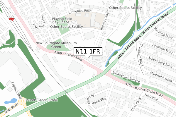
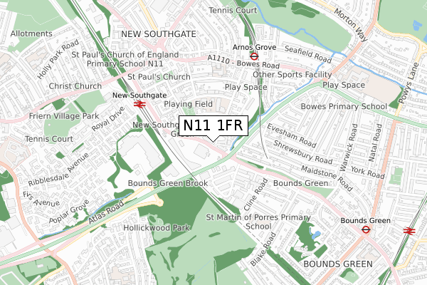
N11 1FR is located in the New Southgate electoral ward, within the London borough of Enfield and the English Parliamentary constituency of Enfield, Southgate. The Sub Integrated Care Board (ICB) Location is NHS North Central London ICB - 93C and the police force is Metropolitan Police. This postcode has been in use since February 2021.


GetTheData
Source: OS Open Zoomstack (Ordnance Survey)
Licence: Open Government Licence (requires attribution)
Attribution: Contains OS data © Crown copyright and database right 2024
Source: Open Postcode Geo
Licence: Open Government Licence (requires attribution)
Attribution: Contains OS data © Crown copyright and database right 2024; Contains Royal Mail data © Royal Mail copyright and database right 2024; Source: Office for National Statistics licensed under the Open Government Licence v.3.0
| Easting | 529081 |
| Northing | 191995 |
| Latitude | 51.611999 |
| Longitude | -0.137163 |
GetTheData
Source: Open Postcode Geo
Licence: Open Government Licence
| Country | England |
| Postcode District | N11 |
| ➜ N11 open data dashboard ➜ See where N11 is on a map ➜ Where is Southgate? | |
GetTheData
Source: Land Registry Price Paid Data
Licence: Open Government Licence
| Ward | New Southgate |
| Constituency | Enfield, Southgate |
GetTheData
Source: ONS Postcode Database
Licence: Open Government Licence
| January 2024 | Anti-social behaviour | On or near Highview Gardens | 235m |
| January 2024 | Violence and sexual offences | On or near Highview Gardens | 235m |
| January 2024 | Anti-social behaviour | On or near Palmer'S Road | 290m |
| ➜ Get more crime data in our Crime section | |||
GetTheData
Source: data.police.uk
Licence: Open Government Licence
| Hobart Corner (Station Road) | Arnos Grove | 64m |
| Hobart Corner (Station Road) | Arnos Grove | 69m |
| Bounds Green Road | Arnos Grove | 125m |
| Lower Park Road (Station Road) | Arnos Grove | 156m |
| Lower Park Road (Station Road) | Arnos Grove | 170m |
| Arnos Grove Underground Station | Arnos Grove | 571m |
| Bounds Green Underground Station | Wood Green | 1,053m |
| New Southgate Station | 0.5km |
| Bowes Park Station | 1.3km |
| Alexandra Palace Station | 2km |
GetTheData
Source: NaPTAN
Licence: Open Government Licence
| Percentage of properties with Next Generation Access | 1.3% |
| Percentage of properties with Superfast Broadband | 1.3% |
| Percentage of properties with Ultrafast Broadband | 1.3% |
| Percentage of properties with Full Fibre Broadband | 0.0% |
Superfast Broadband is between 30Mbps and 300Mbps
Ultrafast Broadband is > 300Mbps
| Percentage of properties unable to receive 2Mbps | 0.0% |
| Percentage of properties unable to receive 5Mbps | 0.0% |
| Percentage of properties unable to receive 10Mbps | 0.0% |
| Percentage of properties unable to receive 30Mbps | 0.0% |
GetTheData
Source: Ofcom
Licence: Ofcom Terms of Use (requires attribution)
GetTheData
Source: ONS Postcode Database
Licence: Open Government Licence


➜ Get more ratings from the Food Standards Agency
GetTheData
Source: Food Standards Agency
Licence: FSA terms & conditions
| Last Collection | |||
|---|---|---|---|
| Location | Mon-Fri | Sat | Distance |
| New Southgate Delivery Office | 17:30 | 12:00 | 279m |
| Cline Road/Bounds Green Road | 17:30 | 12:00 | 379m |
| 148 Maidstone Road | 17:30 | 12:00 | 416m |
GetTheData
Source: Dracos
Licence: Creative Commons Attribution-ShareAlike
| Facility | Distance |
|---|---|
| Garfield Primary School (Closed) Springfield Road, London Grass Pitches | 223m |
| Grove Road Christian Centre (Closed) Grove Road, New Southgate, London Sports Hall | 481m |
| Freehold Community Centre Alexandra Road, London Sports Hall | 604m |
GetTheData
Source: Active Places
Licence: Open Government Licence
| School | Phase of Education | Distance |
|---|---|---|
| Garfield Primary School Upper Park Road, New Southgate, Enfield, London, N11 1BH | Primary | 223m |
| Our Lady of Lourdes Catholic Primary School The Limes Avenue, London, N11 1RD | Primary | 407m |
| Focus 1st Academy 339 Bowes Road, New Southgate, London, N11 1BA | Not applicable | 484m |
GetTheData
Source: Edubase
Licence: Open Government Licence
The below table lists the International Territorial Level (ITL) codes (formerly Nomenclature of Territorial Units for Statistics (NUTS) codes) and Local Administrative Units (LAU) codes for N11 1FR:
| ITL 1 Code | Name |
|---|---|
| TLI | London |
| ITL 2 Code | Name |
| TLI5 | Outer London - East and North East |
| ITL 3 Code | Name |
| TLI54 | Enfield |
| LAU 1 Code | Name |
| E09000010 | Enfield |
GetTheData
Source: ONS Postcode Directory
Licence: Open Government Licence
The below table lists the Census Output Area (OA), Lower Layer Super Output Area (LSOA), and Middle Layer Super Output Area (MSOA) for N11 1FR:
| Code | Name | |
|---|---|---|
| OA | E00007587 | |
| LSOA | E01001528 | Enfield 032B |
| MSOA | E02000308 | Enfield 032 |
GetTheData
Source: ONS Postcode Directory
Licence: Open Government Licence
| N11 1QZ | Weld Place | 106m |
| N11 1SG | Palmers Road | 134m |
| N11 1SA | Upper Park Road | 141m |
| N11 1RX | Upper Park Road | 141m |
| N11 1QY | Weld Place | 142m |
| N11 1RZ | Upper Park Road | 158m |
| N11 1RU | Upper Park Road | 207m |
| N11 1SQ | Highview Gardens | 217m |
| N11 1SY | Inverforth Road | 221m |
| N11 2RT | Totnes Villas | 237m |
GetTheData
Source: Open Postcode Geo; Land Registry Price Paid Data
Licence: Open Government Licence