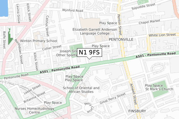
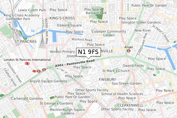
N1 9FS is located in the Barnsbury electoral ward, within the London borough of Islington and the English Parliamentary constituency of Islington South and Finsbury. The Sub Integrated Care Board (ICB) Location is NHS North Central London ICB - 93C and the police force is Metropolitan Police. This postcode has been in use since June 2018.


GetTheData
Source: OS Open Zoomstack (Ordnance Survey)
Licence: Open Government Licence (requires attribution)
Attribution: Contains OS data © Crown copyright and database right 2024
Source: Open Postcode Geo
Licence: Open Government Licence (requires attribution)
Attribution: Contains OS data © Crown copyright and database right 2024; Contains Royal Mail data © Royal Mail copyright and database right 2024; Source: Office for National Statistics licensed under the Open Government Licence v.3.0
| Easting | 530916 |
| Northing | 183102 |
| Latitude | 51.531658 |
| Longitude | -0.113987 |
GetTheData
Source: Open Postcode Geo
Licence: Open Government Licence
| Country | England |
| Postcode District | N1 |
| ➜ N1 open data dashboard ➜ See where N1 is on a map ➜ Where is London? | |
GetTheData
Source: Land Registry Price Paid Data
Licence: Open Government Licence
| Ward | Barnsbury |
| Constituency | Islington South And Finsbury |
GetTheData
Source: ONS Postcode Database
Licence: Open Government Licence
| January 2024 | Public order | On or near Lorenzo Street | 229m |
| January 2024 | Violence and sexual offences | On or near Maygood Street | 345m |
| January 2024 | Anti-social behaviour | On or near Theatre/Concert Hall | 400m |
| ➜ Get more crime data in our Crime section | |||
GetTheData
Source: data.police.uk
Licence: Open Government Licence
| Penton Rise (Pentonville Road) | Pentonville | 103m |
| Penton Rise | Pentonville | 125m |
| Penton Rise (Pentonville Road) | Pentonville | 128m |
| Penton Street (Pentonville Road) | Pentonville | 157m |
| Penton Street White Lion St | Pentonville | 219m |
| Angel Underground Station | Angel | 573m |
| King's Cross St. Pancras Underground Station | King's Cross | 647m |
| Russell Square Underground Station | Russell Square | 1,192m |
| Farringdon Underground Station | Farringdon | 1,417m |
| Euston Underground Station | Euston | 1,431m |
| London Kings Cross Station | 0.6km |
| London St Pancras International Station | 0.9km |
| London St Pancras International LL Station | 0.9km |
GetTheData
Source: NaPTAN
Licence: Open Government Licence
➜ Broadband speed and availability dashboard for N1 9FS
| Percentage of properties with Next Generation Access | 100.0% |
| Percentage of properties with Superfast Broadband | 100.0% |
| Percentage of properties with Ultrafast Broadband | 100.0% |
| Percentage of properties with Full Fibre Broadband | 100.0% |
Superfast Broadband is between 30Mbps and 300Mbps
Ultrafast Broadband is > 300Mbps
Ofcom does not currently provide download speed data for N1 9FS. This is because there are less than four broadband connections in this postcode.
Ofcom does not currently provide upload speed data for N1 9FS. This is because there are less than four broadband connections in this postcode.
| Percentage of properties unable to receive 2Mbps | 0.0% |
| Percentage of properties unable to receive 5Mbps | 0.0% |
| Percentage of properties unable to receive 10Mbps | 0.0% |
| Percentage of properties unable to receive 30Mbps | 0.0% |
➜ Broadband speed and availability dashboard for N1 9FS
GetTheData
Source: Ofcom
Licence: Ofcom Terms of Use (requires attribution)
GetTheData
Source: ONS Postcode Database
Licence: Open Government Licence


➜ Get more ratings from the Food Standards Agency
GetTheData
Source: Food Standards Agency
Licence: FSA terms & conditions
| Last Collection | |||
|---|---|---|---|
| Location | Mon-Fri | Sat | Distance |
| 192 Pentonville Road | 18:30 | 12:00 | 248m |
| Kings Cross Road (Britannia St) | 18:30 | 12:00 | 258m |
| Amwell Street (O/S Tso) | 18:30 | 12:00 | 322m |
GetTheData
Source: Dracos
Licence: Creative Commons Attribution-ShareAlike
| Facility | Distance |
|---|---|
| Elizabeth Garrett Anderson School Donegal Street, London Health and Fitness Gym, Sports Hall, Studio, Outdoor Tennis Courts | 147m |
| Anytime Fitness (London Kings Cross) Pentonville Road, London Health and Fitness Gym | 284m |
| Winton Primary School Killick Street, London Sports Hall | 301m |
GetTheData
Source: Active Places
Licence: Open Government Licence
| School | Phase of Education | Distance |
|---|---|---|
| The Pears Family School 4-8 Rodney Street, London, N1 9JH | Not applicable | 37m |
| The Gower School 10 Cynthia Street, Barnsbury, London, N1 9JF | Not applicable | 52m |
| Elizabeth Garrett Anderson School Donegal Street, Islington, London, N1 9QG | Secondary | 172m |
GetTheData
Source: Edubase
Licence: Open Government Licence
The below table lists the International Territorial Level (ITL) codes (formerly Nomenclature of Territorial Units for Statistics (NUTS) codes) and Local Administrative Units (LAU) codes for N1 9FS:
| ITL 1 Code | Name |
|---|---|
| TLI | London |
| ITL 2 Code | Name |
| TLI4 | Inner London - East |
| ITL 3 Code | Name |
| TLI43 | Haringey and Islington |
| LAU 1 Code | Name |
| E09000019 | Islington |
GetTheData
Source: ONS Postcode Directory
Licence: Open Government Licence
The below table lists the Census Output Area (OA), Lower Layer Super Output Area (LSOA), and Middle Layer Super Output Area (MSOA) for N1 9FS:
| Code | Name | |
|---|---|---|
| OA | E00174805 | |
| LSOA | E01002697 | Islington 019B |
| MSOA | E02000572 | Islington 019 |
GetTheData
Source: ONS Postcode Directory
Licence: Open Government Licence
| N1 9JH | Rodney Street | 65m |
| N1 9QF | Donegal Street | 67m |
| N1 9FH | Pentonville Road | 93m |
| WC1X 9EG | Penton Rise | 101m |
| N1 9LF | Pentonville Road | 103m |
| WC1X 9EF | Penton Rise | 108m |
| N1 9QD | Donegal Street | 114m |
| N1 9JL | Pentonville Road | 120m |
| N1 9LG | Pentonville Road | 130m |
| N1 9JA | Cumming Street | 137m |
GetTheData
Source: Open Postcode Geo; Land Registry Price Paid Data
Licence: Open Government Licence