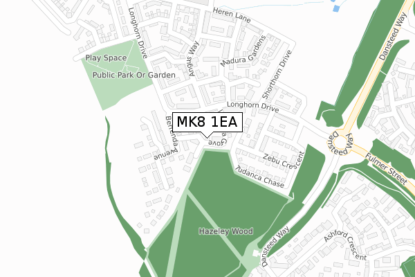
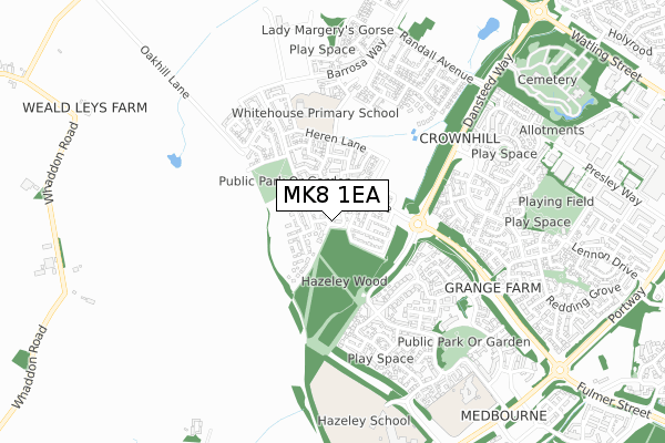
MK8 1EA is located in the Stony Stratford electoral ward, within the unitary authority of Milton Keynes and the English Parliamentary constituency of Milton Keynes South. The Sub Integrated Care Board (ICB) Location is NHS Bedfordshire, Luton and Milton Keynes ICB - M1J4Y and the police force is Thames Valley. This postcode has been in use since March 2019.


GetTheData
Source: OS Open Zoomstack (Ordnance Survey)
Licence: Open Government Licence (requires attribution)
Attribution: Contains OS data © Crown copyright and database right 2024
Source: Open Postcode Geo
Licence: Open Government Licence (requires attribution)
Attribution: Contains OS data © Crown copyright and database right 2024; Contains Royal Mail data © Royal Mail copyright and database right 2024; Source: Office for National Statistics licensed under the Open Government Licence v.3.0
| Easting | 481369 |
| Northing | 237178 |
| Latitude | 52.027068 |
| Longitude | -0.815428 |
GetTheData
Source: Open Postcode Geo
Licence: Open Government Licence
| Country | England |
| Postcode District | MK8 |
| ➜ MK8 open data dashboard ➜ See where MK8 is on a map ➜ Where is Milton Keynes? | |
GetTheData
Source: Land Registry Price Paid Data
Licence: Open Government Licence
| Ward | Stony Stratford |
| Constituency | Milton Keynes South |
GetTheData
Source: ONS Postcode Database
Licence: Open Government Licence
7, VIANESA GROVE, WHITEHOUSE, MILTON KEYNES, MK8 1EA 2020 31 JAN £550,000 |
12, VIANESA GROVE, WHITEHOUSE, MILTON KEYNES, MK8 1EA 2019 19 DEC £495,000 |
14, VIANESA GROVE, WHITEHOUSE, MILTON KEYNES, MK8 1EA 2019 16 DEC £500,000 |
19, VIANESA GROVE, WHITEHOUSE, MILTON KEYNES, MK8 1EA 2019 26 NOV £360,000 |
13, VIANESA GROVE, WHITEHOUSE, MILTON KEYNES, MK8 1EA 2019 22 NOV £365,000 |
11, VIANESA GROVE, WHITEHOUSE, MILTON KEYNES, MK8 1EA 2019 18 NOV £365,000 |
8, VIANESA GROVE, WHITEHOUSE, MILTON KEYNES, MK8 1EA 2019 28 JUN £610,000 |
9, VIANESA GROVE, WHITEHOUSE, MILTON KEYNES, MK8 1EA 2019 28 JUN £615,000 |
10, VIANESA GROVE, WHITEHOUSE, MILTON KEYNES, MK8 1EA 2019 28 JUN £565,000 |
5, VIANESA GROVE, WHITEHOUSE, MILTON KEYNES, MK8 1EA 2019 20 JUN £530,000 |
GetTheData
Source: HM Land Registry Price Paid Data
Licence: Contains HM Land Registry data © Crown copyright and database right 2024. This data is licensed under the Open Government Licence v3.0.
| January 2024 | Violence and sexual offences | On or near Gainsborough Close | 480m |
| January 2024 | Violence and sexual offences | On or near Gainsborough Close | 480m |
| January 2024 | Violence and sexual offences | On or near Gainsborough Close | 480m |
| ➜ Get more crime data in our Crime section | |||
GetTheData
Source: data.police.uk
Licence: Open Government Licence
| Longhorn Drive (Whitehouse) | Whitehouse | 198m |
| Heren Lane (Longhorn Drive) | Whitehouse | 484m |
| Hendrix Drive | Crownhill | 556m |
| Whitehouse School (Barrosa Way) | Whitehouse | 559m |
| Hendrix Drive | Crownhill | 561m |
| Milton Keynes Central Station | 2.9km |
| Wolverton Station | 4.4km |
GetTheData
Source: NaPTAN
Licence: Open Government Licence
| Percentage of properties with Next Generation Access | 86.4% |
| Percentage of properties with Superfast Broadband | 86.4% |
| Percentage of properties with Ultrafast Broadband | 86.4% |
| Percentage of properties with Full Fibre Broadband | 86.4% |
Superfast Broadband is between 30Mbps and 300Mbps
Ultrafast Broadband is > 300Mbps
| Percentage of properties unable to receive 2Mbps | 0.0% |
| Percentage of properties unable to receive 5Mbps | 13.6% |
| Percentage of properties unable to receive 10Mbps | 13.6% |
| Percentage of properties unable to receive 30Mbps | 13.6% |
GetTheData
Source: Ofcom
Licence: Ofcom Terms of Use (requires attribution)
GetTheData
Source: ONS Postcode Database
Licence: Open Government Licence


➜ Get more ratings from the Food Standards Agency
GetTheData
Source: Food Standards Agency
Licence: FSA terms & conditions
| Last Collection | |||
|---|---|---|---|
| Location | Mon-Fri | Sat | Distance |
| Hendrix Drive | 18:00 | 12:30 | 569m |
| Dunthorne Way | 17:30 | 12:00 | 856m |
| Lennon Drive | 17:30 | 12:00 | 881m |
GetTheData
Source: Dracos
Licence: Creative Commons Attribution-ShareAlike
| Facility | Distance |
|---|---|
| Whitehouse Primary School Vaynol Way, Vaynol Way, Whitehouse, Milton Keynes Grass Pitches | 415m |
| Crownhill Sports Ground Lennon Drive, Crownhill, Milton Keynes Grass Pitches | 853m |
| Watling Academy Barrosa Way, Whitehouse, Milton Keynes Artificial Grass Pitch, Sports Hall, Outdoor Tennis Courts | 865m |
GetTheData
Source: Active Places
Licence: Open Government Licence
| School | Phase of Education | Distance |
|---|---|---|
| Whitehouse Primary School Vaynol Way, Whitehouse, Milton Keynes, MK8 1AG | Primary | 367m |
| Christ the Sower Ecumenical Primary School Singleton Drive, Grange Farm, Milton Keynes, MK8 0PZ | Primary | 817m |
| The Hazeley Academy Emperor Drive, Hazeley, Milton Keynes, MK8 0PT | Secondary | 896m |
GetTheData
Source: Edubase
Licence: Open Government Licence
The below table lists the International Territorial Level (ITL) codes (formerly Nomenclature of Territorial Units for Statistics (NUTS) codes) and Local Administrative Units (LAU) codes for MK8 1EA:
| ITL 1 Code | Name |
|---|---|
| TLJ | South East (England) |
| ITL 2 Code | Name |
| TLJ1 | Berkshire, Buckinghamshire and Oxfordshire |
| ITL 3 Code | Name |
| TLJ12 | Milton Keynes |
| LAU 1 Code | Name |
| E06000042 | Milton Keynes |
GetTheData
Source: ONS Postcode Directory
Licence: Open Government Licence
The below table lists the Census Output Area (OA), Lower Layer Super Output Area (LSOA), and Middle Layer Super Output Area (MSOA) for MK8 1EA:
| Code | Name | |
|---|---|---|
| OA | E00175503 | |
| LSOA | E01033525 | Milton Keynes 019H |
| MSOA | E02003477 | Milton Keynes 019 |
GetTheData
Source: ONS Postcode Directory
Licence: Open Government Licence
| MK8 0PY | Wickstead Avenue | 348m |
| MK8 0ND | Hayman Rise | 362m |
| MK8 0LZ | Ashford Crescent | 388m |
| MK8 0PR | Garwood Crescent | 398m |
| MK8 0PS | Garwood Crescent | 420m |
| MK8 0EJ | Chevalier Grove | 446m |
| MK8 0PW | Wickstead Avenue | 452m |
| MK8 0NA | Gainsborough Close | 467m |
| MK8 0PJ | Proctor Rise | 468m |
| MK8 0NN | Ashford Crescent | 469m |
GetTheData
Source: Open Postcode Geo; Land Registry Price Paid Data
Licence: Open Government Licence