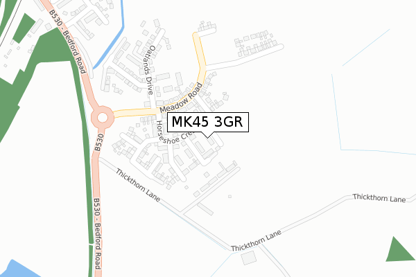
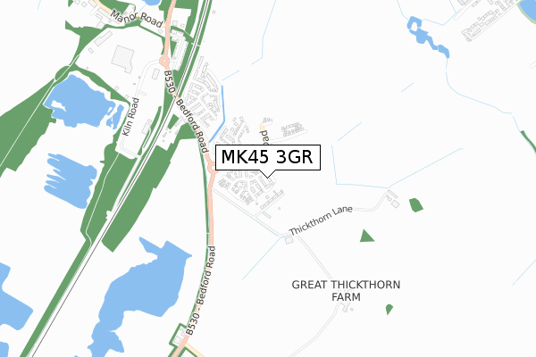
MK45 3GR is located in the Houghton Conquest & Haynes electoral ward, within the unitary authority of Central Bedfordshire and the English Parliamentary constituency of Mid Bedfordshire. The Sub Integrated Care Board (ICB) Location is NHS Bedfordshire, Luton and Milton Keynes ICB - M1J4Y and the police force is Bedfordshire. This postcode has been in use since December 2019.


GetTheData
Source: OS Open Zoomstack (Ordnance Survey)
Licence: Open Government Licence (requires attribution)
Attribution: Contains OS data © Crown copyright and database right 2024
Source: Open Postcode Geo
Licence: Open Government Licence (requires attribution)
Attribution: Contains OS data © Crown copyright and database right 2024; Contains Royal Mail data © Royal Mail copyright and database right 2024; Source: Office for National Statistics licensed under the Open Government Licence v.3.0
| Easting | 504092 |
| Northing | 243457 |
| Latitude | 52.079707 |
| Longitude | -0.482434 |
GetTheData
Source: Open Postcode Geo
Licence: Open Government Licence
| Country | England |
| Postcode District | MK45 |
| ➜ MK45 open data dashboard ➜ See where MK45 is on a map | |
GetTheData
Source: Land Registry Price Paid Data
Licence: Open Government Licence
| Ward | Houghton Conquest & Haynes |
| Constituency | Mid Bedfordshire |
GetTheData
Source: ONS Postcode Database
Licence: Open Government Licence
| June 2022 | Criminal damage and arson | On or near Park/Open Space | 170m |
| June 2022 | Violence and sexual offences | On or near Park/Open Space | 170m |
| June 2022 | Violence and sexual offences | On or near Park/Open Space | 170m |
| ➜ Get more crime data in our Crime section | |||
GetTheData
Source: data.police.uk
Licence: Open Government Licence
| Thickthorn Lane (Bedford Road) | Kempston Hardwick | 297m |
| Thickthorn Lane (Bedford Road) | Kempston Hardwick | 323m |
| Manor Road (Bedford Road) | Kempston Hardwick | 798m |
| Manor Road (Bedford Road) | Kempston Hardwick | 887m |
| Dove Lane (Green Lane) | Wixams | 1,811m |
| Kempston Hardwick Station | 2km |
| Stewartby Station | 2.9km |
| Millbrook (Beds) Station | 4.5km |
GetTheData
Source: NaPTAN
Licence: Open Government Licence
GetTheData
Source: ONS Postcode Database
Licence: Open Government Licence


➜ Get more ratings from the Food Standards Agency
GetTheData
Source: Food Standards Agency
Licence: FSA terms & conditions
| Last Collection | |||
|---|---|---|---|
| Location | Mon-Fri | Sat | Distance |
| Crancott Close | 16:20 | 09:00 | 1,647m |
| Dane Lane Loop | 17:00 | 11:45 | 1,729m |
| Post Office High Street | 16:25 | 10:30 | 1,915m |
GetTheData
Source: Dracos
Licence: Creative Commons Attribution-ShareAlike
| Facility | Distance |
|---|---|
| Wixams Academy Green Lane, Wixams, Bedford Grass Pitches, Studio, Sports Hall | 1.3km |
| Wixams Tree Primary School Green Lane, Wixams, Bedford Grass Pitches | 1.4km |
| Wixams 3g Green Lane, Wixams, Bedford Artificial Grass Pitch | 1.6km |
GetTheData
Source: Active Places
Licence: Open Government Licence
| School | Phase of Education | Distance |
|---|---|---|
| Wixams Academy Green Lane, Wixams, Bedford, MK42 6BA | Secondary | 1.3km |
| Wixams Tree Primary School Green Lane, Wixams, Bedford, MK42 6BA | Primary | 1.4km |
| Houghton Conquest Lower School High Street, Houghton Conquest, Bedford, MK45 3LL | Primary | 2km |
GetTheData
Source: Edubase
Licence: Open Government Licence
The below table lists the International Territorial Level (ITL) codes (formerly Nomenclature of Territorial Units for Statistics (NUTS) codes) and Local Administrative Units (LAU) codes for MK45 3GR:
| ITL 1 Code | Name |
|---|---|
| TLH | East |
| ITL 2 Code | Name |
| TLH2 | Bedfordshire and Hertfordshire |
| ITL 3 Code | Name |
| TLH25 | Central Bedfordshire |
| LAU 1 Code | Name |
| E06000056 | Central Bedfordshire |
GetTheData
Source: ONS Postcode Directory
Licence: Open Government Licence
The below table lists the Census Output Area (OA), Lower Layer Super Output Area (LSOA), and Middle Layer Super Output Area (MSOA) for MK45 3GR:
| Code | Name | |
|---|---|---|
| OA | E00087928 | |
| LSOA | E01017411 | Central Bedfordshire 008B |
| MSOA | E02003606 | Central Bedfordshire 008 |
GetTheData
Source: ONS Postcode Directory
Licence: Open Government Licence
| MK45 3PQ | Juniper Drive | 292m |
| MK45 3FQ | Juniper Drive | 454m |
| MK45 3FP | Juniper Drive | 486m |
| MK45 3FR | Borage Walk | 493m |
| MK45 3JG | Ampthill Road | 538m |
| MK45 3FS | Angelica Grove | 564m |
| MK45 3FT | Angelica Grove | 565m |
| MK45 3JP | Ampthill Road | 880m |
| MK43 9PQ | Kempston Court | 1086m |
| MK43 9NT | Manor Road | 1180m |
GetTheData
Source: Open Postcode Geo; Land Registry Price Paid Data
Licence: Open Government Licence