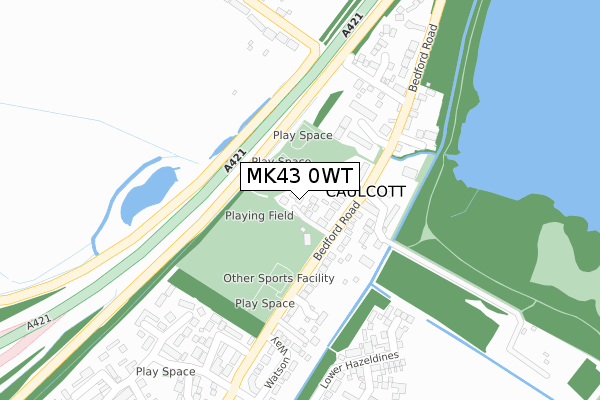
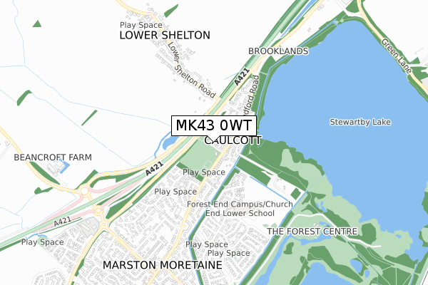
MK43 0WT is located in the Cranfield & Marston Moretaine electoral ward, within the unitary authority of Central Bedfordshire and the English Parliamentary constituency of Mid Bedfordshire. The Sub Integrated Care Board (ICB) Location is NHS Bedfordshire, Luton and Milton Keynes ICB - M1J4Y and the police force is Bedfordshire. This postcode has been in use since December 2017.


GetTheData
Source: OS Open Zoomstack (Ordnance Survey)
Licence: Open Government Licence (requires attribution)
Attribution: Contains OS data © Crown copyright and database right 2024
Source: Open Postcode Geo
Licence: Open Government Licence (requires attribution)
Attribution: Contains OS data © Crown copyright and database right 2024; Contains Royal Mail data © Royal Mail copyright and database right 2024; Source: Office for National Statistics licensed under the Open Government Licence v.3.0
| Easting | 499923 |
| Northing | 242228 |
| Latitude | 52.069429 |
| Longitude | -0.543609 |
GetTheData
Source: Open Postcode Geo
Licence: Open Government Licence
| Country | England |
| Postcode District | MK43 |
| ➜ MK43 open data dashboard ➜ See where MK43 is on a map ➜ Where is Caulcott? | |
GetTheData
Source: Land Registry Price Paid Data
Licence: Open Government Licence
| Ward | Cranfield & Marston Moretaine |
| Constituency | Mid Bedfordshire |
GetTheData
Source: ONS Postcode Database
Licence: Open Government Licence
2, COOK CLOSE, MARSTON MORETAINE, BEDFORD, MK43 0WT 2020 4 DEC £485,000 |
1, COOK CLOSE, MARSTON MORETAINE, BEDFORD, MK43 0WT 2020 28 FEB £480,000 |
6, COOK CLOSE, MARSTON MORETAINE, BEDFORD, MK43 0WT 2019 23 AUG £510,000 |
3, COOK CLOSE, MARSTON MORETAINE, BEDFORD, MK43 0WT 2019 22 MAR £515,000 |
4, COOK CLOSE, MARSTON MORETAINE, BEDFORD, MK43 0WT 2018 18 SEP £499,995 |
5, COOK CLOSE, MARSTON MORETAINE, BEDFORD, MK43 0WT 2017 12 DEC £545,000 |
GetTheData
Source: HM Land Registry Price Paid Data
Licence: Contains HM Land Registry data © Crown copyright and database right 2024. This data is licensed under the Open Government Licence v3.0.
| March 2023 | Vehicle crime | On or near Lakeview | 140m |
| June 2022 | Burglary | On or near Bedford Road | 197m |
| June 2022 | Anti-social behaviour | On or near Longcroft Lane | 390m |
| ➜ Get more crime data in our Crime section | |||
GetTheData
Source: data.police.uk
Licence: Open Government Licence
| Snagge Court (Bedford Road) | Caulcott | 161m |
| Arundel Drive (Bedford Road) | Marston Moretaine | 162m |
| Snagge Court (Bedford Road) | Caulcott | 178m |
| Arundel Road (Bedford Road) | Marston Moretaine | 269m |
| The Church (Lower Shelton Road) | Lower Shelton | 398m |
| Stewartby Station | 1.6km |
| Millbrook (Beds) Station | 1.9km |
| Lidlington Station | 3.3km |
GetTheData
Source: NaPTAN
Licence: Open Government Licence
| Percentage of properties with Next Generation Access | 100.0% |
| Percentage of properties with Superfast Broadband | 100.0% |
| Percentage of properties with Ultrafast Broadband | 0.0% |
| Percentage of properties with Full Fibre Broadband | 0.0% |
Superfast Broadband is between 30Mbps and 300Mbps
Ultrafast Broadband is > 300Mbps
| Percentage of properties unable to receive 2Mbps | 0.0% |
| Percentage of properties unable to receive 5Mbps | 0.0% |
| Percentage of properties unable to receive 10Mbps | 0.0% |
| Percentage of properties unable to receive 30Mbps | 0.0% |
GetTheData
Source: Ofcom
Licence: Ofcom Terms of Use (requires attribution)
GetTheData
Source: ONS Postcode Database
Licence: Open Government Licence


➜ Get more ratings from the Food Standards Agency
GetTheData
Source: Food Standards Agency
Licence: FSA terms & conditions
| Last Collection | |||
|---|---|---|---|
| Location | Mon-Fri | Sat | Distance |
| Rose & Crown Bedford Road | 16:20 | 11:10 | 191m |
| Lower Shelton | 16:20 | 11:10 | 346m |
| Post Office Bedford Road | 16:15 | 11:00 | 768m |
GetTheData
Source: Dracos
Licence: Creative Commons Attribution-ShareAlike
| Facility | Distance |
|---|---|
| Marston Playing Field Bedford Road, Marston Moretaine Grass Pitches | 67m |
| Marston Moreteyne Vc School (Forest End Site) Great Linns, Marston Moretaine, Bedford Grass Pitches | 422m |
| Marston Moreteyne Vc School - (Church End Site) Church Walk, Marston Moretaine, Bedford Swimming Pool, Grass Pitches | 1km |
GetTheData
Source: Active Places
Licence: Open Government Licence
| School | Phase of Education | Distance |
|---|---|---|
| Marston Moreteyne VC School Church Walk, Marston Moreteyne, MK43 0NE | Primary | 1km |
| Shelton Lower School Lower Shelton Road, Marston Moretaine, Bedford, Beds, MK43 0LS | Primary | 1.3km |
| Kimberley 16 - 19 Stem College Green Lane, Stewartby, Bedford, MK43 9LY | 16 plus | 1.3km |
GetTheData
Source: Edubase
Licence: Open Government Licence
The below table lists the International Territorial Level (ITL) codes (formerly Nomenclature of Territorial Units for Statistics (NUTS) codes) and Local Administrative Units (LAU) codes for MK43 0WT:
| ITL 1 Code | Name |
|---|---|
| TLH | East |
| ITL 2 Code | Name |
| TLH2 | Bedfordshire and Hertfordshire |
| ITL 3 Code | Name |
| TLH25 | Central Bedfordshire |
| LAU 1 Code | Name |
| E06000056 | Central Bedfordshire |
GetTheData
Source: ONS Postcode Directory
Licence: Open Government Licence
The below table lists the Census Output Area (OA), Lower Layer Super Output Area (LSOA), and Middle Layer Super Output Area (MSOA) for MK43 0WT:
| Code | Name | |
|---|---|---|
| OA | E00087958 | |
| LSOA | E01017417 | Central Bedfordshire 009B |
| MSOA | E02003607 | Central Bedfordshire 009 |
GetTheData
Source: ONS Postcode Directory
Licence: Open Government Licence
| MK43 0LD | Bedford Road | 106m |
| MK43 0LH | Lake View | 125m |
| MK43 0LF | Snagge Court | 136m |
| MK43 0NB | Horseshoe Close | 183m |
| MK43 0LL | Allen Court | 207m |
| MK43 0LE | Bedford Road | 229m |
| MK43 0LN | Lower Shelton Road | 273m |
| MK43 0LZ | Barkers Piece | 275m |
| MK43 0JY | Denbigh Close | 276m |
| MK43 0GW | Campin Court | 297m |
GetTheData
Source: Open Postcode Geo; Land Registry Price Paid Data
Licence: Open Government Licence