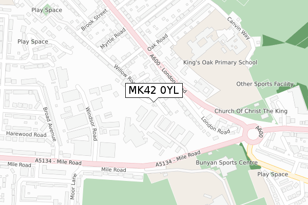
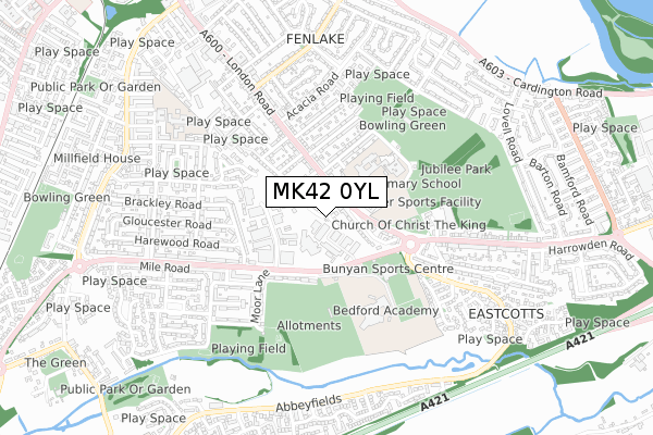
MK42 0YL is located in the Kingsbrook electoral ward, within the unitary authority of Bedford and the English Parliamentary constituency of Bedford. The Sub Integrated Care Board (ICB) Location is NHS Bedfordshire, Luton and Milton Keynes ICB - M1J4Y and the police force is Bedfordshire. This postcode has been in use since December 2019.


GetTheData
Source: OS Open Zoomstack (Ordnance Survey)
Licence: Open Government Licence (requires attribution)
Attribution: Contains OS data © Crown copyright and database right 2024
Source: Open Postcode Geo
Licence: Open Government Licence (requires attribution)
Attribution: Contains OS data © Crown copyright and database right 2024; Contains Royal Mail data © Royal Mail copyright and database right 2024; Source: Office for National Statistics licensed under the Open Government Licence v.3.0
| Easting | 505933 |
| Northing | 248061 |
| Latitude | 52.120737 |
| Longitude | -0.454151 |
GetTheData
Source: Open Postcode Geo
Licence: Open Government Licence
| Country | England |
| Postcode District | MK42 |
| ➜ MK42 open data dashboard ➜ See where MK42 is on a map ➜ Where is Bedford? | |
GetTheData
Source: Land Registry Price Paid Data
Licence: Open Government Licence
| Ward | Kingsbrook |
| Constituency | Bedford |
GetTheData
Source: ONS Postcode Database
Licence: Open Government Licence
| November 2023 | Violence and sexual offences | On or near Stapleton Road | 431m |
| September 2023 | Violence and sexual offences | On or near Stapleton Road | 431m |
| June 2023 | Violence and sexual offences | On or near Stapleton Road | 431m |
| ➜ Get more crime data in our Crime section | |||
GetTheData
Source: data.police.uk
Licence: Open Government Licence
| Oak Road (London Road) | Fenlake | 155m |
| Oak Road (London Road) | Fenlake | 160m |
| Windsor Road (Mile Road) | Cauldwell | 208m |
| John Bunyan Upper School (Mile Road) | Cauldwell | 212m |
| John Bunyan Upper School (Mile Road) | Cauldwell | 222m |
| Bedford St Johns Station | 1.3km |
| Bedford Station | 2.4km |
| Kempston Hardwick Station | 4.7km |
GetTheData
Source: NaPTAN
Licence: Open Government Licence
| Percentage of properties with Next Generation Access | 100.0% |
| Percentage of properties with Superfast Broadband | 100.0% |
| Percentage of properties with Ultrafast Broadband | 0.0% |
| Percentage of properties with Full Fibre Broadband | 0.0% |
Superfast Broadband is between 30Mbps and 300Mbps
Ultrafast Broadband is > 300Mbps
| Percentage of properties unable to receive 2Mbps | 0.0% |
| Percentage of properties unable to receive 5Mbps | 0.0% |
| Percentage of properties unable to receive 10Mbps | 0.0% |
| Percentage of properties unable to receive 30Mbps | 0.0% |
GetTheData
Source: Ofcom
Licence: Ofcom Terms of Use (requires attribution)
GetTheData
Source: ONS Postcode Database
Licence: Open Government Licence


➜ Get more ratings from the Food Standards Agency
GetTheData
Source: Food Standards Agency
Licence: FSA terms & conditions
| Last Collection | |||
|---|---|---|---|
| Location | Mon-Fri | Sat | Distance |
| Post Office London Road | 18:30 | 11:45 | 280m |
| Brackley Road | 17:45 | 11:15 | 489m |
| Meadowsweet Drive | 17:30 | 11:15 | 642m |
GetTheData
Source: Dracos
Licence: Creative Commons Attribution-ShareAlike
| Facility | Distance |
|---|---|
| Harrowden Middle School (Closed) Oak Road, Bedford Sports Hall, Grass Pitches | 247m |
| John Bunyan Health And Fitness Mile Road, Bedford Sports Hall, Health and Fitness Gym, Squash Courts, Studio | 320m |
| Bedford Academy Mile Road, Bedford Grass Pitches, Artificial Grass Pitch, Sports Hall | 411m |
GetTheData
Source: Active Places
Licence: Open Government Licence
| School | Phase of Education | Distance |
|---|---|---|
| Bedford Academy Mile Road, Bedford, MK42 9TR | Secondary | 244m |
| King's Oak Primary School Oak Road, Bedford, MK42 0HH | Primary | 299m |
| Shackleton Primary School Pearcey Road, Bedford, MK42 9LZ | Primary | 674m |
GetTheData
Source: Edubase
Licence: Open Government Licence
The below table lists the International Territorial Level (ITL) codes (formerly Nomenclature of Territorial Units for Statistics (NUTS) codes) and Local Administrative Units (LAU) codes for MK42 0YL:
| ITL 1 Code | Name |
|---|---|
| TLH | East |
| ITL 2 Code | Name |
| TLH2 | Bedfordshire and Hertfordshire |
| ITL 3 Code | Name |
| TLH24 | Bedford |
| LAU 1 Code | Name |
| E06000055 | Bedford |
GetTheData
Source: ONS Postcode Directory
Licence: Open Government Licence
The below table lists the Census Output Area (OA), Lower Layer Super Output Area (LSOA), and Middle Layer Super Output Area (MSOA) for MK42 0YL:
| Code | Name | |
|---|---|---|
| OA | E00088464 | |
| LSOA | E01017518 | Bedford 014A |
| MSOA | E02003629 | Bedford 014 |
GetTheData
Source: ONS Postcode Directory
Licence: Open Government Licence
| MK42 0QU | Willow Road | 96m |
| MK42 0PX | London Road | 127m |
| MK42 0ST | London Road | 139m |
| MK42 0RA | St Helena Road | 158m |
| MK42 0PT | London Road | 170m |
| MK42 0QT | Myrtle Road | 264m |
| MK42 9UP | Mile Road | 265m |
| MK42 9SU | Windsor Road | 266m |
| MK42 0PY | London Road | 273m |
| MK42 0HH | Oak Road | 282m |
GetTheData
Source: Open Postcode Geo; Land Registry Price Paid Data
Licence: Open Government Licence