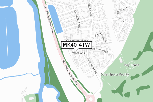
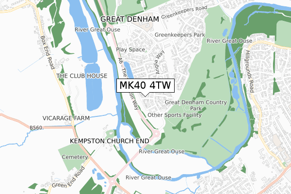
MK40 4TW is located in the Great Denham electoral ward, within the unitary authority of Bedford and the English Parliamentary constituency of North East Bedfordshire. The Sub Integrated Care Board (ICB) Location is NHS Bedfordshire, Luton and Milton Keynes ICB - M1J4Y and the police force is Bedfordshire. This postcode has been in use since October 2017.


GetTheData
Source: OS Open Zoomstack (Ordnance Survey)
Licence: Open Government Licence (requires attribution)
Attribution: Contains OS data © Crown copyright and database right 2024
Source: Open Postcode Geo
Licence: Open Government Licence (requires attribution)
Attribution: Contains OS data © Crown copyright and database right 2024; Contains Royal Mail data © Royal Mail copyright and database right 2024; Source: Office for National Statistics licensed under the Open Government Licence v.3.0
| Easting | 501828 |
| Northing | 248303 |
| Latitude | 52.123682 |
| Longitude | -0.514015 |
GetTheData
Source: Open Postcode Geo
Licence: Open Government Licence
| Country | England |
| Postcode District | MK40 |
| ➜ MK40 open data dashboard ➜ See where MK40 is on a map ➜ Where is Great Denham? | |
GetTheData
Source: Land Registry Price Paid Data
Licence: Open Government Licence
| Ward | Great Denham |
| Constituency | North East Bedfordshire |
GetTheData
Source: ONS Postcode Database
Licence: Open Government Licence
19, BEDE WALK, GREAT DENHAM, BEDFORD, MK40 4TW 2019 5 AUG £379,995 |
11, BEDE WALK, GREAT DENHAM, BEDFORD, MK40 4TW 2019 13 JUN £461,495 |
34, BEDE WALK, GREAT DENHAM, BEDFORD, MK40 4TW 2019 8 MAY £361,995 |
28, BEDE WALK, GREAT DENHAM, BEDFORD, MK40 4TW 2019 29 MAR £461,995 |
13, BEDE WALK, GREAT DENHAM, BEDFORD, MK40 4TW 2019 22 MAR £381,495 |
32, BEDE WALK, GREAT DENHAM, BEDFORD, MK40 4TW 2019 19 MAR £382,495 |
30, BEDE WALK, GREAT DENHAM, BEDFORD, MK40 4TW 2019 8 MAR £382,495 |
15, BEDE WALK, GREAT DENHAM, BEDFORD, MK40 4TW 2018 20 DEC £381,495 |
17, BEDE WALK, GREAT DENHAM, BEDFORD, MK40 4TW 2018 20 DEC £381,495 |
GetTheData
Source: HM Land Registry Price Paid Data
Licence: Contains HM Land Registry data © Crown copyright and database right 2024. This data is licensed under the Open Government Licence v3.0.
| February 2023 | Public order | On or near Great Portway | 389m |
| June 2022 | Anti-social behaviour | On or near The Frank Branston Way | 145m |
| June 2022 | Vehicle crime | On or near The Frank Branston Way | 145m |
| ➜ Get more crime data in our Crime section | |||
GetTheData
Source: data.police.uk
Licence: Open Government Licence
| Carnoustie Drive (Great Denham) | Great Denham | 643m |
| Bury Cottages (Cemetery Road) | Kempston Church End | 847m |
| Bury Cottages (Cemetery Road) | Kempston Church End | 852m |
| Northern Square (Greenkeepers Road) | Great Denham | 876m |
| Northern Square (Greenkeepers Road) | Great Denham | 877m |
| Bedford Station | 2.7km |
| Bedford St Johns Station | 3.3km |
| Kempston Hardwick Station | 3.6km |
GetTheData
Source: NaPTAN
Licence: Open Government Licence
| Percentage of properties with Next Generation Access | 100.0% |
| Percentage of properties with Superfast Broadband | 100.0% |
| Percentage of properties with Ultrafast Broadband | 100.0% |
| Percentage of properties with Full Fibre Broadband | 100.0% |
Superfast Broadband is between 30Mbps and 300Mbps
Ultrafast Broadband is > 300Mbps
| Percentage of properties unable to receive 2Mbps | 0.0% |
| Percentage of properties unable to receive 5Mbps | 0.0% |
| Percentage of properties unable to receive 10Mbps | 0.0% |
| Percentage of properties unable to receive 30Mbps | 0.0% |
GetTheData
Source: Ofcom
Licence: Ofcom Terms of Use (requires attribution)
GetTheData
Source: ONS Postcode Database
Licence: Open Government Licence


➜ Get more ratings from the Food Standards Agency
GetTheData
Source: Food Standards Agency
Licence: FSA terms & conditions
| Last Collection | |||
|---|---|---|---|
| Location | Mon-Fri | Sat | Distance |
| Kingswood Way | 17:30 | 11:10 | 644m |
| Church End | 16:05 | 07:00 | 713m |
| St Mellion Drive | 17:30 | 11:00 | 1,100m |
GetTheData
Source: Dracos
Licence: Creative Commons Attribution-ShareAlike
| Facility | Distance |
|---|---|
| Great Denham Country Park Queen Eleanor Drive, Great Denham Grass Pitches | 253m |
| Kempston Hammers Sports And Social Club High Street, Kempston, Bedford Grass Pitches, Health and Fitness Gym | 985m |
| Robert Bruce Middle School (Closed) Bedford Road, Kempston, Bedford Grass Pitches | 1.1km |
GetTheData
Source: Active Places
Licence: Open Government Licence
| School | Phase of Education | Distance |
|---|---|---|
| Kempston Rural Primary School Martell Drive, Kempston, MK42 7FJ | Primary | 892m |
| Great Denham Primary School Greenkeepers Road, Great Denham, Bedford, MK40 4GG | Primary | 974m |
| Greys Education Centre Manor Drive, Kempston, Bedford, MK42 7AB | Not applicable | 1.1km |
GetTheData
Source: Edubase
Licence: Open Government Licence
The below table lists the International Territorial Level (ITL) codes (formerly Nomenclature of Territorial Units for Statistics (NUTS) codes) and Local Administrative Units (LAU) codes for MK40 4TW:
| ITL 1 Code | Name |
|---|---|
| TLH | East |
| ITL 2 Code | Name |
| TLH2 | Bedfordshire and Hertfordshire |
| ITL 3 Code | Name |
| TLH24 | Bedford |
| LAU 1 Code | Name |
| E06000055 | Bedford |
GetTheData
Source: ONS Postcode Directory
Licence: Open Government Licence
The below table lists the Census Output Area (OA), Lower Layer Super Output Area (LSOA), and Middle Layer Super Output Area (MSOA) for MK40 4TW:
| Code | Name | |
|---|---|---|
| OA | E00173762 | |
| LSOA | E01017461 | Bedford 008C |
| MSOA | E02003623 | Bedford 008 |
GetTheData
Source: ONS Postcode Directory
Licence: Open Government Licence
| MK40 4SH | King Alfred Way | 86m |
| MK40 4SF | Ripley Link | 175m |
| MK40 4SL | Edith Avenue | 210m |
| MK40 4SQ | Queen Eleanor Drive | 230m |
| MK40 4SA | Broad Mead Avenue | 280m |
| MK40 4SD | Anglia Way | 289m |
| MK40 4SE | Midsummer Grove | 331m |
| MK40 4GB | Great Portway | 383m |
| MK40 4GE | Whitings | 394m |
| MK40 4GA | Great Portway | 440m |
GetTheData
Source: Open Postcode Geo; Land Registry Price Paid Data
Licence: Open Government Licence