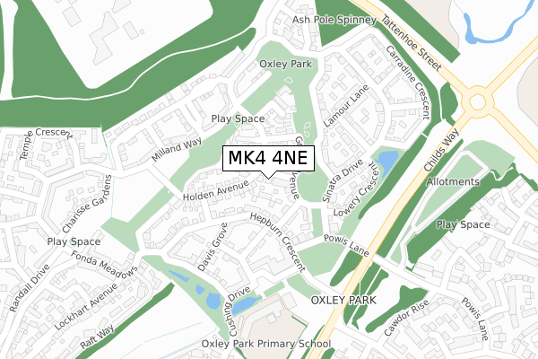
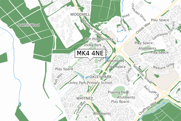
MK4 4NE is located in the Tattenhoe electoral ward, within the unitary authority of Milton Keynes and the English Parliamentary constituency of Milton Keynes South. The Sub Integrated Care Board (ICB) Location is NHS Bedfordshire, Luton and Milton Keynes ICB - M1J4Y and the police force is Thames Valley. This postcode has been in use since June 2018.


GetTheData
Source: OS Open Zoomstack (Ordnance Survey)
Licence: Open Government Licence (requires attribution)
Attribution: Contains OS data © Crown copyright and database right 2024
Source: Open Postcode Geo
Licence: Open Government Licence (requires attribution)
Attribution: Contains OS data © Crown copyright and database right 2024; Contains Royal Mail data © Royal Mail copyright and database right 2024; Source: Office for National Statistics licensed under the Open Government Licence v.3.0
| Easting | 482188 |
| Northing | 235177 |
| Latitude | 52.008960 |
| Longitude | -0.803973 |
GetTheData
Source: Open Postcode Geo
Licence: Open Government Licence
| Country | England |
| Postcode District | MK4 |
| ➜ MK4 open data dashboard ➜ See where MK4 is on a map ➜ Where is Milton Keynes? | |
GetTheData
Source: Land Registry Price Paid Data
Licence: Open Government Licence
| Ward | Tattenhoe |
| Constituency | Milton Keynes South |
GetTheData
Source: ONS Postcode Database
Licence: Open Government Licence
2021 23 APR £465,000 |
7, RAINS ROAD, OXLEY PARK, MILTON KEYNES, MK4 4NE 2018 27 SEP £654,995 |
5, RAINS ROAD, OXLEY PARK, MILTON KEYNES, MK4 4NE 2018 29 JUN £664,995 |
2018 30 MAY £497,995 |
GetTheData
Source: HM Land Registry Price Paid Data
Licence: Contains HM Land Registry data © Crown copyright and database right 2024. This data is licensed under the Open Government Licence v3.0.
| May 2023 | Violence and sexual offences | On or near Berrington Grove | 471m |
| November 2022 | Anti-social behaviour | On or near Berrington Grove | 471m |
| November 2022 | Criminal damage and arson | On or near Berrington Grove | 471m |
| ➜ Get more crime data in our Crime section | |||
GetTheData
Source: data.police.uk
Licence: Open Government Licence
| Davis Grove (Hepburn Crescent) | Oxley Park | 151m |
| Powis Lane | Oxley Park | 152m |
| Powis Lane | Oxley Park | 155m |
| Holden Avenue | Oxley Park | 226m |
| Powis Lane Bridge (Childs Way) | Westcroft | 227m |
| Milton Keynes Central Station | 3.5km |
| Bletchley Station | 4.9km |
GetTheData
Source: NaPTAN
Licence: Open Government Licence
| Percentage of properties with Next Generation Access | 100.0% |
| Percentage of properties with Superfast Broadband | 100.0% |
| Percentage of properties with Ultrafast Broadband | 100.0% |
| Percentage of properties with Full Fibre Broadband | 100.0% |
Superfast Broadband is between 30Mbps and 300Mbps
Ultrafast Broadband is > 300Mbps
| Percentage of properties unable to receive 2Mbps | 0.0% |
| Percentage of properties unable to receive 5Mbps | 0.0% |
| Percentage of properties unable to receive 10Mbps | 0.0% |
| Percentage of properties unable to receive 30Mbps | 0.0% |
GetTheData
Source: Ofcom
Licence: Ofcom Terms of Use (requires attribution)
GetTheData
Source: ONS Postcode Database
Licence: Open Government Licence


➜ Get more ratings from the Food Standards Agency
GetTheData
Source: Food Standards Agency
Licence: FSA terms & conditions
| Last Collection | |||
|---|---|---|---|
| Location | Mon-Fri | Sat | Distance |
| Redgrave Drive | 18:30 | 12:00 | 181m |
| Fonda Meadows | 18:30 | 12:00 | 273m |
| Alton Gate | 17:30 | 12:00 | 535m |
GetTheData
Source: Dracos
Licence: Creative Commons Attribution-ShareAlike
| Facility | Distance |
|---|---|
| Hmp Woodhill Tattenhoe Street, Woodhill, Milton Keynes Artificial Grass Pitch | 527m |
| Westcroft Sports Ground Cranborne Avenue, Westcroft, Milton Keynes Grass Pitches | 573m |
| Long Meadow School Garthwaite Crescent, Shenley Brook End, Milton Keynes Grass Pitches, Sports Hall | 659m |
GetTheData
Source: Active Places
Licence: Open Government Licence
| School | Phase of Education | Distance |
|---|---|---|
| Oxley Park Academy Redgrave Drive, Oxley Park, Milton Keynes, MK4 4TA | Primary | 151m |
| Long Meadow School Garthwaite Crescent, Shenley Brook End, Milton Keynes, MK5 7XX | Primary | 659m |
| Oakhill Secure Training Centre Chalgrove Field, Off Otterburn Crescent, Oakhill, Milton Keynes, MK5 6AJ | Not applicable | 915m |
GetTheData
Source: Edubase
Licence: Open Government Licence
The below table lists the International Territorial Level (ITL) codes (formerly Nomenclature of Territorial Units for Statistics (NUTS) codes) and Local Administrative Units (LAU) codes for MK4 4NE:
| ITL 1 Code | Name |
|---|---|
| TLJ | South East (England) |
| ITL 2 Code | Name |
| TLJ1 | Berkshire, Buckinghamshire and Oxfordshire |
| ITL 3 Code | Name |
| TLJ12 | Milton Keynes |
| LAU 1 Code | Name |
| E06000042 | Milton Keynes |
GetTheData
Source: ONS Postcode Directory
Licence: Open Government Licence
The below table lists the Census Output Area (OA), Lower Layer Super Output Area (LSOA), and Middle Layer Super Output Area (MSOA) for MK4 4NE:
| Code | Name | |
|---|---|---|
| OA | E00175484 | |
| LSOA | E01033505 | Milton Keynes 019E |
| MSOA | E02003477 | Milton Keynes 019 |
GetTheData
Source: ONS Postcode Directory
Licence: Open Government Licence
| MK4 4TH | Grable Avenue | 40m |
| MK4 4TE | Bellamy Mews | 64m |
| MK4 4TD | Hepburn Crescent | 84m |
| MK4 4HS | Holden Avenue | 109m |
| MK4 4TF | Olivier Row | 110m |
| MK4 4HT | Holden Avenue | 111m |
| MK4 4TR | Tracy Way | 144m |
| MK4 4TN | Davis Grove | 145m |
| MK4 4TL | Cagney Crescent | 145m |
| MK4 4TG | Powis Lane | 149m |
GetTheData
Source: Open Postcode Geo; Land Registry Price Paid Data
Licence: Open Government Licence