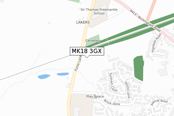
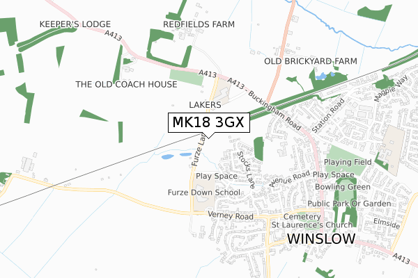
MK18 3GX is located in the Winslow electoral ward, within the unitary authority of Buckinghamshire and the English Parliamentary constituency of Buckingham. The Sub Integrated Care Board (ICB) Location is NHS Buckinghamshire, Oxfordshire and Berkshire West ICB - 14Y and the police force is Thames Valley. This postcode has been in use since September 2019.


GetTheData
Source: OS Open Zoomstack (Ordnance Survey)
Licence: Open Government Licence (requires attribution)
Attribution: Contains OS data © Crown copyright and database right 2024
Source: Open Postcode Geo
Licence: Open Government Licence (requires attribution)
Attribution: Contains OS data © Crown copyright and database right 2024; Contains Royal Mail data © Royal Mail copyright and database right 2024; Source: Office for National Statistics licensed under the Open Government Licence v.3.0
| Easting | 476326 |
| Northing | 228175 |
| Latitude | 51.946854 |
| Longitude | -0.890915 |
GetTheData
Source: Open Postcode Geo
Licence: Open Government Licence
| Country | England |
| Postcode District | MK18 |
| ➜ MK18 open data dashboard ➜ See where MK18 is on a map ➜ Where is Winslow? | |
GetTheData
Source: Land Registry Price Paid Data
Licence: Open Government Licence
| Ward | Winslow |
| Constituency | Buckingham |
GetTheData
Source: ONS Postcode Database
Licence: Open Government Licence
| June 2022 | Criminal damage and arson | On or near Furze Lane | 72m |
| June 2022 | Criminal damage and arson | On or near Furze Lane | 72m |
| June 2022 | Public order | On or near Furze Lane | 72m |
| ➜ Get more crime data in our Crime section | |||
GetTheData
Source: data.police.uk
Licence: Open Government Licence
| Redfield Farm (Buckingham Road) | Winslow | 372m |
| Redfield Farm (Buckingham Road) | Winslow | 374m |
| Station Road (Buckingham Road) | Winslow | 461m |
| Station Road (Buckingham Road) | Winslow | 532m |
| Seven Gables (Buckingham Road) | Winslow | 606m |
GetTheData
Source: NaPTAN
Licence: Open Government Licence
GetTheData
Source: ONS Postcode Database
Licence: Open Government Licence


➜ Get more ratings from the Food Standards Agency
GetTheData
Source: Food Standards Agency
Licence: FSA terms & conditions
| Last Collection | |||
|---|---|---|---|
| Location | Mon-Fri | Sat | Distance |
| Buckingham Road | 17:00 | 11:45 | 569m |
| Western Lane | 17:45 | 12:00 | 735m |
| Winslow Delivery Office | 17:45 | 12:45 | 742m |
GetTheData
Source: Dracos
Licence: Creative Commons Attribution-ShareAlike
| Facility | Distance |
|---|---|
| Sir Thomas Fremantle School Buckingham Road, Winslow, Buckingham Sports Hall, Artificial Grass Pitch, Studio | 265m |
| Winslow Rufc (Winslow Centre) Winslow Centre, Park Road, Winslow, Buckingham Sports Hall, Health and Fitness Gym, Grass Pitches, Outdoor Tennis Courts, Artificial Grass Pitch | 431m |
| Winslow Sports Club Elmfields Gate, Winslow, Buckingham Grass Pitches | 788m |
GetTheData
Source: Active Places
Licence: Open Government Licence
| School | Phase of Education | Distance |
|---|---|---|
| Sir Thomas Fremantle School Buckingham Road, Winslow, MK18 3GH | Secondary | 236m |
| Furze Down School Verney Road, Winslow, Buckingham, MK18 3BL | Not applicable | 352m |
| Winslow Church of England School Lowndes Way, Winslow, Buckingham, MK18 3EN | Primary | 1km |
GetTheData
Source: Edubase
Licence: Open Government Licence
The below table lists the International Territorial Level (ITL) codes (formerly Nomenclature of Territorial Units for Statistics (NUTS) codes) and Local Administrative Units (LAU) codes for MK18 3GX:
| ITL 1 Code | Name |
|---|---|
| TLJ | South East (England) |
| ITL 2 Code | Name |
| TLJ1 | Berkshire, Buckinghamshire and Oxfordshire |
| ITL 3 Code | Name |
| TLJ13 | Buckinghamshire |
| LAU 1 Code | Name |
| E06000060 | Buckinghamshire |
GetTheData
Source: ONS Postcode Directory
Licence: Open Government Licence
The below table lists the Census Output Area (OA), Lower Layer Super Output Area (LSOA), and Middle Layer Super Output Area (MSOA) for MK18 3GX:
| Code | Name | |
|---|---|---|
| OA | E00089493 | |
| LSOA | E01017738 | Aylesbury Vale 005D |
| MSOA | E02003656 | Aylesbury Vale 005 |
GetTheData
Source: ONS Postcode Directory
Licence: Open Government Licence
| MK18 3NB | Furze Lane | 194m |
| MK18 3BW | Furze Lane | 215m |
| MK18 3FZ | Featherbed Close | 277m |
| MK18 3FP | Stocks Lane | 280m |
| MK18 3FY | Browns Close | 315m |
| MK18 3FX | Selby Lane | 373m |
| MK18 3DU | Highfield Road | 382m |
| MK18 3DX | Buckingham Road | 397m |
| MK18 3FW | Horsemead Piece | 409m |
| MK18 3FQ | Gorse Croft | 428m |
GetTheData
Source: Open Postcode Geo; Land Registry Price Paid Data
Licence: Open Government Licence