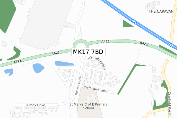
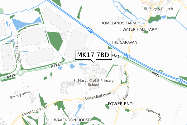
MK17 7BD is located in the Danesborough & Walton electoral ward, within the unitary authority of Milton Keynes and the English Parliamentary constituency of Milton Keynes South. The Sub Integrated Care Board (ICB) Location is NHS Bedfordshire, Luton and Milton Keynes ICB - M1J4Y and the police force is Thames Valley. This postcode has been in use since November 2019.


GetTheData
Source: OS Open Zoomstack (Ordnance Survey)
Licence: Open Government Licence (requires attribution)
Attribution: Contains OS data © Crown copyright and database right 2024
Source: Open Postcode Geo
Licence: Open Government Licence (requires attribution)
Attribution: Contains OS data © Crown copyright and database right 2024; Contains Royal Mail data © Royal Mail copyright and database right 2024; Source: Office for National Statistics licensed under the Open Government Licence v.3.0
| Easting | 492712 |
| Northing | 238397 |
| Latitude | 52.036247 |
| Longitude | -0.649816 |
GetTheData
Source: Open Postcode Geo
Licence: Open Government Licence
| Country | England |
| Postcode District | MK17 |
| ➜ MK17 open data dashboard ➜ See where MK17 is on a map ➜ Where is Milton Keynes? | |
GetTheData
Source: Land Registry Price Paid Data
Licence: Open Government Licence
| Ward | Danesborough & Walton |
| Constituency | Milton Keynes South |
GetTheData
Source: ONS Postcode Database
Licence: Open Government Licence
| Lower End Road | Wavendon | 456m |
| Lower End Road | Wavendon | 464m |
| Fen Street | Magna Park | 998m |
| The Swan (Wavendon Road) | Salford | 1,190m |
| The Swan (Wavendon Road) | Salford | 1,201m |
| Woburn Sands Station | 2km |
| Aspley Guise Station | 2.1km |
| Ridgmont Station | 3.9km |
GetTheData
Source: NaPTAN
Licence: Open Government Licence
GetTheData
Source: ONS Postcode Database
Licence: Open Government Licence


➜ Get more ratings from the Food Standards Agency
GetTheData
Source: Food Standards Agency
Licence: FSA terms & conditions
| Last Collection | |||
|---|---|---|---|
| Location | Mon-Fri | Sat | Distance |
| Lower End | 17:00 | 08:00 | 639m |
| Red Lion Water Hall | 17:00 | 08:00 | 787m |
| Salford | 17:00 | 09:15 | 1,191m |
GetTheData
Source: Dracos
Licence: Creative Commons Attribution-ShareAlike
| Facility | Distance |
|---|---|
| St Marys Wavendon Ce Primary School Wafandun Lane, Eagle Farm South, Milton Keynes Grass Pitches | 220m |
| Wavendon Golf Academy (Closed) Lower End Road, Wavendon, Milton Keynes Golf | 697m |
| Glebe Farm School Burney Drive, Glebe Farm, Milton Keynes Sports Hall, Artificial Grass Pitch, Grass Pitches, Outdoor Tennis Courts | 1.1km |
GetTheData
Source: Active Places
Licence: Open Government Licence
| School | Phase of Education | Distance |
|---|---|---|
| St Mary's Wavendon CofE Primary Wafandun Lane, Milton Keynes, MK17 7AA | Primary | 244m |
| Glebe Farm School Burney Drive, Milton Keynes, MK17 8XY | All-through | 1.1km |
| Swallowfield Primary Weathercock Close, Woburn Sands, Milton Keynes, MK17 8SR | Primary | 2.1km |
GetTheData
Source: Edubase
Licence: Open Government Licence
The below table lists the International Territorial Level (ITL) codes (formerly Nomenclature of Territorial Units for Statistics (NUTS) codes) and Local Administrative Units (LAU) codes for MK17 7BD:
| ITL 1 Code | Name |
|---|---|
| TLJ | South East (England) |
| ITL 2 Code | Name |
| TLJ1 | Berkshire, Buckinghamshire and Oxfordshire |
| ITL 3 Code | Name |
| TLJ12 | Milton Keynes |
| LAU 1 Code | Name |
| E06000042 | Milton Keynes |
GetTheData
Source: ONS Postcode Directory
Licence: Open Government Licence
The below table lists the Census Output Area (OA), Lower Layer Super Output Area (LSOA), and Middle Layer Super Output Area (MSOA) for MK17 7BD:
| Code | Name | |
|---|---|---|
| OA | E00084448 | |
| LSOA | E01016735 | Milton Keynes 024B |
| MSOA | E02003482 | Milton Keynes 024 |
GetTheData
Source: ONS Postcode Directory
Licence: Open Government Licence
| MK17 8AN | Lower End Road | 478m |
| MK17 8AR | Crow Lane | 633m |
| MK17 8AW | Cranfield Road | 636m |
| MK17 8AZ | Wavendon Road | 787m |
| MK17 8AJ | Wavendon House Drive | 789m |
| MK17 8AP | Crabtree Lane | 864m |
| MK17 8DA | Lower End Road | 980m |
| MK17 8BA | Wavendon Road | 1036m |
| MK17 8BE | Brittens Lane | 1043m |
| MK17 8BQ | Broughton Road | 1122m |
GetTheData
Source: Open Postcode Geo; Land Registry Price Paid Data
Licence: Open Government Licence