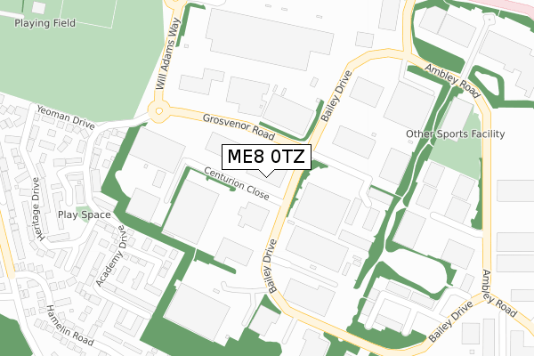
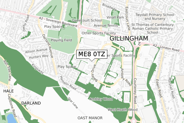
ME8 0TZ is located in the Watling electoral ward, within the unitary authority of Medway and the English Parliamentary constituency of Gillingham and Rainham. The Sub Integrated Care Board (ICB) Location is NHS Kent and Medway ICB - 91Q and the police force is Kent. This postcode has been in use since August 2017.


GetTheData
Source: OS Open Zoomstack (Ordnance Survey)
Licence: Open Government Licence (requires attribution)
Attribution: Contains OS data © Crown copyright and database right 2024
Source: Open Postcode Geo
Licence: Open Government Licence (requires attribution)
Attribution: Contains OS data © Crown copyright and database right 2024; Contains Royal Mail data © Royal Mail copyright and database right 2024; Source: Office for National Statistics licensed under the Open Government Licence v.3.0
| Easting | 579083 |
| Northing | 166189 |
| Latitude | 51.366527 |
| Longitude | 0.571222 |
GetTheData
Source: Open Postcode Geo
Licence: Open Government Licence
| Country | England |
| Postcode District | ME8 |
| ➜ ME8 open data dashboard ➜ See where ME8 is on a map ➜ Where is Gillingham? | |
GetTheData
Source: Land Registry Price Paid Data
Licence: Open Government Licence
| Ward | Watling |
| Constituency | Gillingham And Rainham |
GetTheData
Source: ONS Postcode Database
Licence: Open Government Licence
| May 2023 | Criminal damage and arson | On or near Heritage Drive | 434m |
| April 2023 | Vehicle crime | On or near Heritage Drive | 434m |
| March 2023 | Criminal damage and arson | On or near Heritage Drive | 434m |
| ➜ Get more crime data in our Crime section | |||
GetTheData
Source: data.police.uk
Licence: Open Government Licence
| Featherby Road South (Watling Street) | Gillingham | 408m |
| Featherby Road South (Watling Street) | Gillingham | 441m |
| Hamelin Road (Darland Avenue) | Darland | 511m |
| Hamelin Road (Darland Avenue) | Darland | 516m |
| Eastcourt Lane (Sovereign Boulevard) | Gillingham | 545m |
| Gillingham (Kent) Station | 2.7km |
| Rainham (Kent) Station | 2.8km |
| Chatham Station | 3.8km |
GetTheData
Source: NaPTAN
Licence: Open Government Licence
GetTheData
Source: ONS Postcode Database
Licence: Open Government Licence


➜ Get more ratings from the Food Standards Agency
GetTheData
Source: Food Standards Agency
Licence: FSA terms & conditions
| Last Collection | |||
|---|---|---|---|
| Location | Mon-Fri | Sat | Distance |
| Bailey Drive Meter Box | 18:30 | 12:00 | 325m |
| Yeoman Drive | 17:45 | 12:15 | 325m |
| Bailey Drive | 18:30 | 12:15 | 328m |
GetTheData
Source: Dracos
Licence: Creative Commons Attribution-ShareAlike
| Facility | Distance |
|---|---|
| Planet Ice Gillingham Ambley Road, Gillingham Business Park, Gillingham Ice Rinks | 372m |
| Roko Health Club (Gillingham) Will Adams Way, Gillingham Swimming Pool, Health and Fitness Gym, Studio | 387m |
| Gillingham Anchorians Sports Club Darland Avenue, Darland, Gillingham Artificial Grass Pitch | 465m |
GetTheData
Source: Active Places
Licence: Open Government Licence
| School | Phase of Education | Distance |
|---|---|---|
| Danecourt School Hotel Road, Gillingham, ME8 6AA | Not applicable | 534m |
| St Thomas of Canterbury RC Primary School Romany Road, Rainham, Gillingham, ME8 6JH | Primary | 907m |
| Featherby Junior School Chilham Road, Featherby Junior School, Gillingham, ME8 6BT | Primary | 1km |
GetTheData
Source: Edubase
Licence: Open Government Licence
The below table lists the International Territorial Level (ITL) codes (formerly Nomenclature of Territorial Units for Statistics (NUTS) codes) and Local Administrative Units (LAU) codes for ME8 0TZ:
| ITL 1 Code | Name |
|---|---|
| TLJ | South East (England) |
| ITL 2 Code | Name |
| TLJ4 | Kent |
| ITL 3 Code | Name |
| TLJ41 | Medway |
| LAU 1 Code | Name |
| E06000035 | Medway |
GetTheData
Source: ONS Postcode Directory
Licence: Open Government Licence
The below table lists the Census Output Area (OA), Lower Layer Super Output Area (LSOA), and Middle Layer Super Output Area (MSOA) for ME8 0TZ:
| Code | Name | |
|---|---|---|
| OA | E00081747 | |
| LSOA | E01016176 | Medway 030D |
| MSOA | E02003343 | Medway 030 |
GetTheData
Source: ONS Postcode Directory
Licence: Open Government Licence
| ME7 3AG | Stoney Bank | 283m |
| ME7 3EG | Academy Drive | 302m |
| ME8 0QN | Saracen Close | 360m |
| ME7 3EJ | Academy Drive | 370m |
| ME7 3EW | Highridge | 387m |
| ME7 3EN | Embassy Close | 391m |
| ME7 3ER | Hamelin Road | 418m |
| ME7 3EH | Heritage Drive | 419m |
| ME7 3EL | Yeoman Drive | 431m |
| ME7 3EQ | Heritage Drive | 451m |
GetTheData
Source: Open Postcode Geo; Land Registry Price Paid Data
Licence: Open Government Licence