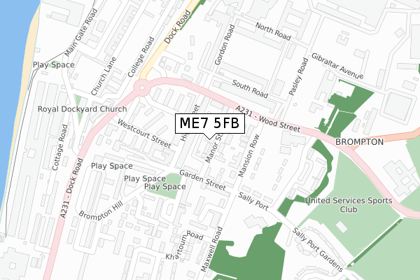
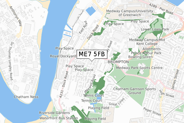
ME7 5FB is located in the Chatham Central & Brompton electoral ward, within the unitary authority of Medway and the English Parliamentary constituency of Rochester and Strood. The Sub Integrated Care Board (ICB) Location is NHS Kent and Medway ICB - 91Q and the police force is Kent. This postcode has been in use since November 2022.


GetTheData
Source: OS Open Zoomstack (Ordnance Survey)
Licence: Open Government Licence (requires attribution)
Attribution: Contains OS data © Crown copyright and database right 2024
Source: Open Postcode Geo
Licence: Open Government Licence (requires attribution)
Attribution: Contains OS data © Crown copyright and database right 2024; Contains Royal Mail data © Royal Mail copyright and database right 2024; Source: Office for National Statistics licensed under the Open Government Licence v.3.0
| Easting | 576199 |
| Northing | 168892 |
| Latitude | 51.391708 |
| Longitude | 0.531176 |
GetTheData
Source: Open Postcode Geo
Licence: Open Government Licence
| Country | England |
| Postcode District | ME7 |
| ➜ ME7 open data dashboard ➜ See where ME7 is on a map ➜ Where is Gillingham? | |
GetTheData
Source: Land Registry Price Paid Data
Licence: Open Government Licence
| Ward | Chatham Central & Brompton |
| Constituency | Rochester And Strood |
GetTheData
Source: ONS Postcode Database
Licence: Open Government Licence
| January 2024 | Violence and sexual offences | On or near High Street | 62m |
| November 2023 | Other theft | On or near High Street | 62m |
| November 2023 | Vehicle crime | On or near Wood Street | 137m |
| ➜ Get more crime data in our Crime section | |||
GetTheData
Source: data.police.uk
Licence: Open Government Licence
| High Street | Brompton | 91m |
| High Street (Wood Street) | Brompton | 115m |
| Dockyard Main Gate (Dock Road) | Chatham | 287m |
| Dockyard Main Gate (Dock Road) | Chatham | 303m |
| King Charles Hotel (Brompton Road) | Brompton | 367m |
| Gillingham (Kent) Station | 1.4km |
| Chatham Station | 1.4km |
| Rochester Station | 1.6km |
GetTheData
Source: NaPTAN
Licence: Open Government Licence
GetTheData
Source: ONS Postcode Database
Licence: Open Government Licence


➜ Get more ratings from the Food Standards Agency
GetTheData
Source: Food Standards Agency
Licence: FSA terms & conditions
| Last Collection | |||
|---|---|---|---|
| Location | Mon-Fri | Sat | Distance |
| Brompton Post Office | 17:45 | 11:45 | 54m |
| Mansion Row | 17:30 | 11:45 | 119m |
| Dockyard Main Gate | 17:30 | 11:30 | 308m |
GetTheData
Source: Dracos
Licence: Creative Commons Attribution-ShareAlike
| Facility | Distance |
|---|---|
| Chatham Garrison Sports Ground Sally Port Gardens, Brompton, Gillingham Artificial Grass Pitch, Grass Pitches, Outdoor Tennis Courts | 571m |
| Prince Arthur Road Indoor Bowls Club Ltd Prince Arthur Road, Gillingham Indoor Bowls | 635m |
| Medway Park Sports Centre Mill Road, Gillingham Sports Hall, Swimming Pool, Health and Fitness Gym, Athletics, Squash Courts, Studio, Grass Pitches | 698m |
GetTheData
Source: Active Places
Licence: Open Government Licence
| School | Phase of Education | Distance |
|---|---|---|
| FORWARD2 EMPLOYMENT LIMITED The Historic Dockyard, Chatham, ME4 4TZ | Not applicable | 418m |
| Brompton-Westbrook Primary School Kings Bastion, Brompton, Gillingham, ME7 5DQ | Primary | 749m |
| MidKent College Medway Road, Gillingham, ME7 1FN | 16 plus | 753m |
GetTheData
Source: Edubase
Licence: Open Government Licence
The below table lists the International Territorial Level (ITL) codes (formerly Nomenclature of Territorial Units for Statistics (NUTS) codes) and Local Administrative Units (LAU) codes for ME7 5FB:
| ITL 1 Code | Name |
|---|---|
| TLJ | South East (England) |
| ITL 2 Code | Name |
| TLJ4 | Kent |
| ITL 3 Code | Name |
| TLJ41 | Medway |
| LAU 1 Code | Name |
| E06000035 | Medway |
GetTheData
Source: ONS Postcode Directory
Licence: Open Government Licence
The below table lists the Census Output Area (OA), Lower Layer Super Output Area (LSOA), and Middle Layer Super Output Area (MSOA) for ME7 5FB:
| Code | Name | |
|---|---|---|
| OA | E00081438 | |
| LSOA | E01032798 | Medway 007E |
| MSOA | E02003320 | Medway 007 |
GetTheData
Source: ONS Postcode Directory
Licence: Open Government Licence
| ME7 5AW | Manor Street | 32m |
| ME7 5AN | Flaxmans Court | 38m |
| ME7 5AQ | High Street | 75m |
| ME7 5AA | High Street | 77m |
| ME7 5SE | Mansion Row | 80m |
| ME7 5SD | Wood Street | 81m |
| ME7 5AJ | Garden Street | 84m |
| ME7 5AT | Manor Street | 86m |
| ME7 5AS | Garden Street | 100m |
| ME7 5AH | High Street | 102m |
GetTheData
Source: Open Postcode Geo; Land Registry Price Paid Data
Licence: Open Government Licence