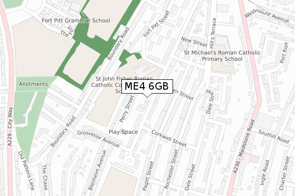
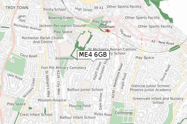
ME4 6GB is located in the Fort Pitt electoral ward, within the unitary authority of Medway and the English Parliamentary constituency of Chatham and Aylesford. The Sub Integrated Care Board (ICB) Location is NHS Kent and Medway ICB - 91Q and the police force is Kent. This postcode has been in use since December 2019.


GetTheData
Source: OS Open Zoomstack (Ordnance Survey)
Licence: Open Government Licence (requires attribution)
Attribution: Contains OS data © Crown copyright and database right 2024
Source: Open Postcode Geo
Licence: Open Government Licence (requires attribution)
Attribution: Contains OS data © Crown copyright and database right 2024; Contains Royal Mail data © Royal Mail copyright and database right 2024; Source: Office for National Statistics licensed under the Open Government Licence v.3.0
| Easting | 575303 |
| Northing | 167208 |
| Latitude | 51.376858 |
| Longitude | 0.517480 |
GetTheData
Source: Open Postcode Geo
Licence: Open Government Licence
| Country | England |
| Postcode District | ME4 |
| ➜ ME4 open data dashboard ➜ See where ME4 is on a map ➜ Where is Chatham? | |
GetTheData
Source: Land Registry Price Paid Data
Licence: Open Government Licence
| Ward | Fort Pitt |
| Constituency | Chatham And Aylesford |
GetTheData
Source: ONS Postcode Database
Licence: Open Government Licence
| January 2024 | Other theft | On or near Cressey Court | 413m |
| December 2022 | Vehicle crime | On or near Cressey Court | 413m |
| November 2022 | Vehicle crime | On or near Cressey Court | 413m |
| ➜ Get more crime data in our Crime section | |||
GetTheData
Source: data.police.uk
Licence: Open Government Licence
| St John Fisher School (Ordnance Street) | Chatham | 62m |
| Corkwell Street (Ordnance Street) | Chatham | 67m |
| Blenheim Avenue (Grosvenor Avenue) | Chatham | 186m |
| St. John Fisher School (Ordnance Street) | Chatham | 198m |
| Atlanta Court (Boundary Road) | Chatham | 338m |
| Chatham Station | 0.5km |
| Rochester Station | 1.1km |
| Strood Station | 2.5km |
GetTheData
Source: NaPTAN
Licence: Open Government Licence
GetTheData
Source: ONS Postcode Database
Licence: Open Government Licence


➜ Get more ratings from the Food Standards Agency
GetTheData
Source: Food Standards Agency
Licence: FSA terms & conditions
| Last Collection | |||
|---|---|---|---|
| Location | Mon-Fri | Sat | Distance |
| Ordnance Place | 17:30 | 11:30 | 446m |
| Balfour Road | 17:30 | 11:30 | 518m |
| Gundulph Road | 18:00 | 11:30 | 610m |
GetTheData
Source: Dracos
Licence: Creative Commons Attribution-ShareAlike
| Facility | Distance |
|---|---|
| St John Fisher Catholic School (Chatham) (Closed) Ordnance Street, Chatham Sports Hall, Studio | 98m |
| St John Fisher Catholic Comprehensive School City Way, Rochester Grass Pitches, Artificial Grass Pitch, Sports Hall | 438m |
| Fort Pitt Grammar School Fort Pitt Hill, Chatham Health and Fitness Gym, Grass Pitches, Sports Hall | 470m |
GetTheData
Source: Active Places
Licence: Open Government Licence
| School | Phase of Education | Distance |
|---|---|---|
| St John Fisher Catholic Comprehensive School City Way, Rochester, ME1 2FA | Secondary | 98m |
| St John's Church of England Infant School 4 New Street, Chatham, ME4 6RH | Primary | 236m |
| St Michael's RC Primary School Hills Terrace, Chatham, ME4 6PX | Primary | 314m |
GetTheData
Source: Edubase
Licence: Open Government Licence
The below table lists the International Territorial Level (ITL) codes (formerly Nomenclature of Territorial Units for Statistics (NUTS) codes) and Local Administrative Units (LAU) codes for ME4 6GB:
| ITL 1 Code | Name |
|---|---|
| TLJ | South East (England) |
| ITL 2 Code | Name |
| TLJ4 | Kent |
| ITL 3 Code | Name |
| TLJ41 | Medway |
| LAU 1 Code | Name |
| E06000035 | Medway |
GetTheData
Source: ONS Postcode Directory
Licence: Open Government Licence
The below table lists the Census Output Area (OA), Lower Layer Super Output Area (LSOA), and Middle Layer Super Output Area (MSOA) for ME4 6GB:
| Code | Name | |
|---|---|---|
| OA | E00080984 | |
| LSOA | E01016020 | Medway 021A |
| MSOA | E02003334 | Medway 021 |
GetTheData
Source: ONS Postcode Directory
Licence: Open Government Licence
| ME4 6SE | Ordnance Street | 45m |
| ME4 6XA | Perry Street | 57m |
| ME4 6SF | Ordnance Street | 84m |
| ME4 6RE | Pagitt Street | 100m |
| ME4 6SP | Charles Street | 136m |
| ME4 6RS | Rochester Street | 137m |
| ME4 6RF | Pagitt Street | 141m |
| ME4 6SD | Ordnance Street | 142m |
| ME4 6SH | Ordnance Street | 148m |
| ME4 6RY | Corkwell Street | 157m |
GetTheData
Source: Open Postcode Geo; Land Registry Price Paid Data
Licence: Open Government Licence