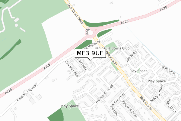
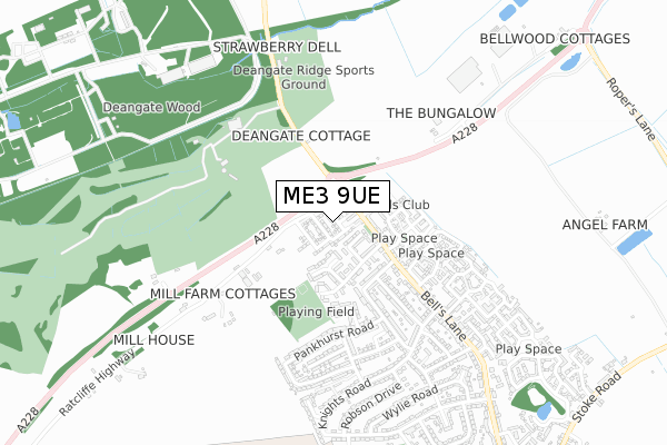
ME3 9UE is located in the Hoo St Werburgh & High Halstow electoral ward, within the unitary authority of Medway and the English Parliamentary constituency of Rochester and Strood. The Sub Integrated Care Board (ICB) Location is NHS Kent and Medway ICB - 91Q and the police force is Kent. This postcode has been in use since January 2019.


GetTheData
Source: OS Open Zoomstack (Ordnance Survey)
Licence: Open Government Licence (requires attribution)
Attribution: Contains OS data © Crown copyright and database right 2024
Source: Open Postcode Geo
Licence: Open Government Licence (requires attribution)
Attribution: Contains OS data © Crown copyright and database right 2024; Contains Royal Mail data © Royal Mail copyright and database right 2024; Source: Office for National Statistics licensed under the Open Government Licence v.3.0
| Easting | 577680 |
| Northing | 173223 |
| Latitude | 51.430152 |
| Longitude | 0.554608 |
GetTheData
Source: Open Postcode Geo
Licence: Open Government Licence
| Country | England |
| Postcode District | ME3 |
| ➜ ME3 open data dashboard ➜ See where ME3 is on a map ➜ Where is Hoo St Werburgh? | |
GetTheData
Source: Land Registry Price Paid Data
Licence: Open Government Licence
| Ward | Hoo St Werburgh & High Halstow |
| Constituency | Rochester And Strood |
GetTheData
Source: ONS Postcode Database
Licence: Open Government Licence
| December 2023 | Violence and sexual offences | On or near Belfry Drive | 483m |
| June 2022 | Anti-social behaviour | On or near Blackman Close | 129m |
| June 2022 | Anti-social behaviour | On or near Blackman Close | 129m |
| ➜ Get more crime data in our Crime section | |||
GetTheData
Source: data.police.uk
Licence: Open Government Licence
| Marconi Sports And Social Club (Bells Lane) | Hoo St Werburgh | 79m |
| Four Wents Road (Bells Lane) | Hoo St Werburgh | 148m |
| Four Wents Road (Bells Lane) | Hoo St Werburgh | 209m |
| Bells Lane | Hoo St Werburgh | 422m |
| Bells Lane | Hoo St Werburgh | 431m |
| Gillingham (Kent) Station | 4.9km |
| Strood Station | 5.3km |
GetTheData
Source: NaPTAN
Licence: Open Government Licence
| Percentage of properties with Next Generation Access | 100.0% |
| Percentage of properties with Superfast Broadband | 100.0% |
| Percentage of properties with Ultrafast Broadband | 100.0% |
| Percentage of properties with Full Fibre Broadband | 100.0% |
Superfast Broadband is between 30Mbps and 300Mbps
Ultrafast Broadband is > 300Mbps
| Percentage of properties unable to receive 2Mbps | 0.0% |
| Percentage of properties unable to receive 5Mbps | 0.0% |
| Percentage of properties unable to receive 10Mbps | 0.0% |
| Percentage of properties unable to receive 30Mbps | 0.0% |
GetTheData
Source: Ofcom
Licence: Ofcom Terms of Use (requires attribution)
GetTheData
Source: ONS Postcode Database
Licence: Open Government Licence


➜ Get more ratings from the Food Standards Agency
GetTheData
Source: Food Standards Agency
Licence: FSA terms & conditions
| Last Collection | |||
|---|---|---|---|
| Location | Mon-Fri | Sat | Distance |
| Moremont Road | 16:45 | 10:30 | 632m |
| Hoo Post Office | 17:15 | 11:15 | 1,265m |
| Hoo Schools | 17:00 | 10:00 | 1,359m |
GetTheData
Source: Dracos
Licence: Creative Commons Attribution-ShareAlike
| Facility | Distance |
|---|---|
| The Peninsular Club (Closed) Bells Lane, Hoo, Rochester Swimming Pool, Grass Pitches, Squash Courts | 39m |
| Deangate Ridge Recreation Ground Dux Court Road, Hoo St Werburgh, Rochester Indoor Bowls, Athletics, Health and Fitness Gym, Golf, Grass Pitches, Outdoor Tennis Courts | 601m |
| The Hundred Of Hoo Academy Main Road, Hoo St Werburgh, Rochester Grass Pitches, Sports Hall, Artificial Grass Pitch, Studio | 985m |
GetTheData
Source: Active Places
Licence: Open Government Licence
| School | Phase of Education | Distance |
|---|---|---|
| Hoo St Werburgh Primary School and the Marlborough Pottery Road, Hoo St Werburgh, Rochester, ME3 9BS | Primary | 941m |
| The Hundred of Hoo Academy Main Road, Hoo, Rochester, ME3 9HH | All-through | 985m |
| High Halstow Primary Academy Harrison Drive, High Halstow, Rochester, ME3 8TF | Primary | 2.3km |
GetTheData
Source: Edubase
Licence: Open Government Licence
The below table lists the International Territorial Level (ITL) codes (formerly Nomenclature of Territorial Units for Statistics (NUTS) codes) and Local Administrative Units (LAU) codes for ME3 9UE:
| ITL 1 Code | Name |
|---|---|
| TLJ | South East (England) |
| ITL 2 Code | Name |
| TLJ4 | Kent |
| ITL 3 Code | Name |
| TLJ41 | Medway |
| LAU 1 Code | Name |
| E06000035 | Medway |
GetTheData
Source: ONS Postcode Directory
Licence: Open Government Licence
The below table lists the Census Output Area (OA), Lower Layer Super Output Area (LSOA), and Middle Layer Super Output Area (MSOA) for ME3 9UE:
| Code | Name | |
|---|---|---|
| OA | E00081253 | |
| LSOA | E01016074 | Medway 001D |
| MSOA | E02003314 | Medway 001 |
GetTheData
Source: ONS Postcode Directory
Licence: Open Government Licence
| ME3 9LF | Blackman Close | 112m |
| ME3 8PU | Ratcliffe Highway | 139m |
| ME3 9JX | Fourwents Road | 161m |
| ME3 9LN | Wall Close | 205m |
| ME3 9JD | Bells Lane | 218m |
| ME3 9JY | Fourwents Road | 220m |
| ME3 9FS | Hedgerows | 231m |
| ME3 9FW | The Fields | 235m |
| ME3 9JJ | Rochester Crescent | 240m |
| ME3 9GD | Bells Lane | 243m |
GetTheData
Source: Open Postcode Geo; Land Registry Price Paid Data
Licence: Open Government Licence