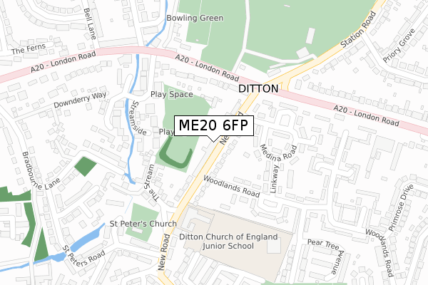
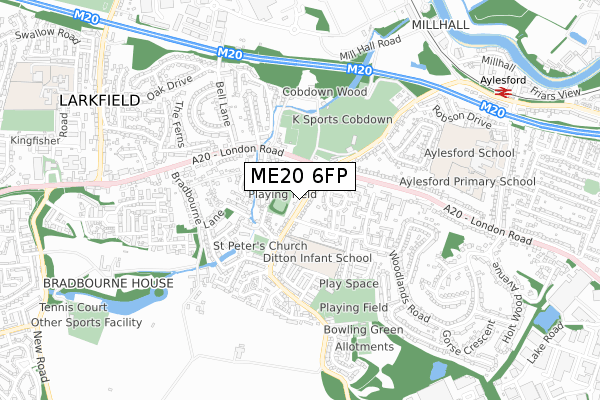
ME20 6FP is located in the Aylesford South & Ditton electoral ward, within the local authority district of Tonbridge and Malling and the English Parliamentary constituency of Chatham and Aylesford. The Sub Integrated Care Board (ICB) Location is NHS Kent and Medway ICB - 91Q and the police force is Kent. This postcode has been in use since September 2017.


GetTheData
Source: OS Open Zoomstack (Ordnance Survey)
Licence: Open Government Licence (requires attribution)
Attribution: Contains OS data © Crown copyright and database right 2024
Source: Open Postcode Geo
Licence: Open Government Licence (requires attribution)
Attribution: Contains OS data © Crown copyright and database right 2024; Contains Royal Mail data © Royal Mail copyright and database right 2024; Source: Office for National Statistics licensed under the Open Government Licence v.3.0
| Easting | 571138 |
| Northing | 158269 |
| Latitude | 51.297825 |
| Longitude | 0.453403 |
GetTheData
Source: Open Postcode Geo
Licence: Open Government Licence
| Country | England |
| Postcode District | ME20 |
| ➜ ME20 open data dashboard ➜ See where ME20 is on a map ➜ Where is Ditton? | |
GetTheData
Source: Land Registry Price Paid Data
Licence: Open Government Licence
| Ward | Aylesford South & Ditton |
| Constituency | Chatham And Aylesford |
GetTheData
Source: ONS Postcode Database
Licence: Open Government Licence
| January 2024 | Bicycle theft | On or near Petrol Station | 260m |
| January 2024 | Other theft | On or near Petrol Station | 260m |
| January 2024 | Other crime | On or near Petrol Station | 260m |
| ➜ Get more crime data in our Crime section | |||
GetTheData
Source: data.police.uk
Licence: Open Government Licence
| Ditton Corner (London Road) | Ditton | 160m |
| Ditton Corner (London Road) | Ditton | 162m |
| Bell Lane (London Road) | Ditton | 360m |
| Bell Lane (London Road) | Ditton | 383m |
| Ta Centre (London Road) | Ditton | 415m |
| Aylesford Station | 1km |
| East Malling Station | 1.7km |
| New Hythe Station | 1.7km |
GetTheData
Source: NaPTAN
Licence: Open Government Licence
| Percentage of properties with Next Generation Access | 100.0% |
| Percentage of properties with Superfast Broadband | 100.0% |
| Percentage of properties with Ultrafast Broadband | 100.0% |
| Percentage of properties with Full Fibre Broadband | 0.0% |
Superfast Broadband is between 30Mbps and 300Mbps
Ultrafast Broadband is > 300Mbps
| Percentage of properties unable to receive 2Mbps | 0.0% |
| Percentage of properties unable to receive 5Mbps | 0.0% |
| Percentage of properties unable to receive 10Mbps | 0.0% |
| Percentage of properties unable to receive 30Mbps | 0.0% |
GetTheData
Source: Ofcom
Licence: Ofcom Terms of Use (requires attribution)
GetTheData
Source: ONS Postcode Database
Licence: Open Government Licence


➜ Get more ratings from the Food Standards Agency
GetTheData
Source: Food Standards Agency
Licence: FSA terms & conditions
| Last Collection | |||
|---|---|---|---|
| Location | Mon-Fri | Sat | Distance |
| Ditton Post Office | 17:00 | 11:00 | 50m |
| St Peters Road | 16:15 | 09:00 | 377m |
| Primrose Drive | 17:30 | 09:00 | 436m |
GetTheData
Source: Dracos
Licence: Creative Commons Attribution-ShareAlike
| Facility | Distance |
|---|---|
| New Road Recreation Ground New Road, Ditton, Aylesford Grass Pitches | 22m |
| Ditton C Of E Junior School New Road, Ditton, Aylesford Grass Pitches | 198m |
| K Sports Cobdown Station Road, Ditton, Aylesford Grass Pitches, Squash Courts, Artificial Grass Pitch, Health and Fitness Gym | 314m |
GetTheData
Source: Active Places
Licence: Open Government Licence
| School | Phase of Education | Distance |
|---|---|---|
| Ditton Church of England Junior School New Road, Ditton, Aylesford, ME20 6AE | Primary | 192m |
| Ditton Infant School Pear Tree Avenue, Ditton, Aylesford, ME20 6EB | Primary | 297m |
| Aylesford School Teapot Lane, Aylesford, ME20 7JU | Secondary | 774m |
GetTheData
Source: Edubase
Licence: Open Government Licence
The below table lists the International Territorial Level (ITL) codes (formerly Nomenclature of Territorial Units for Statistics (NUTS) codes) and Local Administrative Units (LAU) codes for ME20 6FP:
| ITL 1 Code | Name |
|---|---|
| TLJ | South East (England) |
| ITL 2 Code | Name |
| TLJ4 | Kent |
| ITL 3 Code | Name |
| TLJ46 | West Kent |
| LAU 1 Code | Name |
| E07000115 | Tonbridge and Malling |
GetTheData
Source: ONS Postcode Directory
Licence: Open Government Licence
The below table lists the Census Output Area (OA), Lower Layer Super Output Area (LSOA), and Middle Layer Super Output Area (MSOA) for ME20 6FP:
| Code | Name | |
|---|---|---|
| OA | E00125556 | |
| LSOA | E01024736 | Tonbridge and Malling 005D |
| MSOA | E02005153 | Tonbridge and Malling 005 |
GetTheData
Source: ONS Postcode Directory
Licence: Open Government Licence
| ME20 6AD | New Road | 37m |
| ME20 6AR | New Road | 74m |
| ME20 6SY | Streamside | 106m |
| ME20 6DR | Medina Road | 125m |
| ME20 6DL | London Road | 130m |
| ME20 6XE | Ditton Place | 135m |
| ME20 6AS | New Road | 145m |
| ME20 6DT | Woodlands Road | 150m |
| ME20 6AG | The Stream | 174m |
| ME20 6AE | New Road | 198m |
GetTheData
Source: Open Postcode Geo; Land Registry Price Paid Data
Licence: Open Government Licence