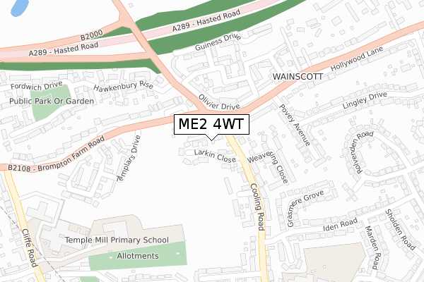
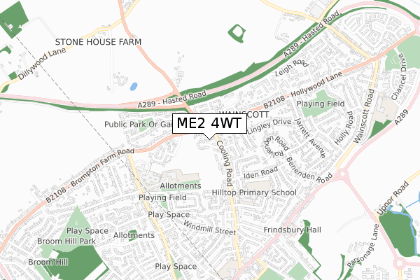
ME2 4WT is located in the Strood Rural electoral ward, within the unitary authority of Medway and the English Parliamentary constituency of Rochester and Strood. The Sub Integrated Care Board (ICB) Location is NHS Kent and Medway ICB - 91Q and the police force is Kent. This postcode has been in use since November 2018.


GetTheData
Source: OS Open Zoomstack (Ordnance Survey)
Licence: Open Government Licence (requires attribution)
Attribution: Contains OS data © Crown copyright and database right 2024
Source: Open Postcode Geo
Licence: Open Government Licence (requires attribution)
Attribution: Contains OS data © Crown copyright and database right 2024; Contains Royal Mail data © Royal Mail copyright and database right 2024; Source: Office for National Statistics licensed under the Open Government Licence v.3.0
| Easting | 573855 |
| Northing | 170678 |
| Latitude | 51.408475 |
| Longitude | 0.498393 |
GetTheData
Source: Open Postcode Geo
Licence: Open Government Licence
| Country | England |
| Postcode District | ME2 |
| ➜ ME2 open data dashboard ➜ See where ME2 is on a map ➜ Where is Rochester? | |
GetTheData
Source: Land Registry Price Paid Data
Licence: Open Government Licence
| Ward | Strood Rural |
| Constituency | Rochester And Strood |
GetTheData
Source: ONS Postcode Database
Licence: Open Government Licence
| December 2023 | Anti-social behaviour | On or near Rolvenden Road | 457m |
| September 2023 | Public order | On or near Cagney Close | 498m |
| July 2023 | Vehicle crime | On or near Cagney Close | 498m |
| ➜ Get more crime data in our Crime section | |||
GetTheData
Source: data.police.uk
Licence: Open Government Licence
| Cooling Road (Hollywood Lane) | Frindsbury | 87m |
| Weavering Close (Cooling Road) | Frindsbury | 108m |
| Hawkenbury Rise (Lower Rochester Road) | Frindsbury | 119m |
| Weavering Close (Cooling Road) | Frindsbury | 124m |
| Hawkenbury Rise (Lower Rochester Road) | Frindsbury | 129m |
| Strood Station | 1.3km |
| Rochester Station | 2.7km |
| Higham Station | 3km |
GetTheData
Source: NaPTAN
Licence: Open Government Licence
| Percentage of properties with Next Generation Access | 100.0% |
| Percentage of properties with Superfast Broadband | 100.0% |
| Percentage of properties with Ultrafast Broadband | 100.0% |
| Percentage of properties with Full Fibre Broadband | 0.0% |
Superfast Broadband is between 30Mbps and 300Mbps
Ultrafast Broadband is > 300Mbps
| Percentage of properties unable to receive 2Mbps | 0.0% |
| Percentage of properties unable to receive 5Mbps | 0.0% |
| Percentage of properties unable to receive 10Mbps | 0.0% |
| Percentage of properties unable to receive 30Mbps | 0.0% |
GetTheData
Source: Ofcom
Licence: Ofcom Terms of Use (requires attribution)
GetTheData
Source: ONS Postcode Database
Licence: Open Government Licence


➜ Get more ratings from the Food Standards Agency
GetTheData
Source: Food Standards Agency
Licence: FSA terms & conditions
| Last Collection | |||
|---|---|---|---|
| Location | Mon-Fri | Sat | Distance |
| Povey Avenue | 17:45 | 11:30 | 173m |
| Royal Oak | 17:45 | 12:30 | 264m |
| Cliffe Road | 17:30 | 11:30 | 481m |
GetTheData
Source: Dracos
Licence: Creative Commons Attribution-ShareAlike
| Facility | Distance |
|---|---|
| Temple Mill Primary School Cliffe Road, Rochester Grass Pitches | 303m |
| Hilltop Primary Academy Hilltop Road, Rochester Grass Pitches, Swimming Pool | 403m |
| Strood Academy - Cliffe Road Campus (Closed) Cliffe Road, Strood, Rochester Grass Pitches, Sports Hall | 448m |
GetTheData
Source: Active Places
Licence: Open Government Licence
| School | Phase of Education | Distance |
|---|---|---|
| Temple Mill Primary School Cliffe Road, Strood, Rochester, ME2 3NL | Primary | 308m |
| Hilltop Primary Academy Hilltop Road, Frindsbury, Rochester, ME2 4QN | Primary | 393m |
| English Martyrs' Catholic Primary School Frindsbury Road, Strood, Rochester, ME2 4JA | Primary | 795m |
GetTheData
Source: Edubase
Licence: Open Government Licence
The below table lists the International Territorial Level (ITL) codes (formerly Nomenclature of Territorial Units for Statistics (NUTS) codes) and Local Administrative Units (LAU) codes for ME2 4WT:
| ITL 1 Code | Name |
|---|---|
| TLJ | South East (England) |
| ITL 2 Code | Name |
| TLJ4 | Kent |
| ITL 3 Code | Name |
| TLJ41 | Medway |
| LAU 1 Code | Name |
| E06000035 | Medway |
GetTheData
Source: ONS Postcode Directory
Licence: Open Government Licence
The below table lists the Census Output Area (OA), Lower Layer Super Output Area (LSOA), and Middle Layer Super Output Area (MSOA) for ME2 4WT:
| Code | Name | |
|---|---|---|
| OA | E00081613 | |
| LSOA | E01016148 | Medway 004C |
| MSOA | E02003317 | Medway 004 |
GetTheData
Source: ONS Postcode Directory
Licence: Open Government Licence
| ME2 4SA | Larkin Close | 48m |
| ME2 3NW | Brompton Farm Road | 64m |
| ME3 8GQ | Olivier Drive | 99m |
| ME3 8AS | Hollywood Lane | 100m |
| ME2 4RT | Cooling Road | 100m |
| ME2 4RN | Cooling Road | 109m |
| ME2 4RR | Gardenia Close | 129m |
| ME3 8GR | Bogarde Drive | 144m |
| ME2 4RQ | Weavering Close | 168m |
| ME3 8GT | Mason Way | 186m |
GetTheData
Source: Open Postcode Geo; Land Registry Price Paid Data
Licence: Open Government Licence