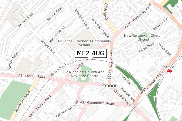
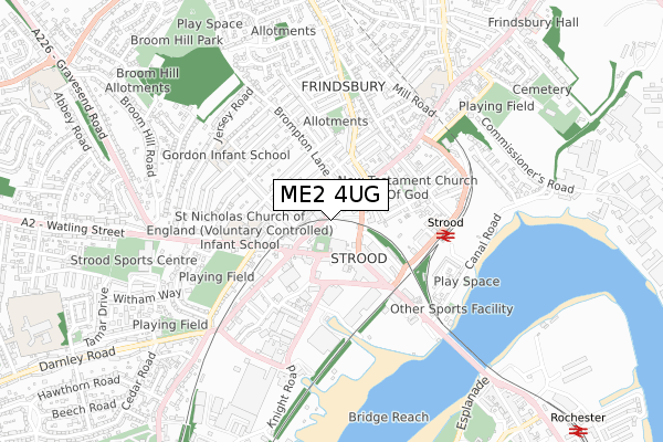
ME2 4UG is located in the Strood North & Frindsbury electoral ward, within the unitary authority of Medway and the English Parliamentary constituency of Rochester and Strood. The Sub Integrated Care Board (ICB) Location is NHS Kent and Medway ICB - 91Q and the police force is Kent. This postcode has been in use since September 2018.


GetTheData
Source: OS Open Zoomstack (Ordnance Survey)
Licence: Open Government Licence (requires attribution)
Attribution: Contains OS data © Crown copyright and database right 2024
Source: Open Postcode Geo
Licence: Open Government Licence (requires attribution)
Attribution: Contains OS data © Crown copyright and database right 2024; Contains Royal Mail data © Royal Mail copyright and database right 2024; Source: Office for National Statistics licensed under the Open Government Licence v.3.0
| Easting | 573584 |
| Northing | 169393 |
| Latitude | 51.397014 |
| Longitude | 0.493873 |
GetTheData
Source: Open Postcode Geo
Licence: Open Government Licence
| Country | England |
| Postcode District | ME2 |
| ➜ ME2 open data dashboard ➜ See where ME2 is on a map ➜ Where is Rochester? | |
GetTheData
Source: Land Registry Price Paid Data
Licence: Open Government Licence
| Ward | Strood North & Frindsbury |
| Constituency | Rochester And Strood |
GetTheData
Source: ONS Postcode Database
Licence: Open Government Licence
| January 2024 | Anti-social behaviour | On or near Parking Area | 212m |
| January 2024 | Anti-social behaviour | On or near Parking Area | 212m |
| January 2024 | Criminal damage and arson | On or near Parking Area | 212m |
| ➜ Get more crime data in our Crime section | |||
GetTheData
Source: data.police.uk
Licence: Open Government Licence
| St Mary's Road (North Street) | Strood | 115m |
| St Mary's Road (North Street) | Strood | 123m |
| Post Office (North Street) | Strood | 132m |
| St Nicholas Church (High Street) | Strood | 144m |
| Commercial Road | Strood | 205m |
| Strood Station | 0.4km |
| Rochester Station | 1.7km |
| Chatham Station | 2.7km |
GetTheData
Source: NaPTAN
Licence: Open Government Licence
GetTheData
Source: ONS Postcode Database
Licence: Open Government Licence


➜ Get more ratings from the Food Standards Agency
GetTheData
Source: Food Standards Agency
Licence: FSA terms & conditions
| Last Collection | |||
|---|---|---|---|
| Location | Mon-Fri | Sat | Distance |
| Strood Post Office | 18:30 | 12:30 | 127m |
| Strood Post Office | 18:30 | 12:30 | 128m |
| Gun Lane | 17:45 | 11:45 | 167m |
GetTheData
Source: Dracos
Licence: Creative Commons Attribution-ShareAlike
| Facility | Distance |
|---|---|
| All Faiths Children's Academy Gun Lane, Rochester Grass Pitches | 97m |
| The Gym Group (Strood) Commercial Road, Rochester Health and Fitness Gym | 288m |
| Beefs & Babes (Strood) Priory Road, Rochester Health and Fitness Gym, Studio | 545m |
GetTheData
Source: Active Places
Licence: Open Government Licence
| School | Phase of Education | Distance |
|---|---|---|
| All Faiths Children's Academy Gun Lane, Strood, Rochester, ME2 4UF | Primary | 115m |
| St Nicholas Cecv Primary School St Nicholas Cevc Primary School, London Road, Strood, Rochester, ME2 3HU | Primary | 333m |
| Gordons Children's Academy, Junior Gordon Road, Strood, Rochester, ME2 3HQ | Primary | 464m |
GetTheData
Source: Edubase
Licence: Open Government Licence
The below table lists the International Territorial Level (ITL) codes (formerly Nomenclature of Territorial Units for Statistics (NUTS) codes) and Local Administrative Units (LAU) codes for ME2 4UG:
| ITL 1 Code | Name |
|---|---|
| TLJ | South East (England) |
| ITL 2 Code | Name |
| TLJ4 | Kent |
| ITL 3 Code | Name |
| TLJ41 | Medway |
| LAU 1 Code | Name |
| E06000035 | Medway |
GetTheData
Source: ONS Postcode Directory
Licence: Open Government Licence
The below table lists the Census Output Area (OA), Lower Layer Super Output Area (LSOA), and Middle Layer Super Output Area (MSOA) for ME2 4UG:
| Code | Name | |
|---|---|---|
| OA | E00081556 | |
| LSOA | E01016141 | Medway 006E |
| MSOA | E02003319 | Medway 006 |
GetTheData
Source: ONS Postcode Directory
Licence: Open Government Licence
| ME2 4UH | Gun Lane | 94m |
| ME2 4UB | Gun Lane | 99m |
| ME2 4SR | North Street | 102m |
| ME2 3EJ | Stanhope Road | 129m |
| ME2 4SH | North Street | 135m |
| ME2 4TJ | High Street | 148m |
| ME2 3BJ | Brompton Lane | 158m |
| ME2 4TH | High Street | 170m |
| ME2 3EW | Bryant Road | 172m |
| ME2 3EH | Glanville Road | 176m |
GetTheData
Source: Open Postcode Geo; Land Registry Price Paid Data
Licence: Open Government Licence