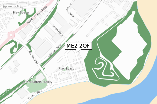
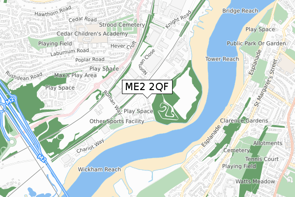
ME2 2QF is located in the Cuxton, Halling & Riverside electoral ward, within the unitary authority of Medway and the English Parliamentary constituency of Rochester and Strood. The Sub Integrated Care Board (ICB) Location is NHS Kent and Medway ICB - 91Q and the police force is Kent. This postcode has been in use since April 2020.


GetTheData
Source: OS Open Zoomstack (Ordnance Survey)
Licence: Open Government Licence (requires attribution)
Attribution: Contains OS data © Crown copyright and database right 2024
Source: Open Postcode Geo
Licence: Open Government Licence (requires attribution)
Attribution: Contains OS data © Crown copyright and database right 2024; Contains Royal Mail data © Royal Mail copyright and database right 2024; Source: Office for National Statistics licensed under the Open Government Licence v.3.0
| Easting | 573015 |
| Northing | 167903 |
| Latitude | 51.383803 |
| Longitude | 0.484977 |
GetTheData
Source: Open Postcode Geo
Licence: Open Government Licence
| Country | England |
| Postcode District | ME2 |
| ➜ ME2 open data dashboard ➜ See where ME2 is on a map ➜ Where is Rochester? | |
GetTheData
Source: Land Registry Price Paid Data
Licence: Open Government Licence
| Ward | Cuxton, Halling & Riverside |
| Constituency | Rochester And Strood |
GetTheData
Source: ONS Postcode Database
Licence: Open Government Licence
| June 2022 | Violence and sexual offences | On or near Saxon Place | 199m |
| June 2022 | Violence and sexual offences | On or near Saxon Place | 199m |
| June 2022 | Violence and sexual offences | On or near Saxon Place | 199m |
| ➜ Get more crime data in our Crime section | |||
GetTheData
Source: data.police.uk
Licence: Open Government Licence
| Roman Way | Medway Valley Park | 256m |
| Roman Way | Medway Valley Park | 277m |
| Ballard Business Park (Cuxton Road) | Medway Valley Park | 379m |
| Ballard Business Park (Cuxton Road) | Medway Valley Park | 412m |
| Poplar Road (Cuxton Road) | Strood | 465m |
| Strood Station | 1.8km |
| Rochester Station | 1.8km |
| Cuxton Station | 2km |
GetTheData
Source: NaPTAN
Licence: Open Government Licence
GetTheData
Source: ONS Postcode Database
Licence: Open Government Licence


➜ Get more ratings from the Food Standards Agency
GetTheData
Source: Food Standards Agency
Licence: FSA terms & conditions
| Last Collection | |||
|---|---|---|---|
| Location | Mon-Fri | Sat | Distance |
| Medway Mail Centre | 19:15 | 11:30 | 436m |
| Medway Mail Centre | 19:15 | 11:30 | 437m |
| Cuxton Road | 17:30 | 12:00 | 604m |
GetTheData
Source: Dracos
Licence: Creative Commons Attribution-ShareAlike
| Facility | Distance |
|---|---|
| Snowpark At Diggerland (Closed) Roman Way, Rochester Ski Slopes | 272m |
| Nuffield Health (Medway) Medway Valley Leisure Park, Chariot Way, Rochester Swimming Pool, Health and Fitness Gym, Studio | 297m |
| Cedar Children's Academy Cedar Road, Rochester Grass Pitches | 726m |
GetTheData
Source: Active Places
Licence: Open Government Licence
| School | Phase of Education | Distance |
|---|---|---|
| Cedar Children's Academy Cedar Road, Strood, Rochester, ME2 2JP | Primary | 806m |
| St Andrew's School (Rochester) 24 - 26 Watts Avenue, Rochester, ME1 1SA | Not applicable | 1km |
| Manorway Independent School The Old St Justus Church, Strood, Rochester, Chatham, ME2 2HG | Not applicable | 1.1km |
GetTheData
Source: Edubase
Licence: Open Government Licence
The below table lists the International Territorial Level (ITL) codes (formerly Nomenclature of Territorial Units for Statistics (NUTS) codes) and Local Administrative Units (LAU) codes for ME2 2QF:
| ITL 1 Code | Name |
|---|---|
| TLJ | South East (England) |
| ITL 2 Code | Name |
| TLJ4 | Kent |
| ITL 3 Code | Name |
| TLJ41 | Medway |
| LAU 1 Code | Name |
| E06000035 | Medway |
GetTheData
Source: ONS Postcode Directory
Licence: Open Government Licence
The below table lists the Census Output Area (OA), Lower Layer Super Output Area (LSOA), and Middle Layer Super Output Area (MSOA) for ME2 2QF:
| Code | Name | |
|---|---|---|
| OA | E00081648 | |
| LSOA | E01016157 | Medway 011D |
| MSOA | E02003324 | Medway 011 |
GetTheData
Source: ONS Postcode Directory
Licence: Open Government Licence
| ME2 2NR | Poplar Road | 434m |
| ME2 2NP | Poplar Close | 471m |
| ME2 2GA | Empire Road | 511m |
| ME2 2NN | Hever Croft | 525m |
| ME2 2NJ | Cuxton Road | 528m |
| ME2 2GX | Silver Streak Way | 544m |
| ME2 2GB | Horace Road | 562m |
| ME2 2PJ | Sycamore Road | 565m |
| ME2 2GD | Oswald Drive | 576m |
| ME2 2NL | North Bank Close | 582m |
GetTheData
Source: Open Postcode Geo; Land Registry Price Paid Data
Licence: Open Government Licence