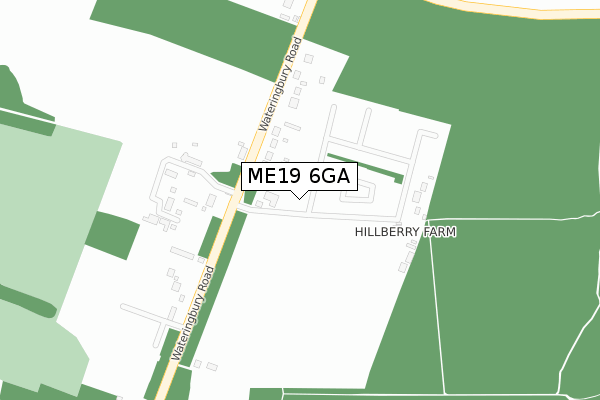
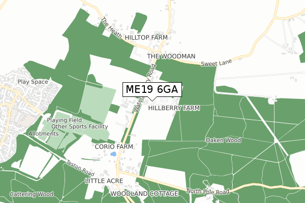
ME19 6GA is located in the East Malling, West Malling & Offham electoral ward, within the local authority district of Tonbridge and Malling and the English Parliamentary constituency of Tonbridge and Malling. The Sub Integrated Care Board (ICB) Location is NHS Kent and Medway ICB - 91Q and the police force is Kent. This postcode has been in use since September 2019.


GetTheData
Source: OS Open Zoomstack (Ordnance Survey)
Licence: Open Government Licence (requires attribution)
Attribution: Contains OS data © Crown copyright and database right 2024
Source: Open Postcode Geo
Licence: Open Government Licence (requires attribution)
Attribution: Contains OS data © Crown copyright and database right 2024; Contains Royal Mail data © Royal Mail copyright and database right 2024; Source: Office for National Statistics licensed under the Open Government Licence v.3.0
| Easting | 569868 |
| Northing | 155495 |
| Latitude | 51.273284 |
| Longitude | 0.433886 |
GetTheData
Source: Open Postcode Geo
Licence: Open Government Licence
| Country | England |
| Postcode District | ME19 |
| ➜ ME19 open data dashboard ➜ See where ME19 is on a map | |
GetTheData
Source: Land Registry Price Paid Data
Licence: Open Government Licence
| Ward | East Malling, West Malling & Offham |
| Constituency | Tonbridge And Malling |
GetTheData
Source: ONS Postcode Database
Licence: Open Government Licence
| June 2022 | Violence and sexual offences | On or near Wateringbury Road | 320m |
| June 2022 | Violence and sexual offences | On or near Wateringbury Road | 320m |
| May 2022 | Violence and sexual offences | On or near Wateringbury Road | 320m |
| ➜ Get more crime data in our Crime section | |||
GetTheData
Source: data.police.uk
Licence: Open Government Licence
| North Pole (Wateringbury Road) | Wateringbury | 772m |
| Holly Way (Discovery Drive) | Kings Hill | 1,147m |
| Holly Way (Discovery Drive) | Kings Hill | 1,153m |
| Regent Way (Beacon Avenue) | Kings Hill | 1,307m |
| Dawn Lane (Discovery Drive) | Kings Hill | 1,310m |
| East Malling Station | 1.4km |
| West Malling Station | 2.3km |
| Wateringbury Station | 2.7km |
GetTheData
Source: NaPTAN
Licence: Open Government Licence
GetTheData
Source: ONS Postcode Database
Licence: Open Government Licence

➜ Get more ratings from the Food Standards Agency
GetTheData
Source: Food Standards Agency
Licence: FSA terms & conditions
| Last Collection | |||
|---|---|---|---|
| Location | Mon-Fri | Sat | Distance |
| North Pole | 17:15 | 09:00 | 779m |
| Easterfield | 16:00 | 09:00 | 1,184m |
| Regent Way | 17:45 | 11:30 | 1,626m |
GetTheData
Source: Dracos
Licence: Creative Commons Attribution-ShareAlike
| Facility | Distance |
|---|---|
| Kings Hill Community Tennis Club Beacon Avenue, Kings Hill, West Malling Outdoor Tennis Courts | 585m |
| Kings Hill Sports Park Beacon Avenue, Kings Hill, West Malling Artificial Grass Pitch, Grass Pitches, Outdoor Tennis Courts | 699m |
| The Discovery School Discovery Drive, Kings Hill, West Malling Grass Pitches, Sports Hall | 1.1km |
GetTheData
Source: Active Places
Licence: Open Government Licence
| School | Phase of Education | Distance |
|---|---|---|
| The Discovery School Discovery Drive, Kings Hill, West Malling, ME19 4GJ | Primary | 1.1km |
| The Malling School Beech Road, East Malling, West Malling, ME19 6DH | Secondary | 1.9km |
| St James the Great Academy Chapman Way, East Malling, ME19 6SD | Primary | 2.3km |
GetTheData
Source: Edubase
Licence: Open Government Licence
The below table lists the International Territorial Level (ITL) codes (formerly Nomenclature of Territorial Units for Statistics (NUTS) codes) and Local Administrative Units (LAU) codes for ME19 6GA:
| ITL 1 Code | Name |
|---|---|
| TLJ | South East (England) |
| ITL 2 Code | Name |
| TLJ4 | Kent |
| ITL 3 Code | Name |
| TLJ46 | West Kent |
| LAU 1 Code | Name |
| E07000115 | Tonbridge and Malling |
GetTheData
Source: ONS Postcode Directory
Licence: Open Government Licence
The below table lists the Census Output Area (OA), Lower Layer Super Output Area (LSOA), and Middle Layer Super Output Area (MSOA) for ME19 6GA:
| Code | Name | |
|---|---|---|
| OA | E00125580 | |
| LSOA | E01024740 | Tonbridge and Malling 014A |
| MSOA | E02006833 | Tonbridge and Malling 014 |
GetTheData
Source: ONS Postcode Directory
Licence: Open Government Licence
| ME19 6JG | Wateringbury Road | 98m |
| ME19 6JH | Wateringbury Road | 172m |
| ME19 6JJ | Wateringbury Road | 242m |
| ME19 6JF | Sweets Lane | 369m |
| ME19 6JQ | Wateringbury Road | 453m |
| ME19 6JL | The Heath | 554m |
| ME19 6JE | Wateringbury Road | 563m |
| ME18 5BE | Red Hill | 633m |
| ME18 5BD | Barming Road | 650m |
| ME19 6JD | Wateringbury Road | 730m |
GetTheData
Source: Open Postcode Geo; Land Registry Price Paid Data
Licence: Open Government Licence