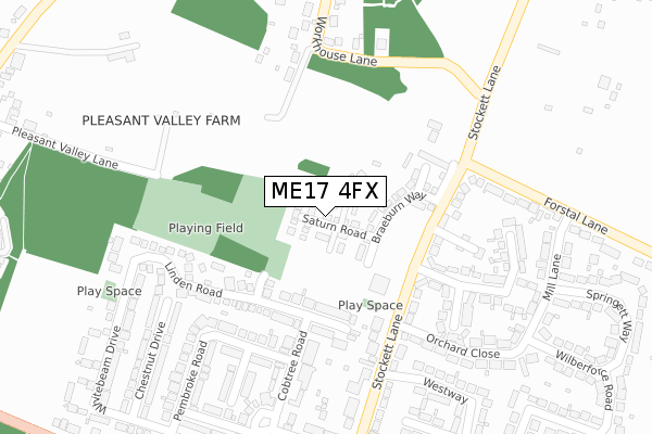
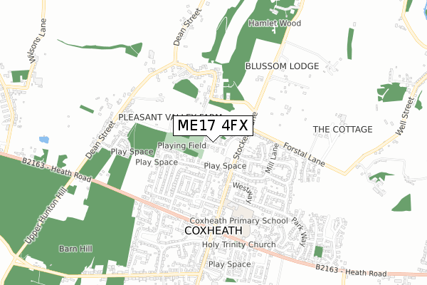
ME17 4FX is located in the Coxheath and Hunton electoral ward, within the local authority district of Maidstone and the English Parliamentary constituency of Maidstone and The Weald. The Sub Integrated Care Board (ICB) Location is NHS Kent and Medway ICB - 91Q and the police force is Kent. This postcode has been in use since August 2019.


GetTheData
Source: OS Open Zoomstack (Ordnance Survey)
Licence: Open Government Licence (requires attribution)
Attribution: Contains OS data © Crown copyright and database right 2024
Source: Open Postcode Geo
Licence: Open Government Licence (requires attribution)
Attribution: Contains OS data © Crown copyright and database right 2024; Contains Royal Mail data © Royal Mail copyright and database right 2024; Source: Office for National Statistics licensed under the Open Government Licence v.3.0
| Easting | 574247 |
| Northing | 151639 |
| Latitude | 51.237323 |
| Longitude | 0.494725 |
GetTheData
Source: Open Postcode Geo
Licence: Open Government Licence
| Country | England |
| Postcode District | ME17 |
| ➜ ME17 open data dashboard ➜ See where ME17 is on a map ➜ Where is Coxheath? | |
GetTheData
Source: Land Registry Price Paid Data
Licence: Open Government Licence
| Ward | Coxheath And Hunton |
| Constituency | Maidstone And The Weald |
GetTheData
Source: ONS Postcode Database
Licence: Open Government Licence
2022 9 DEC £490,000 |
8, SATURN ROAD, COXHEATH, MAIDSTONE, ME17 4FX 2020 23 SEP £424,995 |
2020 12 AUG £435,995 |
10, SATURN ROAD, COXHEATH, MAIDSTONE, ME17 4FX 2020 29 JUL £560,000 |
9, SATURN ROAD, COXHEATH, MAIDSTONE, ME17 4FX 2020 3 JUL £442,995 |
17, SATURN ROAD, COXHEATH, MAIDSTONE, ME17 4FX 2020 29 MAY £255,995 |
15, SATURN ROAD, COXHEATH, MAIDSTONE, ME17 4FX 2020 12 MAR £600,000 |
7, SATURN ROAD, COXHEATH, MAIDSTONE, ME17 4FX 2019 20 DEC £369,995 |
16, SATURN ROAD, COXHEATH, MAIDSTONE, ME17 4FX 2019 20 DEC £484,995 |
1, SATURN ROAD, COXHEATH, MAIDSTONE, ME17 4FX 2019 31 OCT £377,995 |
GetTheData
Source: HM Land Registry Price Paid Data
Licence: Contains HM Land Registry data © Crown copyright and database right 2024. This data is licensed under the Open Government Licence v3.0.
| January 2024 | Violence and sexual offences | On or near Pembroke Road | 320m |
| January 2024 | Violence and sexual offences | On or near Pembroke Road | 320m |
| December 2023 | Violence and sexual offences | On or near Pembroke Road | 320m |
| ➜ Get more crime data in our Crime section | |||
GetTheData
Source: data.police.uk
Licence: Open Government Licence
| Westway | Coxheath | 318m |
| Primary School (Stockett Lane) | Coxheath | 398m |
| Gresham Road (Park Way) | Coxheath | 463m |
| Pembroke Road (Heath Road) | Coxheath | 488m |
| Pembroke Road (Heath Road) | Coxheath | 503m |
| East Farleigh Station | 2.1km |
| Maidstone West Station | 4km |
| Maidstone Barracks Station | 4.6km |
GetTheData
Source: NaPTAN
Licence: Open Government Licence
GetTheData
Source: ONS Postcode Database
Licence: Open Government Licence


➜ Get more ratings from the Food Standards Agency
GetTheData
Source: Food Standards Agency
Licence: FSA terms & conditions
| Last Collection | |||
|---|---|---|---|
| Location | Mon-Fri | Sat | Distance |
| Coxheath Post Office | 17:00 | 11:15 | 507m |
| Stockett Lane | 17:30 | 08:30 | 536m |
| Pippin Close | 16:45 | 09:00 | 913m |
GetTheData
Source: Dracos
Licence: Creative Commons Attribution-ShareAlike
| Facility | Distance |
|---|---|
| Coxheath Village Hall Stockett Lane, Stockett Lane, Coxheath, Maidstone Sports Hall, Grass Pitches | 132m |
| The Beacons Field Pleasant Valley Lane, East Farleigh, Maidstone Grass Pitches | 263m |
| Coxheath Primary School Stockett Lane, Stockett Lane, Coxheath, Maidstone Grass Pitches | 393m |
GetTheData
Source: Active Places
Licence: Open Government Licence
| School | Phase of Education | Distance |
|---|---|---|
| Coxheath Primary School Stockett Lane, Coxheath, Maidstone, ME17 4PS | Primary | 393m |
| East Farleigh Primary School Vicarage Lane, East Farleigh, Maidstone, ME15 0LY | Primary | 1.4km |
| Cornwallis Academy Hubbards Lane, Linton, Maidstone, ME17 4HX | Secondary | 1.9km |
GetTheData
Source: Edubase
Licence: Open Government Licence
The below table lists the International Territorial Level (ITL) codes (formerly Nomenclature of Territorial Units for Statistics (NUTS) codes) and Local Administrative Units (LAU) codes for ME17 4FX:
| ITL 1 Code | Name |
|---|---|
| TLJ | South East (England) |
| ITL 2 Code | Name |
| TLJ4 | Kent |
| ITL 3 Code | Name |
| TLJ45 | Mid Kent |
| LAU 1 Code | Name |
| E07000110 | Maidstone |
GetTheData
Source: ONS Postcode Directory
Licence: Open Government Licence
The below table lists the Census Output Area (OA), Lower Layer Super Output Area (LSOA), and Middle Layer Super Output Area (MSOA) for ME17 4FX:
| Code | Name | |
|---|---|---|
| OA | E00123571 | |
| LSOA | E01024344 | Maidstone 016C |
| MSOA | E02005083 | Maidstone 016 |
GetTheData
Source: ONS Postcode Directory
Licence: Open Government Licence
| ME17 4QS | Linden Road | 150m |
| ME17 4PY | Stockett Lane | 177m |
| ME17 4PX | Stockett Lane | 191m |
| ME17 4PZ | Heathside Avenue | 197m |
| ME15 0QD | Stockett Lane | 206m |
| ME17 4QP | Cobtree Road | 207m |
| ME17 4QL | Pembroke Road | 209m |
| ME17 4PT | Stockett Lane | 231m |
| ME17 4FB | Fir Tree Court | 241m |
| ME17 4QW | Cobtree Road | 263m |
GetTheData
Source: Open Postcode Geo; Land Registry Price Paid Data
Licence: Open Government Licence