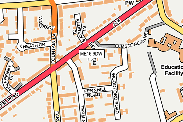
ME16 9DW is located in the Fant electoral ward, within the local authority district of Maidstone and the English Parliamentary constituency of Maidstone and The Weald. The Sub Integrated Care Board (ICB) Location is NHS Kent and Medway ICB - 91Q and the police force is Kent. This postcode has been in use since February 2017.


GetTheData
Source: OS OpenMap – Local (Ordnance Survey)
Source: OS VectorMap District (Ordnance Survey)
Licence: Open Government Licence (requires attribution)
| Easting | 573446 |
| Northing | 154799 |
| Latitude | 51.265954 |
| Longitude | 0.484793 |
GetTheData
Source: Open Postcode Geo
Licence: Open Government Licence
| Country | England |
| Postcode District | ME16 |
| ➜ ME16 open data dashboard ➜ See where ME16 is on a map ➜ Where is Maidstone? | |
GetTheData
Source: Land Registry Price Paid Data
Licence: Open Government Licence
| Ward | Fant |
| Constituency | Maidstone And The Weald |
GetTheData
Source: ONS Postcode Database
Licence: Open Government Licence
| May 2023 | Anti-social behaviour | On or near Springwood Road | 468m |
| November 2022 | Violence and sexual offences | On or near Abbots Field | 468m |
| November 2022 | Public order | On or near Springwood Road | 468m |
| ➜ Get more crime data in our Crime section | |||
GetTheData
Source: data.police.uk
Licence: Open Government Licence
| Spice Fusion (Tonbridge Road) | Barming | 82m |
| St Andrew's Church (Tonbridge Road) | Barming | 130m |
| Spice Fusion (Fountain Lane) | Barming | 137m |
| Spice Fusion (Farleigh Lane) | Barming | 150m |
| Spice Fusion (Tonbridge Road) | Barming | 174m |
| East Farleigh Station | 1.2km |
| Barming Station | 2.1km |
| Maidstone West Station | 2.2km |
GetTheData
Source: NaPTAN
Licence: Open Government Licence
➜ Broadband speed and availability dashboard for ME16 9DW
| Percentage of properties with Next Generation Access | 100.0% |
| Percentage of properties with Superfast Broadband | 100.0% |
| Percentage of properties with Ultrafast Broadband | 100.0% |
| Percentage of properties with Full Fibre Broadband | 0.0% |
Superfast Broadband is between 30Mbps and 300Mbps
Ultrafast Broadband is > 300Mbps
| Median download speed | 50.0Mbps |
| Average download speed | 79.0Mbps |
| Maximum download speed | 200.00Mbps |
| Median upload speed | 3.6Mbps |
| Average upload speed | 6.6Mbps |
| Maximum upload speed | 20.00Mbps |
| Percentage of properties unable to receive 2Mbps | 0.0% |
| Percentage of properties unable to receive 5Mbps | 0.0% |
| Percentage of properties unable to receive 10Mbps | 0.0% |
| Percentage of properties unable to receive 30Mbps | 0.0% |
➜ Broadband speed and availability dashboard for ME16 9DW
GetTheData
Source: Ofcom
Licence: Ofcom Terms of Use (requires attribution)
GetTheData
Source: ONS Postcode Database
Licence: Open Government Licence


➜ Get more ratings from the Food Standards Agency
GetTheData
Source: Food Standards Agency
Licence: FSA terms & conditions
| Last Collection | |||
|---|---|---|---|
| Location | Mon-Fri | Sat | Distance |
| Fountain Inn | 17:30 | 12:15 | 93m |
| Tonbridge Road | 17:15 | 12:00 | 296m |
| Fant Lane | 17:30 | 12:00 | 366m |
GetTheData
Source: Dracos
Licence: Creative Commons Attribution-ShareAlike
| Facility | Distance |
|---|---|
| Gatland Recreation Ground Gatland Lane, Maidstone Grass Pitches | 155m |
| Bower Grove School Fant Lane, Maidstone Grass Pitches, Sports Hall, Health and Fitness Gym | 272m |
| Barming Heath Springwood Road, Barming, Maidstone Grass Pitches | 336m |
GetTheData
Source: Active Places
Licence: Open Government Licence
| School | Phase of Education | Distance |
|---|---|---|
| Bower Grove School Fant Lane, Maidstone, ME16 8NL | Not applicable | 272m |
| Jubilee Primary School Gatland Lane, Maidstone, ME16 8PF | Primary | 314m |
| West Borough Primary School Greenway, Maidstone, ME16 8TL | Primary | 562m |
GetTheData
Source: Edubase
Licence: Open Government Licence
The below table lists the International Territorial Level (ITL) codes (formerly Nomenclature of Territorial Units for Statistics (NUTS) codes) and Local Administrative Units (LAU) codes for ME16 9DW:
| ITL 1 Code | Name |
|---|---|
| TLJ | South East (England) |
| ITL 2 Code | Name |
| TLJ4 | Kent |
| ITL 3 Code | Name |
| TLJ45 | Mid Kent |
| LAU 1 Code | Name |
| E07000110 | Maidstone |
GetTheData
Source: ONS Postcode Directory
Licence: Open Government Licence
The below table lists the Census Output Area (OA), Lower Layer Super Output Area (LSOA), and Middle Layer Super Output Area (MSOA) for ME16 9DW:
| Code | Name | |
|---|---|---|
| OA | E00123661 | |
| LSOA | E01024358 | Maidstone 008B |
| MSOA | E02005075 | Maidstone 008 |
GetTheData
Source: ONS Postcode Directory
Licence: Open Government Licence
| ME16 9AU | Terminus Road | 55m |
| ME16 9LN | Tonbridge Road | 61m |
| ME16 9BL | Fernhill Road | 81m |
| ME16 9LW | Tonbridge Road | 90m |
| ME16 9BS | Woodford Road | 97m |
| ME16 9BT | Woodford Road | 108m |
| ME16 9BN | Fernhill Road | 115m |
| ME16 9BW | Fernhill Road | 124m |
| ME16 9AX | Farleigh Lane | 129m |
| ME16 9BU | Woodford Road | 129m |
GetTheData
Source: Open Postcode Geo; Land Registry Price Paid Data
Licence: Open Government Licence