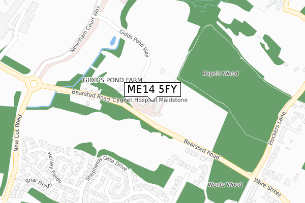
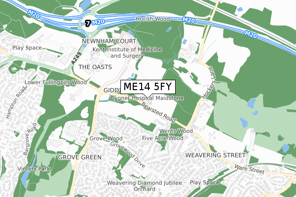
ME14 5FY is located in the Boxley electoral ward, within the local authority district of Maidstone and the English Parliamentary constituency of Faversham and Mid Kent. The Sub Integrated Care Board (ICB) Location is NHS Kent and Medway ICB - 91Q and the police force is Kent. This postcode has been in use since November 2019.


GetTheData
Source: OS Open Zoomstack (Ordnance Survey)
Licence: Open Government Licence (requires attribution)
Attribution: Contains OS data © Crown copyright and database right 2024
Source: Open Postcode Geo
Licence: Open Government Licence (requires attribution)
Attribution: Contains OS data © Crown copyright and database right 2024; Contains Royal Mail data © Royal Mail copyright and database right 2024; Source: Office for National Statistics licensed under the Open Government Licence v.3.0
| Easting | 578373 |
| Northing | 157050 |
| Latitude | 51.284656 |
| Longitude | 0.556462 |
GetTheData
Source: Open Postcode Geo
Licence: Open Government Licence
| Country | England |
| Postcode District | ME14 |
| ➜ ME14 open data dashboard ➜ See where ME14 is on a map ➜ Where is Maidstone? | |
GetTheData
Source: Land Registry Price Paid Data
Licence: Open Government Licence
| Ward | Boxley |
| Constituency | Faversham And Mid Kent |
GetTheData
Source: ONS Postcode Database
Licence: Open Government Licence
| June 2022 | Criminal damage and arson | On or near Bearsted Road | 275m |
| June 2022 | Criminal damage and arson | On or near Bearsted Road | 275m |
| June 2022 | Public order | On or near Bearsted Road | 275m |
| ➜ Get more crime data in our Crime section | |||
GetTheData
Source: data.police.uk
Licence: Open Government Licence
| Maidstone Crematorium (Bearsted Road) | Vinters Park | 370m |
| Maidstone Crematorium (Bearsted Road) | Vinters Park | 483m |
| Sittingbourne Road Park And Ride (Sittingbourne Road) | Maidstone | 625m |
| Tv Studios (Grovewood Drive) | Grove Green | 695m |
| Tv Studios (Grovewood Drive) | Grove Green | 705m |
| Bearsted Station | 1.8km |
| Maidstone East Station | 2.6km |
| Maidstone Barracks Station | 3.1km |
GetTheData
Source: NaPTAN
Licence: Open Government Licence
GetTheData
Source: ONS Postcode Database
Licence: Open Government Licence


➜ Get more ratings from the Food Standards Agency
GetTheData
Source: Food Standards Agency
Licence: FSA terms & conditions
| Last Collection | |||
|---|---|---|---|
| Location | Mon-Fri | Sat | Distance |
| Grove Green Post Office | 17:00 | 12:30 | 846m |
| Averenches Road | 18:15 | 09:00 | 1,045m |
| Provender Way | 16:45 | 09:00 | 1,052m |
GetTheData
Source: Dracos
Licence: Creative Commons Attribution-ShareAlike
| Facility | Distance |
|---|---|
| Bearsted Primary Academy Popesfield Way, Weavering, Maidstone Grass Pitches | 399m |
| Snowfields Academy Popesfield Way, Weavering, Maidstone Sports Hall, Grass Pitches | 427m |
| Livingwell Health Club (Maidstone) (Closed) Bearsted Road, Weavering, Maidstone Swimming Pool, Health and Fitness Gym, Studio | 707m |
GetTheData
Source: Active Places
Licence: Open Government Licence
| School | Phase of Education | Distance |
|---|---|---|
| Bearsted Primary Academy Popesfield Way, Weavering, Maidstone, ME14 5GA | Primary | 404m |
| Snowfields Academy Popesfield Way, Weavering, Maidstone, ME14 5GA | Not applicable | 404m |
| Maidstone, St John's Church of England Primary School Provender Way, Grove Green, Maidstone, ME14 5TZ | Primary | 1.2km |
GetTheData
Source: Edubase
Licence: Open Government Licence
The below table lists the International Territorial Level (ITL) codes (formerly Nomenclature of Territorial Units for Statistics (NUTS) codes) and Local Administrative Units (LAU) codes for ME14 5FY:
| ITL 1 Code | Name |
|---|---|
| TLJ | South East (England) |
| ITL 2 Code | Name |
| TLJ4 | Kent |
| ITL 3 Code | Name |
| TLJ45 | Mid Kent |
| LAU 1 Code | Name |
| E07000110 | Maidstone |
GetTheData
Source: ONS Postcode Directory
Licence: Open Government Licence
The below table lists the Census Output Area (OA), Lower Layer Super Output Area (LSOA), and Middle Layer Super Output Area (MSOA) for ME14 5FY:
| Code | Name | |
|---|---|---|
| OA | E00123544 | |
| LSOA | E01024336 | Maidstone 005B |
| MSOA | E02005072 | Maidstone 005 |
GetTheData
Source: ONS Postcode Directory
Licence: Open Government Licence
| ME14 5LF | Bearsted Road | 263m |
| ME14 5LE | Bearsted Road | 263m |
| ME14 5LH | Bearsted Road | 332m |
| ME14 5TX | Coppice View | 502m |
| ME14 5UY | Henley Fields | 525m |
| ME14 5LB | Ash Tree Gardens | 539m |
| ME14 5UU | Shepherds Gate Drive | 540m |
| ME14 5TT | Horseshoe Close | 554m |
| ME14 5AT | Exton Gardens | 570m |
| ME14 5LD | Bearsted Road | 571m |
GetTheData
Source: Open Postcode Geo; Land Registry Price Paid Data
Licence: Open Government Licence