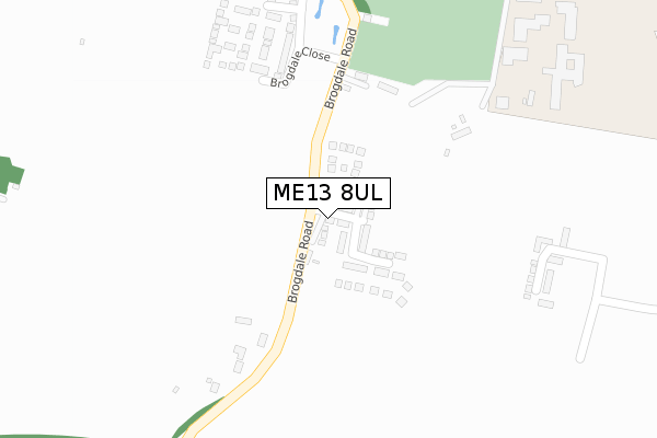
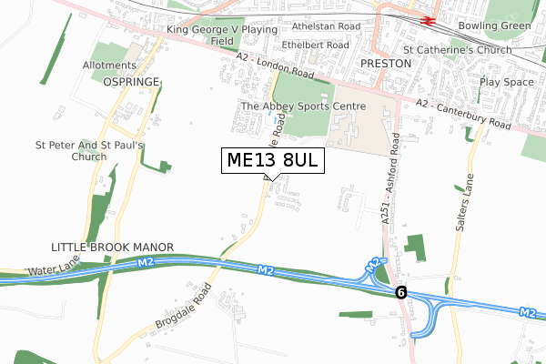
ME13 8UL is located in the Watling electoral ward, within the local authority district of Swale and the English Parliamentary constituency of Faversham and Mid Kent. The Sub Integrated Care Board (ICB) Location is NHS Kent and Medway ICB - 91Q and the police force is Kent. This postcode has been in use since August 2019.


GetTheData
Source: OS Open Zoomstack (Ordnance Survey)
Licence: Open Government Licence (requires attribution)
Attribution: Contains OS data © Crown copyright and database right 2024
Source: Open Postcode Geo
Licence: Open Government Licence (requires attribution)
Attribution: Contains OS data © Crown copyright and database right 2024; Contains Royal Mail data © Royal Mail copyright and database right 2024; Source: Office for National Statistics licensed under the Open Government Licence v.3.0
| Easting | 600877 |
| Northing | 160183 |
| Latitude | 51.305311 |
| Longitude | 0.880514 |
GetTheData
Source: Open Postcode Geo
Licence: Open Government Licence
| Country | England |
| Postcode District | ME13 |
| ➜ ME13 open data dashboard ➜ See where ME13 is on a map ➜ Where is Faversham? | |
GetTheData
Source: Land Registry Price Paid Data
Licence: Open Government Licence
| Ward | Watling |
| Constituency | Faversham And Mid Kent |
GetTheData
Source: ONS Postcode Database
Licence: Open Government Licence
2, FALSTAFF LANE, FAVERSHAM, ME13 8UL 2022 27 OCT £459,995 |
3, FALSTAFF LANE, FAVERSHAM, ME13 8UL 2022 27 OCT £609,995 |
2022 28 JUL £505,000 |
5, FALSTAFF LANE, FAVERSHAM, ME13 8UL 2021 23 SEP £437,500 |
4, FALSTAFF LANE, FAVERSHAM, ME13 8UL 2021 20 SEP £549,995 |
2019 26 SEP £394,746 |
GetTheData
Source: HM Land Registry Price Paid Data
Licence: Contains HM Land Registry data © Crown copyright and database right 2024. This data is licensed under the Open Government Licence v3.0.
| June 2022 | Burglary | On or near Sports/Recreation Area | 365m |
| June 2022 | Violence and sexual offences | On or near Sports/Recreation Area | 365m |
| May 2022 | Anti-social behaviour | On or near Sports/Recreation Area | 365m |
| ➜ Get more crime data in our Crime section | |||
GetTheData
Source: data.police.uk
Licence: Open Government Licence
| Abbey School (Abbey School Grounds) | Faversham | 432m |
| Brogdale Road (London Road) | Faversham | 506m |
| Brogdale Road (London Road) | Faversham | 527m |
| Canute Road | Faversham | 596m |
| The Mall | Faversham | 663m |
| Faversham Station | 1km |
| Selling Station | 5.2km |
GetTheData
Source: NaPTAN
Licence: Open Government Licence
| Percentage of properties with Next Generation Access | 100.0% |
| Percentage of properties with Superfast Broadband | 100.0% |
| Percentage of properties with Ultrafast Broadband | 100.0% |
| Percentage of properties with Full Fibre Broadband | 100.0% |
Superfast Broadband is between 30Mbps and 300Mbps
Ultrafast Broadband is > 300Mbps
| Percentage of properties unable to receive 2Mbps | 0.0% |
| Percentage of properties unable to receive 5Mbps | 0.0% |
| Percentage of properties unable to receive 10Mbps | 0.0% |
| Percentage of properties unable to receive 30Mbps | 0.0% |
GetTheData
Source: Ofcom
Licence: Ofcom Terms of Use (requires attribution)
GetTheData
Source: ONS Postcode Database
Licence: Open Government Licence


➜ Get more ratings from the Food Standards Agency
GetTheData
Source: Food Standards Agency
Licence: FSA terms & conditions
| Last Collection | |||
|---|---|---|---|
| Location | Mon-Fri | Sat | Distance |
| Brogdale Road | 16:30 | 10:30 | 544m |
| Upper St Annes Road | 17:30 | 12:00 | 635m |
| The Mall | 17:30 | 12:00 | 702m |
GetTheData
Source: Dracos
Licence: Creative Commons Attribution-ShareAlike
| Facility | Distance |
|---|---|
| The Abbey School London Road, Faversham Grass Pitches, Health and Fitness Gym, Sports Hall, Artificial Grass Pitch | 418m |
| King Georges Playing Field (Faversham) The Mount, London Road, Faversham Grass Pitches, Artificial Grass Pitch | 722m |
| Faversham Town Football Club Salters Lane, Faversham Grass Pitches | 1km |
GetTheData
Source: Active Places
Licence: Open Government Licence
| School | Phase of Education | Distance |
|---|---|---|
| Ethelbert Road Primary School Ethelbert Road, Faversham, ME13 8SQ | Primary | 633m |
| Ospringe Church of England Primary School Water Lane, Ospringe, Faversham, ME13 8TX | Primary | 835m |
| Bysing Wood Primary School Lower Road, Faversham, ME13 7NU | Primary | 1.6km |
GetTheData
Source: Edubase
Licence: Open Government Licence
The below table lists the International Territorial Level (ITL) codes (formerly Nomenclature of Territorial Units for Statistics (NUTS) codes) and Local Administrative Units (LAU) codes for ME13 8UL:
| ITL 1 Code | Name |
|---|---|
| TLJ | South East (England) |
| ITL 2 Code | Name |
| TLJ4 | Kent |
| ITL 3 Code | Name |
| TLJ43 | Kent Thames Gateway |
| LAU 1 Code | Name |
| E07000113 | Swale |
GetTheData
Source: ONS Postcode Directory
Licence: Open Government Licence
The below table lists the Census Output Area (OA), Lower Layer Super Output Area (LSOA), and Middle Layer Super Output Area (MSOA) for ME13 8UL:
| Code | Name | |
|---|---|---|
| OA | E00124983 | |
| LSOA | E01024626 | Swale 014E |
| MSOA | E02005128 | Swale 014 |
GetTheData
Source: ONS Postcode Directory
Licence: Open Government Licence
| ME13 8YA | Brogdale Road | 213m |
| ME13 8ST | Brogdale Road | 222m |
| ME13 8SU | Brogdale Road | 405m |
| ME13 8SX | Brogdale Road | 410m |
| ME13 0AF | Brogdale Place | 437m |
| ME13 8TB | Ospringe Place | 528m |
| ME13 8SL | London Road | 545m |
| ME13 8SN | London Road | 552m |
| ME13 8XN | Ashford Road | 577m |
| ME13 8TA | London Road | 586m |
GetTheData
Source: Open Postcode Geo; Land Registry Price Paid Data
Licence: Open Government Licence