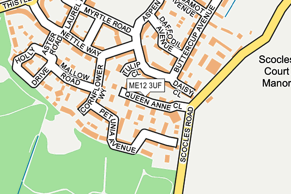
ME12 3UF is located in the Sheppey Central electoral ward, within the local authority district of Swale and the English Parliamentary constituency of Sittingbourne and Sheppey. The Sub Integrated Care Board (ICB) Location is NHS Kent and Medway ICB - 91Q and the police force is Kent. This postcode has been in use since March 2017.


GetTheData
Source: OS OpenMap – Local (Ordnance Survey)
Source: OS VectorMap District (Ordnance Survey)
Licence: Open Government Licence (requires attribution)
| Easting | 594822 |
| Northing | 171831 |
| Latitude | 51.412024 |
| Longitude | 0.800133 |
GetTheData
Source: Open Postcode Geo
Licence: Open Government Licence
| Country | England |
| Postcode District | ME12 |
| ➜ ME12 open data dashboard ➜ See where ME12 is on a map ➜ Where is Minster? | |
GetTheData
Source: Land Registry Price Paid Data
Licence: Open Government Licence
| Ward | Sheppey Central |
| Constituency | Sittingbourne And Sheppey |
GetTheData
Source: ONS Postcode Database
Licence: Open Government Licence
| September 2023 | Anti-social behaviour | On or near Sorrel Close | 468m |
| September 2023 | Violence and sexual offences | On or near Sorrel Close | 468m |
| August 2023 | Anti-social behaviour | On or near Sorrel Close | 468m |
| ➜ Get more crime data in our Crime section | |||
GetTheData
Source: data.police.uk
Licence: Open Government Licence
| Scocles Road (Forty Acres Hill) | Minster | 226m |
| Scocles Road (Forty Acres Hill) | Minster | 240m |
| Nettle Way (Thistle Hill Way) | Thistle Hill | 296m |
| Nettle Way (Thistle Hill Way) | Thistle Hill | 311m |
| Mistletoe Drive (Thistle Hill Way) | Thistle Hill | 357m |
| Queenborough Station | 3.5km |
| Sheerness-on-Sea Station | 4.3km |
| Swale Station | 4.5km |
GetTheData
Source: NaPTAN
Licence: Open Government Licence
➜ Broadband speed and availability dashboard for ME12 3UF
| Percentage of properties with Next Generation Access | 100.0% |
| Percentage of properties with Superfast Broadband | 66.7% |
| Percentage of properties with Ultrafast Broadband | 0.0% |
| Percentage of properties with Full Fibre Broadband | 0.0% |
Superfast Broadband is between 30Mbps and 300Mbps
Ultrafast Broadband is > 300Mbps
| Median download speed | 18.4Mbps |
| Average download speed | 18.9Mbps |
| Maximum download speed | 33.85Mbps |
| Median upload speed | 3.3Mbps |
| Average upload speed | 3.6Mbps |
| Maximum upload speed | 7.64Mbps |
| Percentage of properties unable to receive 2Mbps | 0.0% |
| Percentage of properties unable to receive 5Mbps | 0.0% |
| Percentage of properties unable to receive 10Mbps | 0.0% |
| Percentage of properties unable to receive 30Mbps | 33.3% |
➜ Broadband speed and availability dashboard for ME12 3UF
GetTheData
Source: Ofcom
Licence: Ofcom Terms of Use (requires attribution)
GetTheData
Source: ONS Postcode Database
Licence: Open Government Licence


➜ Get more ratings from the Food Standards Agency
GetTheData
Source: Food Standards Agency
Licence: FSA terms & conditions
| Last Collection | |||
|---|---|---|---|
| Location | Mon-Fri | Sat | Distance |
| Brambledown | 16:15 | 11:15 | 473m |
| East Minster Post Office | 16:30 | 11:30 | 878m |
| Sheerness East | 17:15 | 09:45 | 996m |
GetTheData
Source: Dracos
Licence: Creative Commons Attribution-ShareAlike
| Facility | Distance |
|---|---|
| Thistle Hill Playing Field Thistle Hill Way, Thistle Hill Way, Minster-on-sea Grass Pitches | 246m |
| Sheppey Rugby Club Lower Road, Minster On Sea, Sheerness Grass Pitches | 718m |
| Oasis Academy Isle Of Sheppey (East Site) Minster Road, Minster On Sea, Sheerness Artificial Grass Pitch, Sports Hall, Studio, Grass Pitches, Outdoor Tennis Courts | 1.3km |
GetTheData
Source: Active Places
Licence: Open Government Licence
| School | Phase of Education | Distance |
|---|---|---|
| Thistle Hill Academy Aspen Drive, Minster-on-Sea, Sheerness, ME12 3UD | Primary | 314m |
| Minster in Sheppey Primary School Brecon Chase, Minster, Sheerness, ME12 2HX | Primary | 1.3km |
| The Elmley Dray School 18-20 Marina Drive, Minster-on-Sea, Sheerness, ME12 2DP | Not applicable | 1.4km |
GetTheData
Source: Edubase
Licence: Open Government Licence
The below table lists the International Territorial Level (ITL) codes (formerly Nomenclature of Territorial Units for Statistics (NUTS) codes) and Local Administrative Units (LAU) codes for ME12 3UF:
| ITL 1 Code | Name |
|---|---|
| TLJ | South East (England) |
| ITL 2 Code | Name |
| TLJ4 | Kent |
| ITL 3 Code | Name |
| TLJ43 | Kent Thames Gateway |
| LAU 1 Code | Name |
| E07000113 | Swale |
GetTheData
Source: ONS Postcode Directory
Licence: Open Government Licence
The below table lists the Census Output Area (OA), Lower Layer Super Output Area (LSOA), and Middle Layer Super Output Area (MSOA) for ME12 3UF:
| Code | Name | |
|---|---|---|
| OA | E00166813 | |
| LSOA | E01032654 | Swale 004G |
| MSOA | E02005118 | Swale 004 |
GetTheData
Source: ONS Postcode Directory
Licence: Open Government Licence
| ME12 3TS | Petunia Avenue | 70m |
| ME12 3FA | Tulip Close | 85m |
| ME12 3TU | Petunia Avenue | 86m |
| ME12 3GZ | Daisy Close | 87m |
| ME12 3GY | Cornflower Way | 126m |
| ME12 3FE | Dahlia Walk | 138m |
| ME12 3FX | Buttercup Avenue | 143m |
| ME12 3GT | Mallow Road | 155m |
| ME12 3GU | Mallow Road | 165m |
| ME12 3FD | Camellia Road | 173m |
GetTheData
Source: Open Postcode Geo; Land Registry Price Paid Data
Licence: Open Government Licence