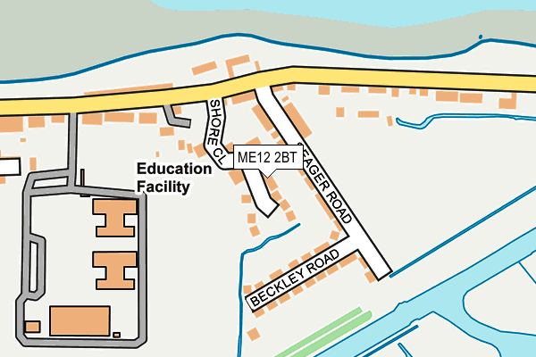
ME12 2BT is located in the Sheerness electoral ward, within the local authority district of Swale and the English Parliamentary constituency of Sittingbourne and Sheppey. The Sub Integrated Care Board (ICB) Location is NHS Kent and Medway ICB - 91Q and the police force is Kent. This postcode has been in use since April 2017.


GetTheData
Source: OS OpenMap – Local (Ordnance Survey)
Source: OS VectorMap District (Ordnance Survey)
Licence: Open Government Licence (requires attribution)
| Easting | 593272 |
| Northing | 174800 |
| Latitude | 51.439219 |
| Longitude | 0.779491 |
GetTheData
Source: Open Postcode Geo
Licence: Open Government Licence
| Country | England |
| Postcode District | ME12 |
➜ See where ME12 is on a map ➜ Where is Sheerness? | |
GetTheData
Source: Land Registry Price Paid Data
Licence: Open Government Licence
| Ward | Sheerness |
| Constituency | Sittingbourne And Sheppey |
GetTheData
Source: ONS Postcode Database
Licence: Open Government Licence
| Yacht Club (Marine Parade) | Marine Town | 114m |
| Yacht Club (Marine Parade) | Marine Town | 135m |
| Ship-on-shore (Marine Parade) | Marine Town | 286m |
| Ship-on-shore (Marine Parade) | Marine Town | 302m |
| Richmond Street (Marine Parade) | Marine Town | 348m |
| Sheerness-on-Sea Station | 1.5km |
| Queenborough Station | 3.3km |
GetTheData
Source: NaPTAN
Licence: Open Government Licence
| Percentage of properties with Next Generation Access | 100.0% |
| Percentage of properties with Superfast Broadband | 100.0% |
| Percentage of properties with Ultrafast Broadband | 0.0% |
| Percentage of properties with Full Fibre Broadband | 0.0% |
Superfast Broadband is between 30Mbps and 300Mbps
Ultrafast Broadband is > 300Mbps
| Median download speed | 17.5Mbps |
| Average download speed | 19.0Mbps |
| Maximum download speed | 38.44Mbps |
| Median upload speed | 6.0Mbps |
| Average upload speed | 4.7Mbps |
| Maximum upload speed | 8.14Mbps |
| Percentage of properties unable to receive 2Mbps | 0.0% |
| Percentage of properties unable to receive 5Mbps | 0.0% |
| Percentage of properties unable to receive 10Mbps | 0.0% |
| Percentage of properties unable to receive 30Mbps | 0.0% |
GetTheData
Source: Ofcom
Licence: Ofcom Terms of Use (requires attribution)
GetTheData
Source: ONS Postcode Database
Licence: Open Government Licence


➜ Get more ratings from the Food Standards Agency
GetTheData
Source: Food Standards Agency
Licence: FSA terms & conditions
| Last Collection | |||
|---|---|---|---|
| Location | Mon-Fri | Sat | Distance |
| Marine Parade | 17:00 | 11:30 | 170m |
| Richmond Street | 17:00 | 11:30 | 430m |
| High Street East (Ex P O) | 18:30 | 11:30 | 1,018m |
GetTheData
Source: Dracos
Licence: Creative Commons Attribution-ShareAlike
| Risk of ME12 2BT flooding from rivers and sea | Low |
| ➜ ME12 2BT flood map | |
GetTheData
Source: Open Flood Risk by Postcode
Licence: Open Government Licence
The below table lists the International Territorial Level (ITL) codes (formerly Nomenclature of Territorial Units for Statistics (NUTS) codes) and Local Administrative Units (LAU) codes for ME12 2BT:
| ITL 1 Code | Name |
|---|---|
| TLJ | South East (England) |
| ITL 2 Code | Name |
| TLJ4 | Kent |
| ITL 3 Code | Name |
| TLJ43 | Kent Thames Gateway |
| LAU 1 Code | Name |
| E07000113 | Swale |
GetTheData
Source: ONS Postcode Directory
Licence: Open Government Licence
The below table lists the Census Output Area (OA), Lower Layer Super Output Area (LSOA), and Middle Layer Super Output Area (MSOA) for ME12 2BT:
| Code | Name | |
|---|---|---|
| OA | E00124897 | |
| LSOA | E01024610 | Swale 001B |
| MSOA | E02005115 | Swale 001 |
GetTheData
Source: ONS Postcode Directory
Licence: Open Government Licence
| ME12 2BG | Seager Road | 36m |
| ME12 2BQ | Beckley Road | 128m |
| ME12 2BE | Marine Parade | 159m |
| ME12 2BX | Marine Parade | 199m |
| ME12 2BD | Marine Parade | 353m |
| ME12 2AZ | Alma Street | 359m |
| ME12 2AY | Alma Street | 366m |
| ME12 2PY | James Street | 377m |
| ME12 2PU | Jefferson Road | 391m |
| ME12 2PN | Unity Court | 419m |
GetTheData
Source: Open Postcode Geo; Land Registry Price Paid Data
Licence: Open Government Licence