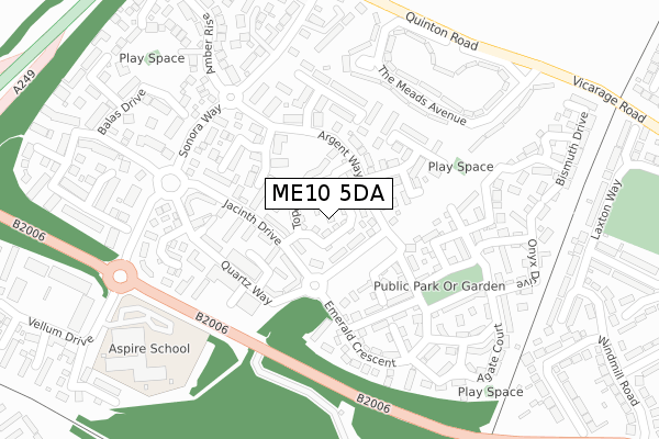
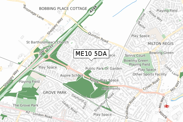
ME10 5DA is located in the The Meads electoral ward, within the local authority district of Swale and the English Parliamentary constituency of Sittingbourne and Sheppey. The Sub Integrated Care Board (ICB) Location is NHS Kent and Medway ICB - 91Q and the police force is Kent. This postcode has been in use since August 2019.


GetTheData
Source: OS Open Zoomstack (Ordnance Survey)
Licence: Open Government Licence (requires attribution)
Attribution: Contains OS data © Crown copyright and database right 2024
Source: Open Postcode Geo
Licence: Open Government Licence (requires attribution)
Attribution: Contains OS data © Crown copyright and database right 2024; Contains Royal Mail data © Royal Mail copyright and database right 2024; Source: Office for National Statistics licensed under the Open Government Licence v.3.0
| Easting | 589168 |
| Northing | 164638 |
| Latitude | 51.349331 |
| Longitude | 0.715102 |
GetTheData
Source: Open Postcode Geo
Licence: Open Government Licence
| Country | England |
| Postcode District | ME10 |
| ➜ ME10 open data dashboard ➜ See where ME10 is on a map ➜ Where is Sittingbourne? | |
GetTheData
Source: Land Registry Price Paid Data
Licence: Open Government Licence
| Ward | The Meads |
| Constituency | Sittingbourne And Sheppey |
GetTheData
Source: ONS Postcode Database
Licence: Open Government Licence
| January 2024 | Anti-social behaviour | On or near Agate Court | 476m |
| December 2023 | Violence and sexual offences | On or near Agate Court | 476m |
| December 2023 | Violence and sexual offences | On or near Agate Court | 476m |
| ➜ Get more crime data in our Crime section | |||
GetTheData
Source: data.police.uk
Licence: Open Government Licence
| The Meads (Sonora Way) | Sonora Fields | 188m |
| The Meads (Sonora Way) | Sonora Fields | 197m |
| Topaz Drive (Jacinth Drive) | Sonora Fields | 247m |
| Jacinth Drive (Sonora Way) | Sonora Fields | 322m |
| Emerald Crescent (Jacinth Drive) | Sonora Fields | 326m |
| Sittingbourne Station | 1.6km |
| Kemsley Station | 2km |
| Newington Station | 3.3km |
GetTheData
Source: NaPTAN
Licence: Open Government Licence
GetTheData
Source: ONS Postcode Database
Licence: Open Government Licence


➜ Get more ratings from the Food Standards Agency
GetTheData
Source: Food Standards Agency
Licence: FSA terms & conditions
| Last Collection | |||
|---|---|---|---|
| Location | Mon-Fri | Sat | Distance |
| Gadby Road (Ex P O) | 17:30 | 11:30 | 308m |
| Sonora Way | 17:15 | 09:00 | 330m |
| Bobbing Church | 16:30 | 09:00 | 624m |
GetTheData
Source: Dracos
Licence: Creative Commons Attribution-ShareAlike
| Facility | Distance |
|---|---|
| Grove Park Primary School Hilton Drive, Sittingbourne Grass Pitches | 432m |
| Gore Court Cricket Club (Top Ground) Key Street, Sittingbourne Grass Pitches | 649m |
| Reynolds Fitness Spa Sittingbourne London Road, Sittingbourne Health and Fitness Gym, Swimming Pool, Studio | 681m |
GetTheData
Source: Active Places
Licence: Open Government Licence
| School | Phase of Education | Distance |
|---|---|---|
| Aspire School Vellum Drive, Sittingbourne, ME10 5DA | Not applicable | 0m |
| Grove Park Primary School Hilton Drive, Sittingbourne, ME10 1PT | Primary | 343m |
| Bobbing Village School Sheppey Way, Bobbing, Sittingbourne, ME9 8PL | Primary | 585m |
GetTheData
Source: Edubase
Licence: Open Government Licence
The below table lists the International Territorial Level (ITL) codes (formerly Nomenclature of Territorial Units for Statistics (NUTS) codes) and Local Administrative Units (LAU) codes for ME10 5DA:
| ITL 1 Code | Name |
|---|---|
| TLJ | South East (England) |
| ITL 2 Code | Name |
| TLJ4 | Kent |
| ITL 3 Code | Name |
| TLJ43 | Kent Thames Gateway |
| LAU 1 Code | Name |
| E07000113 | Swale |
GetTheData
Source: ONS Postcode Directory
Licence: Open Government Licence
The below table lists the Census Output Area (OA), Lower Layer Super Output Area (LSOA), and Middle Layer Super Output Area (MSOA) for ME10 5DA:
| Code | Name | |
|---|---|---|
| OA | E00124710 | |
| LSOA | E01024567 | Swale 009C |
| MSOA | E02005123 | Swale 009 |
GetTheData
Source: ONS Postcode Directory
Licence: Open Government Licence
| ME10 5BE | Bristol Close | 91m |
| ME10 5AW | Vellum Drive | 135m |
| ME10 5AD | Helidor Walk | 138m |
| ME10 5BG | Bristol Close | 148m |
| ME10 5AH | Spinel Close | 149m |
| ME10 5AL | Spinel Close | 151m |
| ME10 5AG | Pearl Walk | 158m |
| ME10 5AB | Quartz Way | 160m |
| ME10 5BJ | Papyrus Drive | 161m |
| ME10 5AA | Quartz Way | 187m |
GetTheData
Source: Open Postcode Geo; Land Registry Price Paid Data
Licence: Open Government Licence