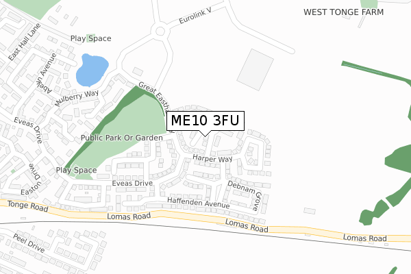
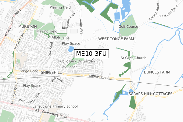
ME10 3FU is located in the Teynham and Lynsted electoral ward, within the local authority district of Swale and the English Parliamentary constituency of Sittingbourne and Sheppey. The Sub Integrated Care Board (ICB) Location is NHS Kent and Medway ICB - 91Q and the police force is Kent. This postcode has been in use since April 2018.


GetTheData
Source: OS Open Zoomstack (Ordnance Survey)
Licence: Open Government Licence (requires attribution)
Attribution: Contains OS data © Crown copyright and database right 2024
Source: Open Postcode Geo
Licence: Open Government Licence (requires attribution)
Attribution: Contains OS data © Crown copyright and database right 2024; Contains Royal Mail data © Royal Mail copyright and database right 2024; Source: Office for National Statistics licensed under the Open Government Licence v.3.0
| Easting | 592862 |
| Northing | 163985 |
| Latitude | 51.342227 |
| Longitude | 0.767730 |
GetTheData
Source: Open Postcode Geo
Licence: Open Government Licence
| Country | England |
| Postcode District | ME10 |
| ➜ ME10 open data dashboard ➜ See where ME10 is on a map ➜ Where is Sittingbourne? | |
GetTheData
Source: Land Registry Price Paid Data
Licence: Open Government Licence
| Ward | Teynham And Lynsted |
| Constituency | Sittingbourne And Sheppey |
GetTheData
Source: ONS Postcode Database
Licence: Open Government Licence
2023 31 AUG £490,000 |
4, SHORT RISE, SITTINGBOURNE, ME10 3FU 2018 30 APR £382,000 |
2018 20 APR £410,000 |
GetTheData
Source: HM Land Registry Price Paid Data
Licence: Contains HM Land Registry data © Crown copyright and database right 2024. This data is licensed under the Open Government Licence v3.0.
| January 2024 | Other theft | On or near Easton Drive | 434m |
| December 2023 | Violence and sexual offences | On or near Easton Drive | 434m |
| December 2023 | Anti-social behaviour | On or near Easton Drive | 434m |
| ➜ Get more crime data in our Crime section | |||
GetTheData
Source: data.police.uk
Licence: Open Government Licence
| Mulberry Way | Great Easthall | 294m |
| Great Easthall Way | Great Easthall | 423m |
| Great Easthall Way | Great Easthall | 426m |
| Broom Road (Oak Road) | Murston | 607m |
| Broom Road (Oak Road) | Murston | 618m |
| Sittingbourne Station | 2.3km |
| Teynham Station | 2.9km |
| Kemsley Station | 3.2km |
GetTheData
Source: NaPTAN
Licence: Open Government Licence
| Percentage of properties with Next Generation Access | 100.0% |
| Percentage of properties with Superfast Broadband | 100.0% |
| Percentage of properties with Ultrafast Broadband | 100.0% |
| Percentage of properties with Full Fibre Broadband | 100.0% |
Superfast Broadband is between 30Mbps and 300Mbps
Ultrafast Broadband is > 300Mbps
| Percentage of properties unable to receive 2Mbps | 0.0% |
| Percentage of properties unable to receive 5Mbps | 0.0% |
| Percentage of properties unable to receive 10Mbps | 0.0% |
| Percentage of properties unable to receive 30Mbps | 0.0% |
GetTheData
Source: Ofcom
Licence: Ofcom Terms of Use (requires attribution)
GetTheData
Source: ONS Postcode Database
Licence: Open Government Licence


➜ Get more ratings from the Food Standards Agency
GetTheData
Source: Food Standards Agency
Licence: FSA terms & conditions
| Last Collection | |||
|---|---|---|---|
| Location | Mon-Fri | Sat | Distance |
| Lansdown Road | 17:15 | 12:00 | 688m |
| Murston Road Post Office | 18:15 | 11:45 | 1,061m |
| Eurolink Estate | 18:30 | 1,241m | |
GetTheData
Source: Dracos
Licence: Creative Commons Attribution-ShareAlike
| Facility | Distance |
|---|---|
| Sittingbourne Golf Centre Church Road, Tonge, Sittingbourne Golf, Artificial Grass Pitch | 519m |
| Murston Junior School (Closed) Sunnybank, Murston, Sittingbourne Grass Pitches | 937m |
| Bapchild And Tonge Village Hall School Lane, Bapchild, Sittingbourne Sports Hall | 944m |
GetTheData
Source: Active Places
Licence: Open Government Licence
| School | Phase of Education | Distance |
|---|---|---|
| Lansdowne Primary School Gladstone Drive, Sittingbourne, ME10 3BH | Primary | 765m |
| Sunny Bank Primary School Sunny Bank, Murston, Sittingbourne, ME10 3QN | Primary | 934m |
| Bapchild and Tonge Church of England Primary School and Nursery School Lane, Bapchild, Sittingbourne, ME9 9NL | Primary | 983m |
GetTheData
Source: Edubase
Licence: Open Government Licence
The below table lists the International Territorial Level (ITL) codes (formerly Nomenclature of Territorial Units for Statistics (NUTS) codes) and Local Administrative Units (LAU) codes for ME10 3FU:
| ITL 1 Code | Name |
|---|---|
| TLJ | South East (England) |
| ITL 2 Code | Name |
| TLJ4 | Kent |
| ITL 3 Code | Name |
| TLJ43 | Kent Thames Gateway |
| LAU 1 Code | Name |
| E07000113 | Swale |
GetTheData
Source: ONS Postcode Directory
Licence: Open Government Licence
The below table lists the Census Output Area (OA), Lower Layer Super Output Area (LSOA), and Middle Layer Super Output Area (MSOA) for ME10 3FU:
| Code | Name | |
|---|---|---|
| OA | E00124974 | |
| LSOA | E01024624 | Swale 016E |
| MSOA | E02005130 | Swale 016 |
GetTheData
Source: ONS Postcode Directory
Licence: Open Government Licence
| ME10 3TE | Great Easthall Way | 80m |
| ME10 3TF | Great Easthall Way | 257m |
| ME10 3FD | Eveas Drive | 276m |
| ME10 3TP | Barnfields Court | 284m |
| ME10 3TQ | Limehouse Court | 333m |
| ME10 3FL | Clifford Crescent | 343m |
| ME10 3TG | Mulberry Way | 356m |
| ME9 9BD | Lomas Road | 363m |
| ME10 3GF | Hargraves Road | 377m |
| ME10 3DB | Rosebery Close | 395m |
GetTheData
Source: Open Postcode Geo; Land Registry Price Paid Data
Licence: Open Government Licence