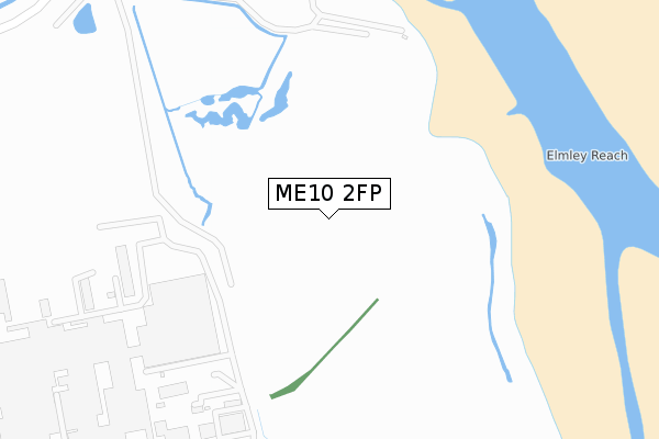
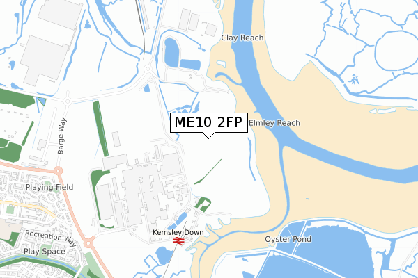
ME10 2FP is located in the Kemsley electoral ward, within the local authority district of Swale and the English Parliamentary constituency of Sittingbourne and Sheppey. The Sub Integrated Care Board (ICB) Location is NHS Kent and Medway ICB - 91Q and the police force is Kent. This postcode has been in use since October 2017.


GetTheData
Source: OS Open Zoomstack (Ordnance Survey)
Licence: Open Government Licence (requires attribution)
Attribution: Contains OS data © Crown copyright and database right 2025
Source: Open Postcode Geo
Licence: Open Government Licence (requires attribution)
Attribution: Contains OS data © Crown copyright and database right 2025; Contains Royal Mail data © Royal Mail copyright and database right 2025; Source: Office for National Statistics licensed under the Open Government Licence v.3.0
| Easting | 592193 |
| Northing | 166628 |
| Latitude | 51.366190 |
| Longitude | 0.759563 |
GetTheData
Source: Open Postcode Geo
Licence: Open Government Licence
| Country | England |
| Postcode District | ME10 |
➜ See where ME10 is on a map ➜ Where is Sittingbourne? | |
GetTheData
Source: Land Registry Price Paid Data
Licence: Open Government Licence
| Ward | Kemsley |
| Constituency | Sittingbourne And Sheppey |
GetTheData
Source: ONS Postcode Database
Licence: Open Government Licence
| Coldharbour Lane East (Ridham Avenue) | Kemsley | 1,013m |
| Coldharbour Lane East (Ridham Avenue) | Kemsley | 1,028m |
| Lloyd Drive (Swale Way) | Kemsley | 1,110m |
| Lloyd Drive (Swale Way) | Kemsley | 1,114m |
| The Crescent (Ridham Avenue) | Kemsley | 1,177m |
| Kemsley Station | 1.7km |
| Swale Station | 2.7km |
| Sittingbourne Station | 3.2km |
GetTheData
Source: NaPTAN
Licence: Open Government Licence
GetTheData
Source: ONS Postcode Database
Licence: Open Government Licence


➜ Get more ratings from the Food Standards Agency
GetTheData
Source: Food Standards Agency
Licence: FSA terms & conditions
| Last Collection | |||
|---|---|---|---|
| Location | Mon-Fri | Sat | Distance |
| Todd Crescent | 17:30 | 09:00 | 1,332m |
| Tunstall | 16:00 | 09:00 | 1,427m |
| Newman Drive | 17:30 | 11:45 | 1,453m |
GetTheData
Source: Dracos
Licence: Creative Commons Attribution-ShareAlike
| Risk of ME10 2FP flooding from rivers and sea | Low |
| ➜ ME10 2FP flood map | |
GetTheData
Source: Open Flood Risk by Postcode
Licence: Open Government Licence
The below table lists the International Territorial Level (ITL) codes (formerly Nomenclature of Territorial Units for Statistics (NUTS) codes) and Local Administrative Units (LAU) codes for ME10 2FP:
| ITL 1 Code | Name |
|---|---|
| TLJ | South East (England) |
| ITL 2 Code | Name |
| TLJ4 | Kent |
| ITL 3 Code | Name |
| TLJ43 | Kent Thames Gateway |
| LAU 1 Code | Name |
| E07000113 | Swale |
GetTheData
Source: ONS Postcode Directory
Licence: Open Government Licence
The below table lists the Census Output Area (OA), Lower Layer Super Output Area (LSOA), and Middle Layer Super Output Area (MSOA) for ME10 2FP:
| Code | Name | |
|---|---|---|
| OA | E00124744 | |
| LSOA | E01024578 | Swale 007D |
| MSOA | E02005121 | Swale 007 |
GetTheData
Source: ONS Postcode Directory
Licence: Open Government Licence
| ME10 2UJ | Recreation Way | 981m |
| ME10 2UN | Marsh Rise | 982m |
| ME10 2GD | Reams Way | 983m |
| ME10 2GB | Samuel Drive | 1019m |
| ME10 2GQ | Manisty Court | 1027m |
| ME10 2GW | George Walk | 1042m |
| ME10 2FB | Barge Way | 1059m |
| ME10 2UP | Saxon Shore | 1085m |
| ME10 2TG | Recreation Way | 1096m |
| ME10 2SF | Ridham Avenue | 1102m |
GetTheData
Source: Open Postcode Geo; Land Registry Price Paid Data
Licence: Open Government Licence