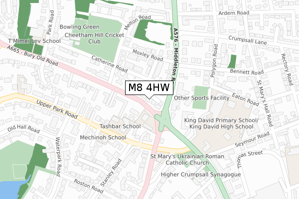
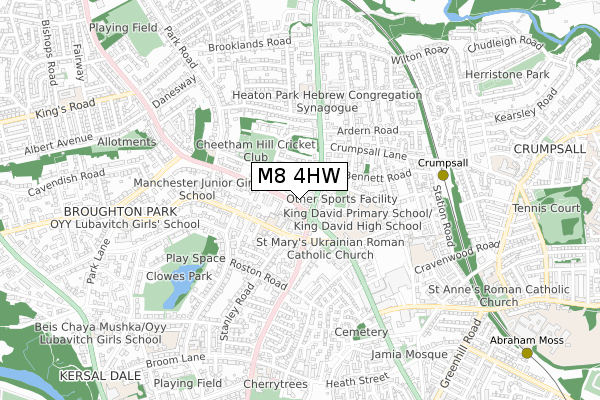
M8 4HW is located in the Crumpsall electoral ward, within the metropolitan district of Manchester and the English Parliamentary constituency of Blackley and Broughton. The Sub Integrated Care Board (ICB) Location is NHS Greater Manchester ICB - 14L and the police force is Greater Manchester. This postcode has been in use since January 2018.


GetTheData
Source: OS Open Zoomstack (Ordnance Survey)
Licence: Open Government Licence (requires attribution)
Attribution: Contains OS data © Crown copyright and database right 2024
Source: Open Postcode Geo
Licence: Open Government Licence (requires attribution)
Attribution: Contains OS data © Crown copyright and database right 2024; Contains Royal Mail data © Royal Mail copyright and database right 2024; Source: Office for National Statistics licensed under the Open Government Licence v.3.0
| Easting | 383517 |
| Northing | 402215 |
| Latitude | 53.516365 |
| Longitude | -2.250046 |
GetTheData
Source: Open Postcode Geo
Licence: Open Government Licence
| Country | England |
| Postcode District | M8 |
| ➜ M8 open data dashboard ➜ See where M8 is on a map ➜ Where is Manchester? | |
GetTheData
Source: Land Registry Price Paid Data
Licence: Open Government Licence
| Ward | Crumpsall |
| Constituency | Blackley And Broughton |
GetTheData
Source: ONS Postcode Database
Licence: Open Government Licence
| February 2022 | Other crime | On or near Eskrigge Close | 362m |
| February 2021 | Violence and sexual offences | On or near Holland Road | 469m |
| ➜ Get more crime data in our Crime section | |||
GetTheData
Source: data.police.uk
Licence: Open Government Licence
| Bury Old Rd/Half Way House (Bury Old Rd) | Cheetham Hill | 22m |
| Bury Old Rd/Half Way House (Bury Old Rd) | Cheetham Hill | 42m |
| Middleton Rd/Half Way House (Middleton Rd) | Cheetham Hill | 51m |
| Middleton Rd/Half Way House (Middleton Rd) | Cheetham Hill | 99m |
| Leicester Rd/Bury Old Rd (Leicester Rd) | Cheetham Hill | 136m |
| Crumpsall (Manchester Metrolink) (Off Station Road) | Higher Crumpsall | 609m |
| Bowker Vale (Manchester Metrolink) (Middleton Road) | Bowker Vale | 914m |
| Abraham Moss (Manchester Metrolink) (Woodlands Road) | Cheetham Hill | 1,139m |
| Woodlands Road (Manchester Metrolink) (Off Woodlands Road) | Cheetham Hill | 1,408m |
| Manchester Victoria Station | 3.3km |
| Salford Central Station | 3.7km |
| Salford Crescent Station | 3.7km |
GetTheData
Source: NaPTAN
Licence: Open Government Licence
| Percentage of properties with Next Generation Access | 100.0% |
| Percentage of properties with Superfast Broadband | 100.0% |
| Percentage of properties with Ultrafast Broadband | 100.0% |
| Percentage of properties with Full Fibre Broadband | 0.0% |
Superfast Broadband is between 30Mbps and 300Mbps
Ultrafast Broadband is > 300Mbps
| Percentage of properties unable to receive 2Mbps | 0.0% |
| Percentage of properties unable to receive 5Mbps | 0.0% |
| Percentage of properties unable to receive 10Mbps | 0.0% |
| Percentage of properties unable to receive 30Mbps | 0.0% |
GetTheData
Source: Ofcom
Licence: Ofcom Terms of Use (requires attribution)
GetTheData
Source: ONS Postcode Database
Licence: Open Government Licence


➜ Get more ratings from the Food Standards Agency
GetTheData
Source: Food Standards Agency
Licence: FSA terms & conditions
| Last Collection | |||
|---|---|---|---|
| Location | Mon-Fri | Sat | Distance |
| Bury Old Road / Melton Road | 17:30 | 11:45 | 135m |
| Waterpark Road | 17:30 | 11:45 | 341m |
| Opp Crumpsall Station | 17:30 | 11:45 | 567m |
GetTheData
Source: Dracos
Licence: Creative Commons Attribution-ShareAlike
| Facility | Distance |
|---|---|
| Cheetham Hill Sports Club Catherine Road, Manchester Squash Courts, Grass Pitches | 306m |
| The King David High School Eaton Road, Manchester Health and Fitness Gym, Sports Hall, Grass Pitches, Swimming Pool | 316m |
| Park Swim School (Closed) Park Road, Manchester Swimming Pool | 379m |
GetTheData
Source: Active Places
Licence: Open Government Licence
| School | Phase of Education | Distance |
|---|---|---|
| Tashbar of Manchester 20 Upper Park Road, Salford, M7 4HL | Not applicable | 128m |
| OYY Lubavitch Boys School 4, Upper Park road, M7 4HL | Not applicable | 131m |
| Langdon College 9 Leicester Avenue, Salford, Langdon College, Manchester, M7 4HA | Not applicable | 192m |
GetTheData
Source: Edubase
Licence: Open Government Licence
The below table lists the International Territorial Level (ITL) codes (formerly Nomenclature of Territorial Units for Statistics (NUTS) codes) and Local Administrative Units (LAU) codes for M8 4HW:
| ITL 1 Code | Name |
|---|---|
| TLD | North West (England) |
| ITL 2 Code | Name |
| TLD3 | Greater Manchester |
| ITL 3 Code | Name |
| TLD33 | Manchester |
| LAU 1 Code | Name |
| E08000003 | Manchester |
GetTheData
Source: ONS Postcode Directory
Licence: Open Government Licence
The below table lists the Census Output Area (OA), Lower Layer Super Output Area (LSOA), and Middle Layer Super Output Area (MSOA) for M8 4HW:
| Code | Name | |
|---|---|---|
| OA | E00026151 | |
| LSOA | E01005162 | Manchester 004D |
| MSOA | E02001048 | Manchester 004 |
GetTheData
Source: ONS Postcode Directory
Licence: Open Government Licence
| M8 4HA | Catherine Road | 103m |
| M8 4HH | Fraser Road | 109m |
| M8 5DT | Middleton Road | 111m |
| M7 4QZ | Bury Old Road | 118m |
| M7 4HL | Upper Park Road | 131m |
| M8 4HJ | Moxley Road | 137m |
| M7 4QX | Bury Old Road | 144m |
| M8 5DS | Middleton Road | 179m |
| M7 4GZ | Upper Park Road | 189m |
| M7 4LQ | Cadogan Place | 199m |
GetTheData
Source: Open Postcode Geo; Land Registry Price Paid Data
Licence: Open Government Licence