M5 4YF maps, stats, and open data
- Home
- Postcode
- M
- M5
- M5 4
M5 4YF is located in the Quays electoral ward, within the metropolitan district of Salford and the English Parliamentary constituency of Salford and Eccles. The Sub Integrated Care Board (ICB) Location is NHS Greater Manchester ICB - 01G and the police force is Greater Manchester. This postcode has been in use since June 2019.
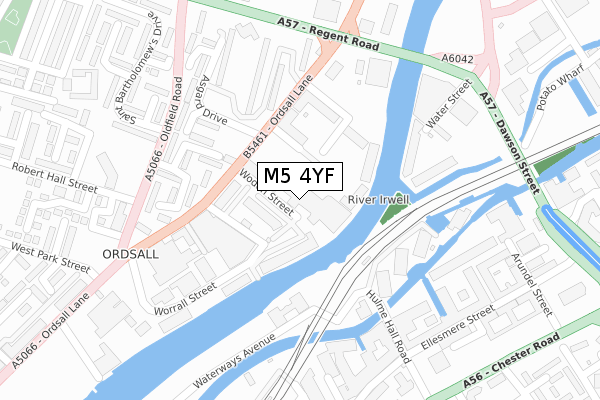
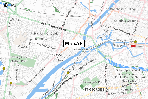
M5 4YF maps


Source: OS Open Zoomstack (Ordnance Survey)
Licence: Open Government Licence (requires attribution)
Attribution: Contains OS data © Crown copyright and database right 2025
Source: Open Postcode GeoLicence: Open Government Licence (requires attribution)
Attribution: Contains OS data © Crown copyright and database right 2025; Contains Royal Mail data © Royal Mail copyright and database right 2025; Source: Office for National Statistics licensed under the Open Government Licence v.3.0
M5 4YF geodata
| Easting | 382433 |
| Northing | 397452 |
| Latitude | 53.473519 |
| Longitude | -2.266127 |
Where is M5 4YF?
| Country | England |
| Postcode District | M5 |
Politics
| Ward | Quays |
|---|
| Constituency | Salford And Eccles |
|---|
Transport
Nearest bus stops to M5 4YF
| Ordsall Ln/Bricklayers Arms (Ordsall Ln) | Ordsall | 135m |
| Ordsall Ln/Regent Rd (Ordsall Ln) | Ordsall | 220m |
| Oldfield Rd/Robert Hall St (Oldfield Rd) | Ordsall | 244m |
| Oldfield Rd/Robert Hall St (Oldfield Rd) | Ordsall | 255m |
| Regent Rd/Ordsall Ln (Regent Rd) | Ordsall | 281m |
Nearest underground/metro/tram to M5 4YF
| Cornbrook (Manchester Metrolink) | Cornbrook | 408m |
| Deansgate-castlefield (Manchester Metrolink) (Whitworth Street West) | Manchester City Centre | 993m |
| Pomona (Manchester Metrolink) (Pomona Strand) | Salford Quays | 1,234m |
| Salford Quays (Manchester Metrolink) (St Peters Quay) | Salford Quays | 1,240m |
| Exchange Quay (Manchester Metrolink) (Exchange Quay) | Salford Quays | 1,294m |
Nearest railway stations to M5 4YF
| Deansgate Station | 1km |
| Salford Central Station | 1.3km |
| Salford Crescent Station | 1.6km |
Broadband
Broadband access in M5 4YF (2020 data)
| Percentage of properties with Next Generation Access | 100.0% |
| Percentage of properties with Superfast Broadband | 100.0% |
| Percentage of properties with Ultrafast Broadband | 100.0% |
| Percentage of properties with Full Fibre Broadband | 100.0% |
Superfast Broadband is between 30Mbps and 300Mbps
Ultrafast Broadband is > 300Mbps
Broadband limitations in M5 4YF (2020 data)
| Percentage of properties unable to receive 2Mbps | 0.0% |
| Percentage of properties unable to receive 5Mbps | 0.0% |
| Percentage of properties unable to receive 10Mbps | 0.0% |
| Percentage of properties unable to receive 30Mbps | 0.0% |
Deprivation
67.7% of English postcodes are less deprived than
M5 4YF:
Food Standards Agency
Three nearest food hygiene ratings to M5 4YF (metres)
Co-operative
Unit 1 Bridgewater Point
163m
The Plantisserie UK
within Makers Quarter
178m
Bricklayers Arms
➜ Get more ratings from the Food Standards Agency
Nearest post box to M5 4YF
| | Last Collection | |
|---|
| Location | Mon-Fri | Sat | Distance |
|---|
| Chester Road/Hulme Hall Road | 17:30 | 12:00 | 382m |
| Slate Wharf Castlefield | 17:30 | 12:00 | 553m |
| Sandiway | 17:30 | 11:45 | 581m |
Environment
| Risk of M5 4YF flooding from rivers and sea | Low |
M5 4YF ITL and M5 4YF LAU
The below table lists the International Territorial Level (ITL) codes (formerly Nomenclature of Territorial Units for Statistics (NUTS) codes) and Local Administrative Units (LAU) codes for M5 4YF:
| ITL 1 Code | Name |
|---|
| TLD | North West (England) |
| ITL 2 Code | Name |
|---|
| TLD3 | Greater Manchester |
| ITL 3 Code | Name |
|---|
| TLD34 | Greater Manchester South West |
| LAU 1 Code | Name |
|---|
| E08000006 | Salford |
M5 4YF census areas
The below table lists the Census Output Area (OA), Lower Layer Super Output Area (LSOA), and Middle Layer Super Output Area (MSOA) for M5 4YF:
| Code | Name |
|---|
| OA | E00028700 | |
|---|
| LSOA | E01032917 | Salford 028J |
|---|
| MSOA | E02001184 | Salford 028 |
|---|
Nearest postcodes to M5 4YF


