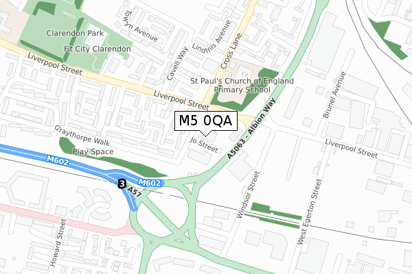
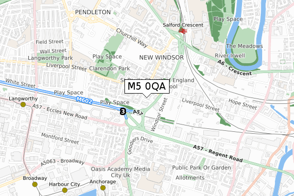
M5 0QA is located in the Pendleton & Charlestown electoral ward, within the metropolitan district of Salford and the English Parliamentary constituency of Salford and Eccles. The Sub Integrated Care Board (ICB) Location is NHS Greater Manchester ICB - 01G and the police force is Greater Manchester. This postcode has been in use since July 2019.


GetTheData
Source: OS Open Zoomstack (Ordnance Survey)
Licence: Open Government Licence (requires attribution)
Attribution: Contains OS data © Crown copyright and database right 2024
Source: Open Postcode Geo
Licence: Open Government Licence (requires attribution)
Attribution: Contains OS data © Crown copyright and database right 2024; Contains Royal Mail data © Royal Mail copyright and database right 2024; Source: Office for National Statistics licensed under the Open Government Licence v.3.0
| Easting | 381487 |
| Northing | 398312 |
| Latitude | 53.481217 |
| Longitude | -2.280430 |
GetTheData
Source: Open Postcode Geo
Licence: Open Government Licence
| Country | England |
| Postcode District | M5 |
| ➜ M5 open data dashboard ➜ See where M5 is on a map ➜ Where is Salford? | |
GetTheData
Source: Land Registry Price Paid Data
Licence: Open Government Licence
| Ward | Pendleton & Charlestown |
| Constituency | Salford And Eccles |
GetTheData
Source: ONS Postcode Database
Licence: Open Government Licence
| August 2021 | Violence and sexual offences | On or near Bermondsay Street | 431m |
| August 2021 | Violence and sexual offences | On or near Bermondsay Street | 431m |
| ➜ Get more crime data in our Crime section | |||
GetTheData
Source: data.police.uk
Licence: Open Government Licence
| Liverpool St/Cross Ln (Liverpool St) | New Windsor | 83m |
| Cross Ln/The Ship (Cross Ln) | New Windsor | 125m |
| Liverpool St/Sedan Cl (Liverpool St) | New Windsor | 137m |
| Cross Ln/The Ship (Cross Ln) | New Windsor | 176m |
| Liverpool St/West Egerton St (Liverpool St) | New Windsor | 209m |
| Anchorage (Manchester Metrolink) (Anchorage Quay) | Salford Quays | 830m |
| Langworthy (Manchester Metrolink) (Eccles New Road) | Langworthy | 1,055m |
| Harbour City (Manchester Metrolink) (The Quays) | The Lowry | 1,111m |
| Broadway (Manchester Metrolink) (Off Broadway) | Broadway | 1,191m |
| Salford Quays (Manchester Metrolink) (St Peters Quay) | Salford Quays | 1,243m |
| Salford Crescent Station | 0.7km |
| Salford Central Station | 1.7km |
| Deansgate Station | 2.1km |
GetTheData
Source: NaPTAN
Licence: Open Government Licence
GetTheData
Source: ONS Postcode Database
Licence: Open Government Licence


➜ Get more ratings from the Food Standards Agency
GetTheData
Source: Food Standards Agency
Licence: FSA terms & conditions
| Last Collection | |||
|---|---|---|---|
| Location | Mon-Fri | Sat | Distance |
| Salford Delivery Office | 18:00 | 12:00 | 35m |
| Lindinis Avenue/Cavell Way | 17:30 | 11:45 | 239m |
| Blutcher Street | 17:30 | 11:45 | 428m |
GetTheData
Source: Dracos
Licence: Creative Commons Attribution-ShareAlike
| Facility | Distance |
|---|---|
| Clarendon Leisure Centre Liverpool Street, Salford Sports Hall, Swimming Pool, Health and Fitness Gym, Artificial Grass Pitch, Squash Courts, Studio | 362m |
| Lark Hill Community Primary School Liverpool Street, Salford Grass Pitches | 598m |
| Windsor High School (Closed) Liverpool Street, Salford Grass Pitches | 598m |
GetTheData
Source: Active Places
Licence: Open Government Licence
| School | Phase of Education | Distance |
|---|---|---|
| St Paul's CofE Primary School Cross Lane, Salford, M5 4AL | Primary | 180m |
| Primrose Hill Primary School and Children's Centre Phoebe Street, Ordsall, Salford, M5 3PJ | Primary | 557m |
| Lark Hill Community Primary School Liverpool Street, Salford, M5 4BJ | Primary | 607m |
GetTheData
Source: Edubase
Licence: Open Government Licence
The below table lists the International Territorial Level (ITL) codes (formerly Nomenclature of Territorial Units for Statistics (NUTS) codes) and Local Administrative Units (LAU) codes for M5 0QA:
| ITL 1 Code | Name |
|---|---|
| TLD | North West (England) |
| ITL 2 Code | Name |
| TLD3 | Greater Manchester |
| ITL 3 Code | Name |
| TLD34 | Greater Manchester South West |
| LAU 1 Code | Name |
| E08000006 | Salford |
GetTheData
Source: ONS Postcode Directory
Licence: Open Government Licence
The below table lists the Census Output Area (OA), Lower Layer Super Output Area (LSOA), and Middle Layer Super Output Area (MSOA) for M5 0QA:
| Code | Name | |
|---|---|---|
| OA | E00028381 | |
| LSOA | E01032907 | Salford 022H |
| MSOA | E02001178 | Salford 022 |
GetTheData
Source: ONS Postcode Directory
Licence: Open Government Licence
| M5 4HH | Sedan Close | 84m |
| M5 4HJ | Eddystone Close | 158m |
| M5 4HN | Ewart Avenue | 216m |
| M6 5AB | Lindinis Avenue | 243m |
| M5 4BF | Trenam Place | 269m |
| M5 4HY | Peterhead Walk | 273m |
| M5 4HB | Windsor Street | 273m |
| M5 4AJ | Cross Lane | 297m |
| M5 4BE | Brunel Avenue | 336m |
| M5 3JZ | Goodiers Drive | 363m |
GetTheData
Source: Open Postcode Geo; Land Registry Price Paid Data
Licence: Open Government Licence