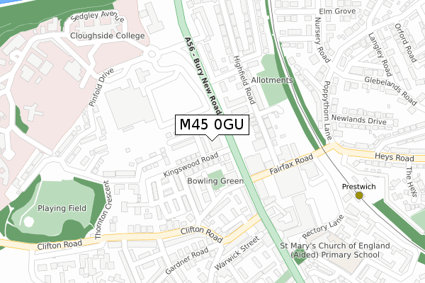
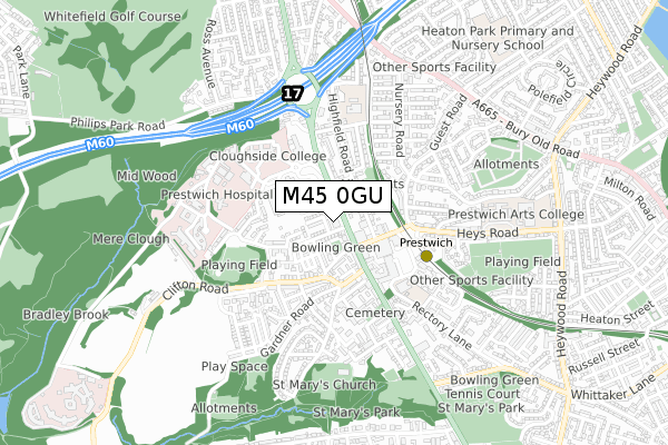
M45 0GU is located in the St. Mary's electoral ward, within the metropolitan district of Bury and the English Parliamentary constituency of Bury South. The Sub Integrated Care Board (ICB) Location is NHS Greater Manchester ICB - 00V and the police force is Greater Manchester. This postcode has been in use since December 2019.


GetTheData
Source: OS Open Zoomstack (Ordnance Survey)
Licence: Open Government Licence (requires attribution)
Attribution: Contains OS data © Crown copyright and database right 2024
Source: Open Postcode Geo
Licence: Open Government Licence (requires attribution)
Attribution: Contains OS data © Crown copyright and database right 2024; Contains Royal Mail data © Royal Mail copyright and database right 2024; Source: Office for National Statistics licensed under the Open Government Licence v.3.0
| Easting | 381078 |
| Northing | 404227 |
| Latitude | 53.534367 |
| Longitude | -2.286951 |
GetTheData
Source: Open Postcode Geo
Licence: Open Government Licence
| Country | England |
| Postcode District | M45 |
| ➜ M45 open data dashboard ➜ See where M45 is on a map ➜ Where is Prestwich? | |
GetTheData
Source: Land Registry Price Paid Data
Licence: Open Government Licence
| Ward | St. Mary's |
| Constituency | Bury South |
GetTheData
Source: ONS Postcode Database
Licence: Open Government Licence
| December 2021 | Violence and sexual offences | On or near Sunningdale Drive | 442m |
| February 2021 | Violence and sexual offences | On or near Birch Grove | 370m |
| February 2021 | Violence and sexual offences | On or near Birch Grove | 370m |
| ➜ Get more crime data in our Crime section | |||
GetTheData
Source: data.police.uk
Licence: Open Government Licence
| Fairfax Rd (Ebd) (Fairfax Rd) | Prestwich | 125m |
| Bury New Rd/Tesco (Bury New Rd) | Prestwich Hospital | 146m |
| Bury New Rd/Longfield Ctr (Bury New Rd) | Prestwich | 152m |
| Bury New Rd/Tesco (Bury New Rd) | Prestwich Hospital | 184m |
| Fairfax Road (Wbd) (Fairfax Road) | Prestwich | 206m |
| Prestwich (Manchester Metrolink) (Off Fairfax Road) | Prestwich | 348m |
| Besses O'th'barn (Manchester Metrolink) (Off Bury Old Road) | Besses O Th Barn | 859m |
| Heaton Park (Manchester Metrolink) (Off Bury Old Road) | Heaton Park | 1,420m |
| Clifton (Manchester) Station | 2.3km |
| Swinton (Manchester) Station | 4km |
| Moorside Station | 4.7km |
GetTheData
Source: NaPTAN
Licence: Open Government Licence
GetTheData
Source: ONS Postcode Database
Licence: Open Government Licence


➜ Get more ratings from the Food Standards Agency
GetTheData
Source: Food Standards Agency
Licence: FSA terms & conditions
| Last Collection | |||
|---|---|---|---|
| Location | Mon-Fri | Sat | Distance |
| Prestwich P.o. | 18:00 | 12:00 | 11m |
| Tesco | 17:30 | 12:00 | 188m |
| 1 Guest Road | 17:30 | 11:45 | 447m |
GetTheData
Source: Dracos
Licence: Creative Commons Attribution-ShareAlike
| Facility | Distance |
|---|---|
| Our Lady Of Grace Hall Fairfax Road, Prestwich, Manchester Sports Hall | 154m |
| Peak Health & Fitness (Closed) Warwick Street, Prestwich, Manchester Health and Fitness Gym, Studio | 251m |
| Clifton Road Playing Fields Pinfold Drive, Prestwich Grass Pitches | 385m |
GetTheData
Source: Active Places
Licence: Open Government Licence
| School | Phase of Education | Distance |
|---|---|---|
| St Mary's Church of England Aided Primary School, Prestwich Rectory Lane, Prestwich, Manchester, M25 1BP | Primary | 332m |
| Cloughside College Bury New Road, Prestwich, Manchester, M25 3BL | Not applicable | 401m |
| Our Lady of Grace RC Primary School Highfield Road, Prestwich, Manchester, M25 3AS | Primary | 442m |
GetTheData
Source: Edubase
Licence: Open Government Licence
The below table lists the International Territorial Level (ITL) codes (formerly Nomenclature of Territorial Units for Statistics (NUTS) codes) and Local Administrative Units (LAU) codes for M45 0GU:
| ITL 1 Code | Name |
|---|---|
| TLD | North West (England) |
| ITL 2 Code | Name |
| TLD3 | Greater Manchester |
| ITL 3 Code | Name |
| TLD37 | Greater Manchester North East |
| LAU 1 Code | Name |
| E08000002 | Bury |
GetTheData
Source: ONS Postcode Directory
Licence: Open Government Licence
The below table lists the Census Output Area (OA), Lower Layer Super Output Area (LSOA), and Middle Layer Super Output Area (MSOA) for M45 0GU:
| Code | Name | |
|---|---|---|
| OA | E00025468 | |
| LSOA | E01005034 | Bury 022D |
| MSOA | E02001040 | Bury 022 |
GetTheData
Source: ONS Postcode Directory
Licence: Open Government Licence
| M25 3AJ | Bury New Road | 34m |
| M25 3AB | Kingswood Road | 79m |
| M25 3AN | Bury New Road | 93m |
| M25 3FF | Devonshire Place | 96m |
| M25 3AE | Dashwood Road | 121m |
| M25 3FG | Devonshire Place | 122m |
| M25 3AW | Highfield Road | 138m |
| M25 1AS | Fairfax Road | 140m |
| M25 3AF | Chester Street | 150m |
| M25 1AD | Bury New Road | 151m |
GetTheData
Source: Open Postcode Geo; Land Registry Price Paid Data
Licence: Open Government Licence