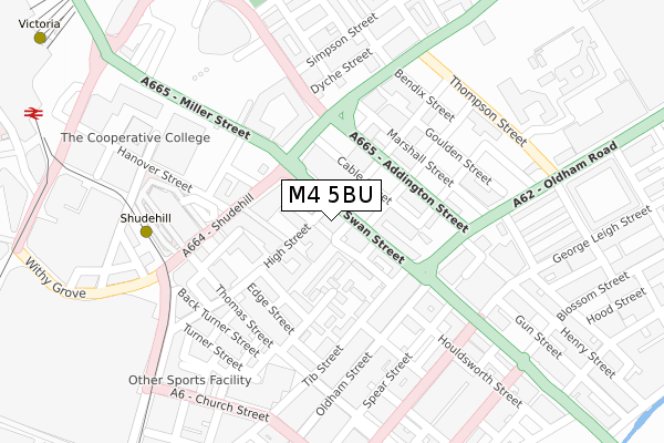
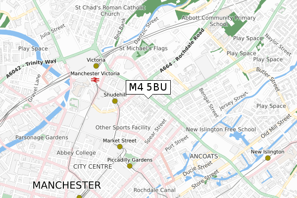
M4 5BU is located in the Piccadilly electoral ward, within the metropolitan district of Manchester and the English Parliamentary constituency of Manchester Central. The Sub Integrated Care Board (ICB) Location is NHS Greater Manchester ICB - 14L and the police force is Greater Manchester. This postcode has been in use since August 2017.


GetTheData
Source: OS Open Zoomstack (Ordnance Survey)
Licence: Open Government Licence (requires attribution)
Attribution: Contains OS data © Crown copyright and database right 2024
Source: Open Postcode Geo
Licence: Open Government Licence (requires attribution)
Attribution: Contains OS data © Crown copyright and database right 2024; Contains Royal Mail data © Royal Mail copyright and database right 2024; Source: Office for National Statistics licensed under the Open Government Licence v.3.0
| Easting | 384508 |
| Northing | 398776 |
| Latitude | 53.485484 |
| Longitude | -2.234930 |
GetTheData
Source: Open Postcode Geo
Licence: Open Government Licence
| Country | England |
| Postcode District | M4 |
| ➜ M4 open data dashboard ➜ See where M4 is on a map ➜ Where is Manchester? | |
GetTheData
Source: Land Registry Price Paid Data
Licence: Open Government Licence
| Ward | Piccadilly |
| Constituency | Manchester Central |
GetTheData
Source: ONS Postcode Database
Licence: Open Government Licence
| May 2022 | Burglary | On or near Durant Street | 360m |
| February 2022 | Violence and sexual offences | On or near Baptist Street | 298m |
| May 2021 | Violence and sexual offences | On or near Baptist Street | 298m |
| ➜ Get more crime data in our Crime section | |||
GetTheData
Source: data.police.uk
Licence: Open Government Licence
| Shudehill/Mayes St (Shudehill) | Shudehill | 130m |
| Oldham Rd/New Cross (Oldham Rd) | Manchester City Centre | 158m |
| Oldham St/Warwick St (Oldham St) | Manchester City Centre | 190m |
| Shudehill/Thomas St (Shudehill) | Shudehill | 192m |
| Rochdale Rd/Angel St (Rochdale Rd) | Newtown | 208m |
| Shudehill (Manchester Metrolink) (Shudehill) | Manchester City Centre | 261m |
| Market Street (Manchester Metrolink) (Market Street) | Manchester City Centre | 483m |
| Victoria (Manchester Metrolink) (Off Corporation Street) | Manchester City Centre | 516m |
| Exchange Square (Manchester Metrolink) (Corporation St) | Manchester City Centre | 526m |
| Piccadilly Gardens (Manchester Metrolink) (Portland Street) | Piccadilly Gardens | 612m |
| Manchester Victoria Station | 0.6km |
| Manchester Piccadilly Station | 0.9km |
| Salford Central Station | 1.3km |
GetTheData
Source: NaPTAN
Licence: Open Government Licence
GetTheData
Source: ONS Postcode Database
Licence: Open Government Licence


➜ Get more ratings from the Food Standards Agency
GetTheData
Source: Food Standards Agency
Licence: FSA terms & conditions
| Last Collection | |||
|---|---|---|---|
| Location | Mon-Fri | Sat | Distance |
| Shudehill | 19:00 | 12:00 | 62m |
| Oldham Street | 19:00 | 12:00 | 193m |
| Nicholas Croft | 19:00 | 12:00 | 204m |
GetTheData
Source: Dracos
Licence: Creative Commons Attribution-ShareAlike
| Facility | Distance |
|---|---|
| One Xps Fitness George Leigh Street, George Leigh Street, Manchester Health and Fitness Gym | 257m |
| Fitness Exchange (Manchester) (Closed) Church Street, Manchester Studio, Health and Fitness Gym | 321m |
| California Fitness (Closed) Oldham Street, Manchester Health and Fitness Gym, Studio | 381m |
GetTheData
Source: Active Places
Licence: Open Government Licence
| School | Phase of Education | Distance |
|---|---|---|
| The Cooperative College Holyoake House, Hanover Street, Manchester, M60 0AS | Not applicable | 312m |
| Digital Advantage Hanover Street, Manchester, M60 0AS | Not applicable | 313m |
| Thompsons Academy trading as Navigators 1202, 61 Houldsworth Street, Manchester, M1 2FB | Not applicable | 431m |
GetTheData
Source: Edubase
Licence: Open Government Licence
The below table lists the International Territorial Level (ITL) codes (formerly Nomenclature of Territorial Units for Statistics (NUTS) codes) and Local Administrative Units (LAU) codes for M4 5BU:
| ITL 1 Code | Name |
|---|---|
| TLD | North West (England) |
| ITL 2 Code | Name |
| TLD3 | Greater Manchester |
| ITL 3 Code | Name |
| TLD33 | Manchester |
| LAU 1 Code | Name |
| E08000003 | Manchester |
GetTheData
Source: ONS Postcode Directory
Licence: Open Government Licence
The below table lists the Census Output Area (OA), Lower Layer Super Output Area (LSOA), and Middle Layer Super Output Area (MSOA) for M4 5BU:
| Code | Name | |
|---|---|---|
| OA | E00175864 | |
| LSOA | E01033667 | Manchester 054E |
| MSOA | E02006902 | Manchester 054 |
GetTheData
Source: ONS Postcode Directory
Licence: Open Government Licence
| M4 1AB | High Street | 32m |
| M4 5JG | Swan Street | 43m |
| M4 5JZ | Swan Street | 46m |
| M4 5JU | Swan Street | 64m |
| M4 5LA | Len Cox Walk | 64m |
| M4 1HQ | High Street | 76m |
| M4 5JQ | Swan Street | 77m |
| M4 5LB | Foundry Lane | 84m |
| M4 1BH | William Fairburn Way | 90m |
| M4 1HG | High Street | 94m |
GetTheData
Source: Open Postcode Geo; Land Registry Price Paid Data
Licence: Open Government Licence