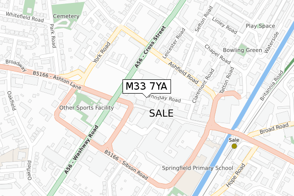
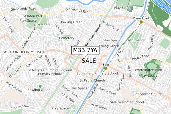
M33 7YA lies on Springfield Road in Sale. M33 7YA is located in the Sale Central electoral ward, within the metropolitan district of Trafford and the English Parliamentary constituency of Wythenshawe and Sale East. The Sub Integrated Care Board (ICB) Location is NHS Greater Manchester ICB - 02A and the police force is Greater Manchester. This postcode has been in use since September 2017.


GetTheData
Source: OS Open Zoomstack (Ordnance Survey)
Licence: Open Government Licence (requires attribution)
Attribution: Contains OS data © Crown copyright and database right 2024
Source: Open Postcode Geo
Licence: Open Government Licence (requires attribution)
Attribution: Contains OS data © Crown copyright and database right 2024; Contains Royal Mail data © Royal Mail copyright and database right 2024; Source: Office for National Statistics licensed under the Open Government Licence v.3.0
| Easting | 378597 |
| Northing | 392147 |
| Latitude | 53.425693 |
| Longitude | -2.323557 |
GetTheData
Source: Open Postcode Geo
Licence: Open Government Licence
| Street | Springfield Road |
| Town/City | Sale |
| Country | England |
| Postcode District | M33 |
| ➜ M33 open data dashboard ➜ See where M33 is on a map | |
GetTheData
Source: Land Registry Price Paid Data
Licence: Open Government Licence
| Ward | Sale Central |
| Constituency | Wythenshawe And Sale East |
GetTheData
Source: ONS Postcode Database
Licence: Open Government Licence
| School Rd/Hayfield St (School Road) | Sale | 59m |
| Hayfield St/John St (Hayfield Street) | Sale | 79m |
| Hayfield St/John St (Hayfield Street) | Sale | 99m |
| Ashfield Road/Cross Street (Ashfield Road) | Sale | 137m |
| Ashfield Road/Sainsbury's (Ashfield Road) | Sale | 147m |
| Sale (Manchester Metrolink) (Off School Road) | Sale | 335m |
| Brooklands (Manchester Metrolink) (Brooklands Road) | Brooklands | 936m |
| Dane Road (Manchester Metrolink) (Dane Road) | Sale | 958m |
| Humphrey Park Station | 3km |
| Urmston Station | 3.2km |
| Trafford Park Station | 3.4km |
GetTheData
Source: NaPTAN
Licence: Open Government Licence
GetTheData
Source: ONS Postcode Database
Licence: Open Government Licence


➜ Get more ratings from the Food Standards Agency
GetTheData
Source: Food Standards Agency
Licence: FSA terms & conditions
| Last Collection | |||
|---|---|---|---|
| Location | Mon-Fri | Sat | Distance |
| Outside Co-op | 57m | ||
| Sainsbury's | 17:30 | 12:00 | 64m |
| Northenden Road P.o. | 17:30 | 12:00 | 449m |
GetTheData
Source: Dracos
Licence: Creative Commons Attribution-ShareAlike
| Facility | Distance |
|---|---|
| Everlast Gyms (Sale) Washway Road, Sale Swimming Pool, Health and Fitness Gym, Studio | 175m |
| Snap Fitness (Manchester Sale) Springfield Road, Springfield Road, Sale Health and Fitness Gym | 238m |
| Sale Leisure Centre Broad Road, Sale Sports Hall, Swimming Pool, Health and Fitness Gym, Studio, Squash Courts | 518m |
GetTheData
Source: Active Places
Licence: Open Government Licence
| School | Phase of Education | Distance |
|---|---|---|
| Springfield Primary School Springfield Road, Sale, M33 7XS | Primary | 282m |
| Forest Park Preparatory School 27 Oakfield, Ashton-upon-Mersey, Sale, M33 6NB | Not applicable | 466m |
| St Joseph's Catholic Primary School, a Voluntary Academy Marlborough Road, Sale, M33 3AF | Primary | 487m |
GetTheData
Source: Edubase
Licence: Open Government Licence
The below table lists the International Territorial Level (ITL) codes (formerly Nomenclature of Territorial Units for Statistics (NUTS) codes) and Local Administrative Units (LAU) codes for M33 7YA:
| ITL 1 Code | Name |
|---|---|
| TLD | North West (England) |
| ITL 2 Code | Name |
| TLD3 | Greater Manchester |
| ITL 3 Code | Name |
| TLD34 | Greater Manchester South West |
| LAU 1 Code | Name |
| E08000009 | Trafford |
GetTheData
Source: ONS Postcode Directory
Licence: Open Government Licence
The below table lists the Census Output Area (OA), Lower Layer Super Output Area (LSOA), and Middle Layer Super Output Area (MSOA) for M33 7YA:
| Code | Name | |
|---|---|---|
| OA | E00031231 | |
| LSOA | E01006160 | Trafford 015B |
| MSOA | E02001273 | Trafford 015 |
GetTheData
Source: ONS Postcode Directory
Licence: Open Government Licence
| M33 7YB | Orchard Place | 0m |
| M33 7XB | School Road | 27m |
| M33 7DR | Curzon Road | 49m |
| M33 7YF | School Road | 62m |
| M33 7AE | Cross Street | 76m |
| M33 7XE | School Road | 95m |
| M33 7YE | School Road | 98m |
| M33 7ZD | School Road | 128m |
| M33 7FT | Cross Street | 134m |
| M33 7AD | Washway Road | 139m |
GetTheData
Source: Open Postcode Geo; Land Registry Price Paid Data
Licence: Open Government Licence