Property/Postcode Data Search:
M3 5GD maps, stats, and open data
M3 5GD is located in the Blackfriars & Trinity electoral ward, within the metropolitan district of Salford and the English Parliamentary constituency of Salford and Eccles. The Sub Integrated Care Board (ICB) Location is NHS Greater Manchester ICB - 01G and the police force is Greater Manchester. This postcode has been in use since December 2019.
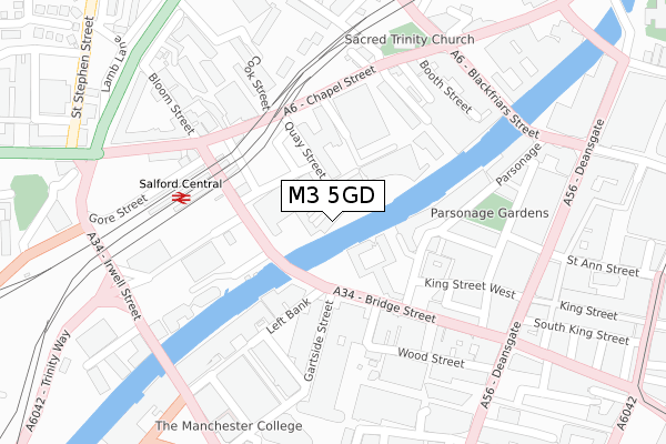
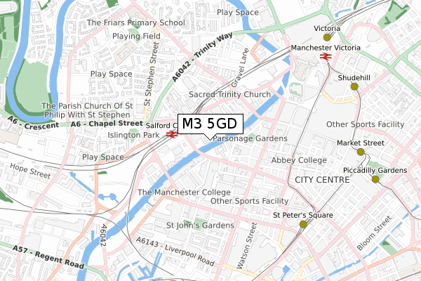
M3 5GD maps


Source: OS Open Zoomstack (Ordnance Survey)
Licence: Open Government Licence (requires attribution)
Attribution: Contains OS data © Crown copyright and database right 2025
Source: Open Postcode Geo
Licence: Open Government Licence (requires attribution)
Attribution: Contains OS data © Crown copyright and database right 2025; Contains Royal Mail data © Royal Mail copyright and database right 2025; Source: Office for National Statistics licensed under the Open Government Licence v.3.0
Licence: Open Government Licence (requires attribution)
Attribution: Contains OS data © Crown copyright and database right 2025
Source: Open Postcode Geo
Licence: Open Government Licence (requires attribution)
Attribution: Contains OS data © Crown copyright and database right 2025; Contains Royal Mail data © Royal Mail copyright and database right 2025; Source: Office for National Statistics licensed under the Open Government Licence v.3.0
M3 5GD geodata
| Easting | 383373 |
| Northing | 398440 |
| Latitude | 53.482430 |
| Longitude | -2.252016 |
Where is M3 5GD?
| Country | England |
| Postcode District | M3 |
Politics
| Ward | Blackfriars & Trinity |
|---|---|
| Constituency | Salford And Eccles |
Transport
Nearest bus stops to M3 5GD
| Bridge St/Gartside St (Bridge Street) | Manchester City Centre | 121m |
| New Bailey St/Salford Stn (New Bailey St) | Salford | 157m |
| Chapel St/Quay St (Chapel St) | Salford | 169m |
| New Bailey St/Salford Stn (New Bailey St) | Salford | 199m |
| Chapel St/Cook St (Chapel St) | Salford | 201m |
Nearest underground/metro/tram to M3 5GD
| Exchange Square (Manchester Metrolink) (Corporation St) | Manchester City Centre | 660m |
| St Peters Square (Manchester Metrolink) (Peter Street) | Manchester City Centre | 754m |
| Deansgate-castlefield (Manchester Metrolink) (Whitworth Street West) | Manchester City Centre | 854m |
| Market Street (Manchester Metrolink) (Market Street) | Manchester City Centre | 857m |
| Victoria (Manchester Metrolink) (Off Corporation Street) | Manchester City Centre | 858m |
Nearest railway stations to M3 5GD
| Salford Central Station | 0.2km |
| Manchester Victoria Station | 0.8km |
| Deansgate Station | 0.9km |
Deprivation
40.4% of English postcodes are less deprived than M3 5GD:Food Standards Agency
Three nearest food hygiene ratings to M3 5GD (metres)
Ottoman Grill and Bar
within Affinity Living Riverside
0m
Champions Cafe within Moneyplus Group

within Delphian House
38m
Loaf Mcr

within Affinity living
68m
➜ Get more ratings from the Food Standards Agency
Nearest post box to M3 5GD
| Last Collection | |||
|---|---|---|---|
| Location | Mon-Fri | Sat | Distance |
| Salford Station, On Steps Of | 19:00 | 12:00 | 171m |
| Opp 64 Bridge Street | 19:00 | 12:00 | 278m |
| Blackfriars St/Chapel St | 19:00 | 12:00 | 320m |
Environment
| Risk of M3 5GD flooding from rivers and sea | Medium |
M3 5GD ITL and M3 5GD LAU
The below table lists the International Territorial Level (ITL) codes (formerly Nomenclature of Territorial Units for Statistics (NUTS) codes) and Local Administrative Units (LAU) codes for M3 5GD:
| ITL 1 Code | Name |
|---|---|
| TLD | North West (England) |
| ITL 2 Code | Name |
| TLD3 | Greater Manchester |
| ITL 3 Code | Name |
| TLD34 | Greater Manchester South West |
| LAU 1 Code | Name |
| E08000006 | Salford |
M3 5GD census areas
The below table lists the Census Output Area (OA), Lower Layer Super Output Area (LSOA), and Middle Layer Super Output Area (MSOA) for M3 5GD:
| Code | Name | |
|---|---|---|
| OA | E00168580 | |
| LSOA | E01032687 | Salford 022F |
| MSOA | E02001178 | Salford 022 |
Nearest postcodes to M3 5GD
| M3 5EW | Dearmans Place | 61m |
| M3 5AX | New Bailey Street | 143m |
| M3 3DS | Bridge Street | 165m |
| M3 3AD | Leftbank | 174m |
| M3 2DD | St Marys Parsonage | 197m |
| M3 2DE | St Marys Parsonage | 197m |
| M3 2PB | Back Bridge Street | 198m |
| M3 2LF | Parsonage Gardens | 203m |
| M3 3AE | Leftbank | 207m |
| M3 3AF | Leftbank | 207m |