Property/Postcode Data Search:
M3 5DZ maps, stats, and open data
M3 5DZ is located in the Blackfriars & Trinity electoral ward, within the metropolitan district of Salford and the English Parliamentary constituency of Salford and Eccles. The Sub Integrated Care Board (ICB) Location is NHS Greater Manchester ICB - 01G and the police force is Greater Manchester. This postcode has been in use since October 2019.
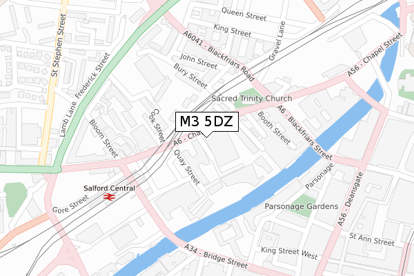
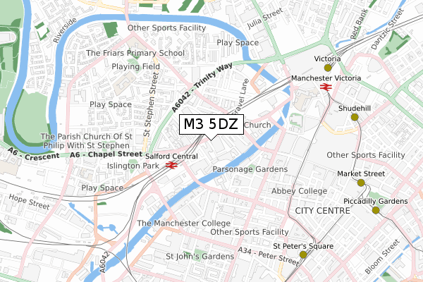
M3 5DZ maps


Source: OS Open Zoomstack (Ordnance Survey)
Licence: Open Government Licence (requires attribution)
Attribution: Contains OS data © Crown copyright and database right 2025
Source: Open Postcode Geo
Licence: Open Government Licence (requires attribution)
Attribution: Contains OS data © Crown copyright and database right 2025; Contains Royal Mail data © Royal Mail copyright and database right 2025; Source: Office for National Statistics licensed under the Open Government Licence v.3.0
Licence: Open Government Licence (requires attribution)
Attribution: Contains OS data © Crown copyright and database right 2025
Source: Open Postcode Geo
Licence: Open Government Licence (requires attribution)
Attribution: Contains OS data © Crown copyright and database right 2025; Contains Royal Mail data © Royal Mail copyright and database right 2025; Source: Office for National Statistics licensed under the Open Government Licence v.3.0
M3 5DZ geodata
| Easting | 383380 |
| Northing | 398619 |
| Latitude | 53.484039 |
| Longitude | -2.251920 |
Where is M3 5DZ?
| Country | England |
| Postcode District | M3 |
Politics
| Ward | Blackfriars & Trinity |
|---|---|
| Constituency | Salford And Eccles |
Transport
Nearest bus stops to M3 5DZ
| Chapel St/Quay St (Chapel St) | Salford | 67m |
| Chapel St/Trinity Church (Chapel St) | Salford | 117m |
| Chapel St/Cook St (Chapel St) | Salford | 142m |
| Blackfriars Rd/Trinity Church (Blackfriars Rd) | Salford | 167m |
| Blackfriars Rd/Chapel St (Blackfriars Rd) | Salford | 187m |
Nearest underground/metro/tram to M3 5DZ
| Exchange Square (Manchester Metrolink) (Corporation St) | Manchester City Centre | 616m |
| Victoria (Manchester Metrolink) (Off Corporation Street) | Manchester City Centre | 751m |
| St Peters Square (Manchester Metrolink) (Peter Street) | Manchester City Centre | 872m |
| Shudehill (Manchester Metrolink) (Shudehill) | Manchester City Centre | 880m |
| Market Street (Manchester Metrolink) (Market Street) | Manchester City Centre | 880m |
Nearest railway stations to M3 5DZ
| Salford Central Station | 0.2km |
| Manchester Victoria Station | 0.7km |
| Deansgate Station | 1.1km |
Deprivation
40.4% of English postcodes are less deprived than M3 5DZ:Food Standards Agency
Three nearest food hygiene ratings to M3 5DZ (metres)
Asda Express Salford Chapel

106-108 Chapel Street
23m
Sodexo

within Trinity Bridge House
59m
Fez Tajine

110 Chapel Street
62m
➜ Get more ratings from the Food Standards Agency
Nearest post box to M3 5DZ
| Last Collection | |||
|---|---|---|---|
| Location | Mon-Fri | Sat | Distance |
| Blackfriars St/Chapel St | 19:00 | 12:00 | 198m |
| Salford Station, On Steps Of | 19:00 | 12:00 | 229m |
| Opp 64 Bridge Street | 19:00 | 12:00 | 412m |
Environment
| Risk of M3 5DZ flooding from rivers and sea | Low |
M3 5DZ ITL and M3 5DZ LAU
The below table lists the International Territorial Level (ITL) codes (formerly Nomenclature of Territorial Units for Statistics (NUTS) codes) and Local Administrative Units (LAU) codes for M3 5DZ:
| ITL 1 Code | Name |
|---|---|
| TLD | North West (England) |
| ITL 2 Code | Name |
| TLD3 | Greater Manchester |
| ITL 3 Code | Name |
| TLD34 | Greater Manchester South West |
| LAU 1 Code | Name |
| E08000006 | Salford |
M3 5DZ census areas
The below table lists the Census Output Area (OA), Lower Layer Super Output Area (LSOA), and Middle Layer Super Output Area (MSOA) for M3 5DZ:
| Code | Name | |
|---|---|---|
| OA | E00168580 | |
| LSOA | E01032687 | Salford 022F |
| MSOA | E02001178 | Salford 022 |
Nearest postcodes to M3 5DZ
| M3 7WQ | 109m | |
| M3 5EW | Dearmans Place | 126m |
| M3 7BE | Trinity Way | 139m |
| M3 5NG | Clowes Street | 146m |
| M3 7DU | Bury Street | 150m |
| M3 6DE | Chapel Street | 155m |
| M3 6AF | Chapel Street | 162m |
| M3 5BZ | Chapel Street | 163m |
| M3 5NE | Clowes Street | 171m |
| M3 5NF | Clowes Street | 171m |