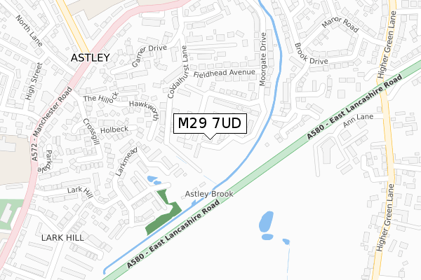
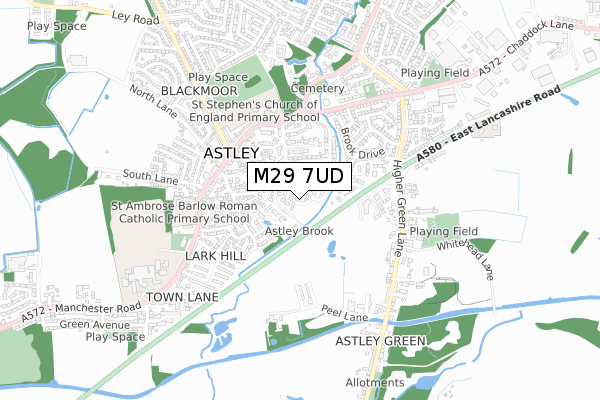
M29 7UD is located in the Astley electoral ward, within the metropolitan district of Wigan and the English Parliamentary constituency of Leigh. The Sub Integrated Care Board (ICB) Location is NHS Greater Manchester ICB - 02H and the police force is Greater Manchester. This postcode has been in use since November 2019.


GetTheData
Source: OS Open Zoomstack (Ordnance Survey)
Licence: Open Government Licence (requires attribution)
Attribution: Contains OS data © Crown copyright and database right 2024
Source: Open Postcode Geo
Licence: Open Government Licence (requires attribution)
Attribution: Contains OS data © Crown copyright and database right 2024; Contains Royal Mail data © Royal Mail copyright and database right 2024; Source: Office for National Statistics licensed under the Open Government Licence v.3.0
| Easting | 369931 |
| Northing | 400271 |
| Latitude | 53.498288 |
| Longitude | -2.454744 |
GetTheData
Source: Open Postcode Geo
Licence: Open Government Licence
| Country | England |
| Postcode District | M29 |
| ➜ M29 open data dashboard ➜ See where M29 is on a map ➜ Where is Astley? | |
GetTheData
Source: Land Registry Price Paid Data
Licence: Open Government Licence
| Ward | Astley |
| Constituency | Leigh |
GetTheData
Source: ONS Postcode Database
Licence: Open Government Licence
3, HURSTBROOK CLOSE, ASTLEY, MANCHESTER, M29 7UD 2020 28 FEB £331,995 |
4, HURSTBROOK CLOSE, ASTLEY, MANCHESTER, M29 7UD 2019 20 DEC £304,995 |
5, HURSTBROOK CLOSE, ASTLEY, MANCHESTER, M29 7UD 2019 20 DEC £282,995 |
2, HURSTBROOK CLOSE, ASTLEY, MANCHESTER, M29 7UD 2019 13 DEC £311,995 |
1, HURSTBROOK CLOSE, ASTLEY, MANCHESTER, M29 7UD 2019 22 NOV £374,995 |
GetTheData
Source: HM Land Registry Price Paid Data
Licence: Contains HM Land Registry data © Crown copyright and database right 2024. This data is licensed under the Open Government Licence v3.0.
| Manchester Rd/Miners Arms (Manchester Rd) | Blackmoor | 359m |
| Manchester Rd/Miners Arms (Manchester Rd) | Blackmoor | 360m |
| Manchester Rd/Astley Straits (Manchester Rd) | Astley | 377m |
| Manchester Rd/Astley Straits (Manchester Rd) | Astley | 382m |
| Princes Ave/Manchester Rd (Princes Ave) | Blackmoor | 387m |
| Atherton Station | 3.8km |
| Walkden Station | 4.6km |
| Hag Fold Station | 4.8km |
GetTheData
Source: NaPTAN
Licence: Open Government Licence
GetTheData
Source: ONS Postcode Database
Licence: Open Government Licence


➜ Get more ratings from the Food Standards Agency
GetTheData
Source: Food Standards Agency
Licence: FSA terms & conditions
| Last Collection | |||
|---|---|---|---|
| Location | Mon-Fri | Sat | Distance |
| Bodmin Road / Truro Road | 17:30 | 11:30 | 1,380m |
| Mossley Common P.o. | 17:30 | 12:00 | 2,259m |
| Boothstown P.o. | 17:30 | 12:00 | 2,306m |
GetTheData
Source: Dracos
Licence: Creative Commons Attribution-ShareAlike
| Facility | Distance |
|---|---|
| St. Ambrose Barlow Catholic Primary School Manchester Road, Astley, Tyldesley, Manchester Grass Pitches | 490m |
| The Ley Recreation Ground Parkfield Avenue, Tyldesley Grass Pitches | 526m |
| Ellesmere Street Playing Fields Ellesmere Street, Astley, Tyldesley Grass Pitches | 625m |
GetTheData
Source: Active Places
Licence: Open Government Licence
| School | Phase of Education | Distance |
|---|---|---|
| St Stephen's CofE Primary School Manchester Road, Astley, Tyldesley, Manchester, M29 7BT | Primary | 410m |
| St Ambrose Barlow Catholic Primary School Manchester Road, Astley, Tyldesley, Manchester, M29 7DY | Primary | 483m |
| St Mary's Catholic High School Manchester Road, Astley, Tyldesley, Manchester, M29 7EE | Secondary | 745m |
GetTheData
Source: Edubase
Licence: Open Government Licence
The below table lists the International Territorial Level (ITL) codes (formerly Nomenclature of Territorial Units for Statistics (NUTS) codes) and Local Administrative Units (LAU) codes for M29 7UD:
| ITL 1 Code | Name |
|---|---|
| TLD | North West (England) |
| ITL 2 Code | Name |
| TLD3 | Greater Manchester |
| ITL 3 Code | Name |
| TLD36 | Greater Manchester North West |
| LAU 1 Code | Name |
| E08000010 | Wigan |
GetTheData
Source: ONS Postcode Directory
Licence: Open Government Licence
The below table lists the Census Output Area (OA), Lower Layer Super Output Area (LSOA), and Middle Layer Super Output Area (MSOA) for M29 7UD:
| Code | Name | |
|---|---|---|
| OA | E00031680 | |
| LSOA | E01006250 | Wigan 029A |
| MSOA | E02001315 | Wigan 029 |
GetTheData
Source: ONS Postcode Directory
Licence: Open Government Licence
| M29 7DQ | Fieldhead Avenue | 185m |
| M29 7DP | Hawkworth | 188m |
| M29 7RW | Parnell Close | 210m |
| M29 7BS | Coldalhurst Lane | 211m |
| M29 7DU | Holbeck | 216m |
| M29 7DG | Moorgate Drive | 224m |
| M29 7JD | Brook Meadow Close | 242m |
| M29 7GW | The Hillock | 245m |
| M29 7RT | Garner Drive | 274m |
| M29 7DS | Penketh Avenue | 279m |
GetTheData
Source: Open Postcode Geo; Land Registry Price Paid Data
Licence: Open Government Licence