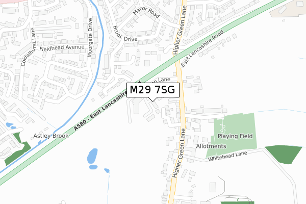
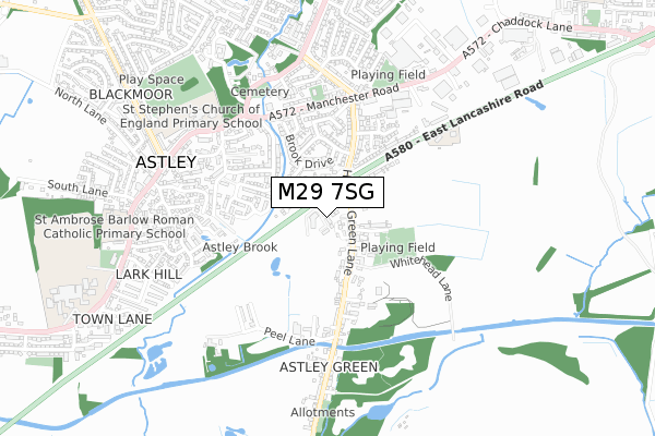
M29 7SG is located in the Astley electoral ward, within the metropolitan district of Wigan and the English Parliamentary constituency of Leigh. The Sub Integrated Care Board (ICB) Location is NHS Greater Manchester ICB - 02H and the police force is Greater Manchester. This postcode has been in use since July 2018.


GetTheData
Source: OS Open Zoomstack (Ordnance Survey)
Licence: Open Government Licence (requires attribution)
Attribution: Contains OS data © Crown copyright and database right 2024
Source: Open Postcode Geo
Licence: Open Government Licence (requires attribution)
Attribution: Contains OS data © Crown copyright and database right 2024; Contains Royal Mail data © Royal Mail copyright and database right 2024; Source: Office for National Statistics licensed under the Open Government Licence v.3.0
| Easting | 370262 |
| Northing | 400253 |
| Latitude | 53.498145 |
| Longitude | -2.449753 |
GetTheData
Source: Open Postcode Geo
Licence: Open Government Licence
| Country | England |
| Postcode District | M29 |
| ➜ M29 open data dashboard ➜ See where M29 is on a map ➜ Where is Astley? | |
GetTheData
Source: Land Registry Price Paid Data
Licence: Open Government Licence
| Ward | Astley |
| Constituency | Leigh |
GetTheData
Source: ONS Postcode Database
Licence: Open Government Licence
| Higher Green Ln/Ellesmere St (Higher Green Ln) | Higher Green | 98m |
| Higher Green Ln/Ellesmere St (Higher Green Ln) | Higher Green | 98m |
| Higher Green Ln/Manor Rd (Higher Green Ln) | Astley | 240m |
| Higher Green Ln/Manor Rd (Higher Green Ln) | Astley | 243m |
| Higher Green Ln/Mining Museum (Higher Green Ln) | Higher Green | 296m |
| Atherton Station | 4km |
| Walkden Station | 4.3km |
| Hag Fold Station | 5km |
GetTheData
Source: NaPTAN
Licence: Open Government Licence
| Percentage of properties with Next Generation Access | 100.0% |
| Percentage of properties with Superfast Broadband | 100.0% |
| Percentage of properties with Ultrafast Broadband | 100.0% |
| Percentage of properties with Full Fibre Broadband | 100.0% |
Superfast Broadband is between 30Mbps and 300Mbps
Ultrafast Broadband is > 300Mbps
| Percentage of properties unable to receive 2Mbps | 0.0% |
| Percentage of properties unable to receive 5Mbps | 0.0% |
| Percentage of properties unable to receive 10Mbps | 0.0% |
| Percentage of properties unable to receive 30Mbps | 0.0% |
GetTheData
Source: Ofcom
Licence: Ofcom Terms of Use (requires attribution)
GetTheData
Source: ONS Postcode Database
Licence: Open Government Licence


➜ Get more ratings from the Food Standards Agency
GetTheData
Source: Food Standards Agency
Licence: FSA terms & conditions
| Last Collection | |||
|---|---|---|---|
| Location | Mon-Fri | Sat | Distance |
| Bodmin Road / Truro Road | 17:30 | 11:30 | 1,331m |
| Mossley Common P.o. | 17:30 | 12:00 | 1,980m |
| Boothstown P.o. | 17:30 | 12:00 | 1,987m |
GetTheData
Source: Dracos
Licence: Creative Commons Attribution-ShareAlike
| Facility | Distance |
|---|---|
| Ellesmere Street Playing Fields Ellesmere Street, Astley, Tyldesley Grass Pitches | 301m |
| The Ley Recreation Ground Parkfield Avenue, Tyldesley Grass Pitches | 751m |
| St. Ambrose Barlow Catholic Primary School Manchester Road, Astley, Tyldesley, Manchester Grass Pitches | 821m |
GetTheData
Source: Active Places
Licence: Open Government Licence
| School | Phase of Education | Distance |
|---|---|---|
| St Stephen's CofE Primary School Manchester Road, Astley, Tyldesley, Manchester, M29 7BT | Primary | 632m |
| St Ambrose Barlow Catholic Primary School Manchester Road, Astley, Tyldesley, Manchester, M29 7DY | Primary | 814m |
| St Mary's Catholic High School Manchester Road, Astley, Tyldesley, Manchester, M29 7EE | Secondary | 1km |
GetTheData
Source: Edubase
Licence: Open Government Licence
The below table lists the International Territorial Level (ITL) codes (formerly Nomenclature of Territorial Units for Statistics (NUTS) codes) and Local Administrative Units (LAU) codes for M29 7SG:
| ITL 1 Code | Name |
|---|---|
| TLD | North West (England) |
| ITL 2 Code | Name |
| TLD3 | Greater Manchester |
| ITL 3 Code | Name |
| TLD36 | Greater Manchester North West |
| LAU 1 Code | Name |
| E08000010 | Wigan |
GetTheData
Source: ONS Postcode Directory
Licence: Open Government Licence
The below table lists the Census Output Area (OA), Lower Layer Super Output Area (LSOA), and Middle Layer Super Output Area (MSOA) for M29 7SG:
| Code | Name | |
|---|---|---|
| OA | E00031664 | |
| LSOA | E01006250 | Wigan 029A |
| MSOA | E02001315 | Wigan 029 |
GetTheData
Source: ONS Postcode Directory
Licence: Open Government Licence
| M29 7JP | Grundys Close | 61m |
| M29 7HY | Higher Green Lane | 94m |
| M29 7HZ | Higher Green Lane | 114m |
| M29 7JD | Brook Meadow Close | 158m |
| M29 7QT | Worsley View | 181m |
| M29 7QP | Ellesmere Street | 182m |
| M29 7QR | Corless Fold | 183m |
| M29 7HR | Brook Drive | 226m |
| M29 7HS | Brook Drive | 229m |
| M29 7PH | Manor Road | 292m |
GetTheData
Source: Open Postcode Geo; Land Registry Price Paid Data
Licence: Open Government Licence